
Easier access to scientific data

Brought to you by NOAA CoastWatch Great Lakes Node
|
ERDDAP
Easier access to scientific data |
|
Brought to you by NOAA CoastWatch Great Lakes Node |
| Dataset Title: | Lake Huron Central Region Surface Temperature Contour Map (2022-present)


|
| Institution: | CoastWatch Great Lakes Node (Dataset ID: LH_NRT_TC_h2) |
| Information: | Summary
| License
| Metadata
| Background | Subset
| Data Access Form
| Make a graph
| Subset
| Data Access Form
| Make a graph
|
![[ICO]](https://apps.glerl.noaa.gov/erddap/images/fileIcons/blank.gif) | Name | Last modified | Size | Description |
|---|---|---|---|---|
![[DIR]](https://apps.glerl.noaa.gov/erddap/images/fileIcons/back.gif) | Parent Directory | - | - | |
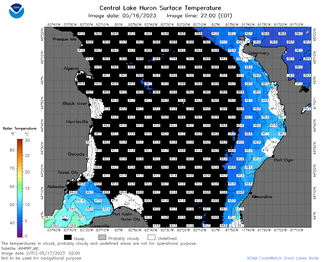
![[IMG]](https://apps.glerl.noaa.gov/erddap/images/fileIcons/image2.gif)  | h2_2023_05_17_0110.png | 17-May-2023 16:25 | 53584 | |
 | h2_2023_05_17_0200.png | 17-May-2023 17:25 | 70459 | |
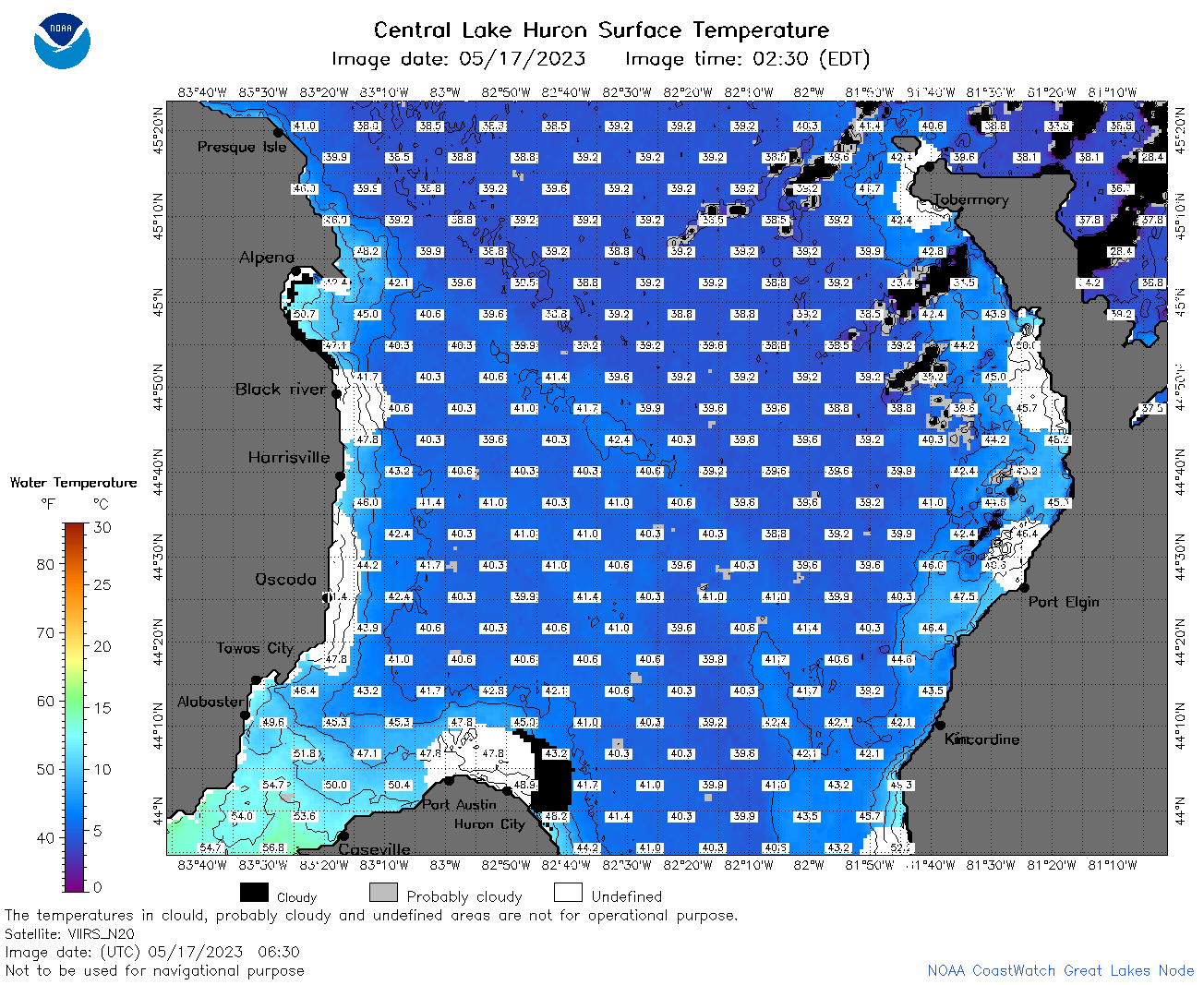 | h2_2023_05_17_0630.png | 17-May-2023 16:31 | 126929 | |
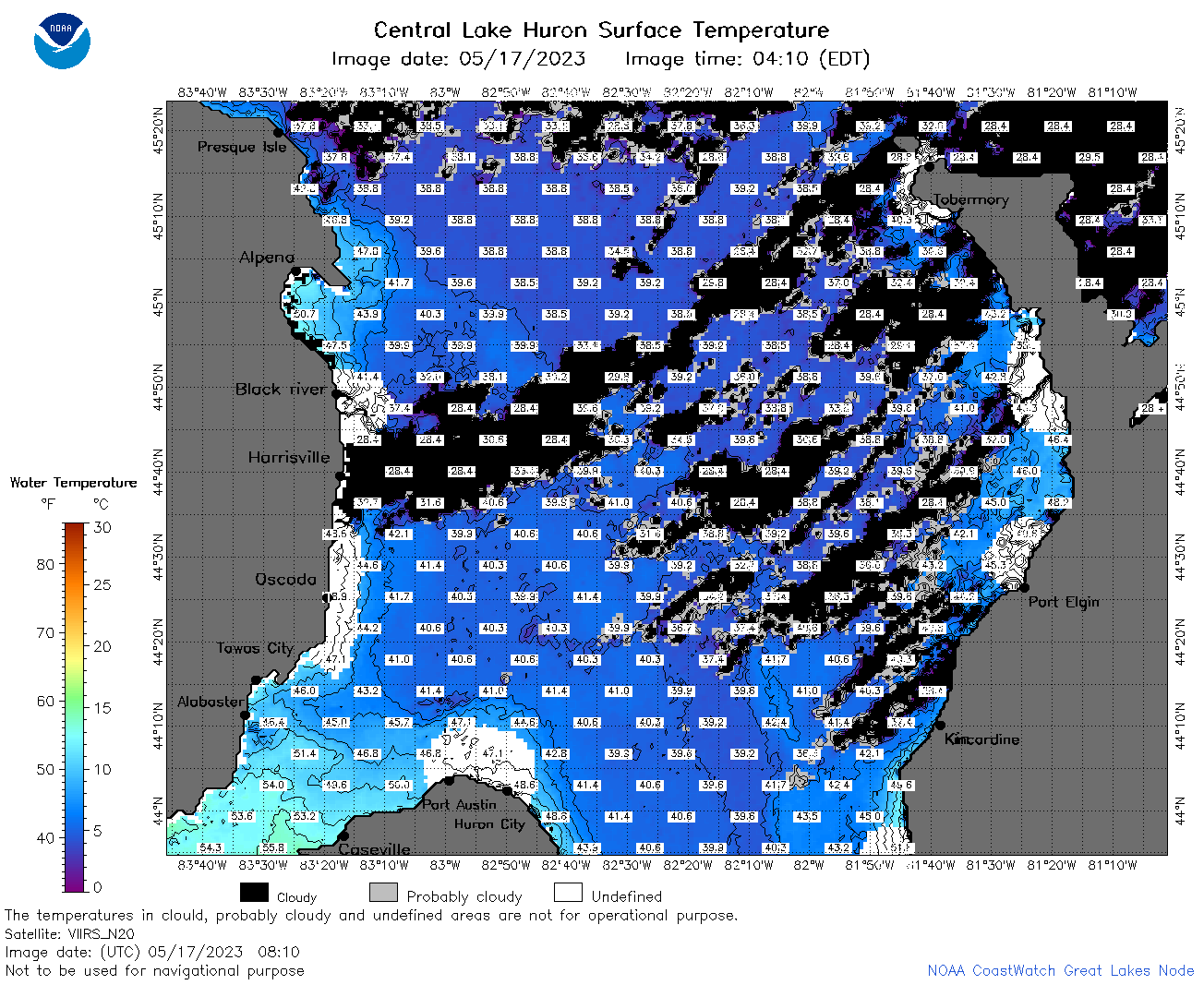 | h2_2023_05_17_0810.png | 17-May-2023 16:34 | 146028 | |
 | h2_2023_05_17_1420.png | 17-May-2023 19:25 | 56190 | |
 | h2_2023_05_17_1510.png | 17-May-2023 18:25 | 99155 | |
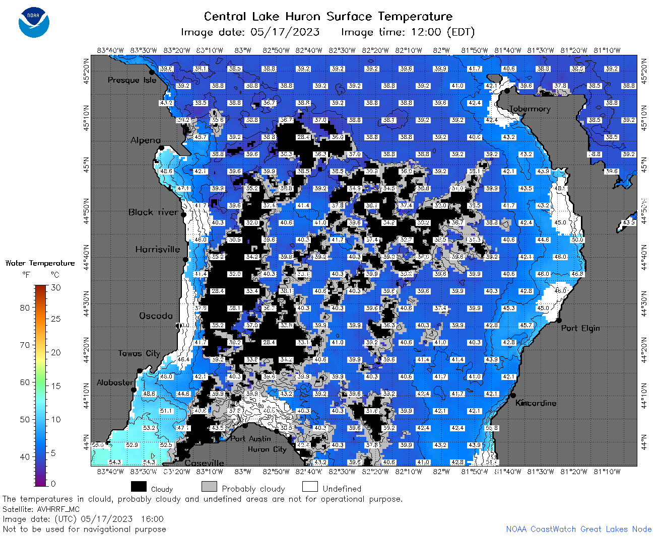 | h2_2023_05_17_1600.png | 17-May-2023 21:26 | 116214 | |
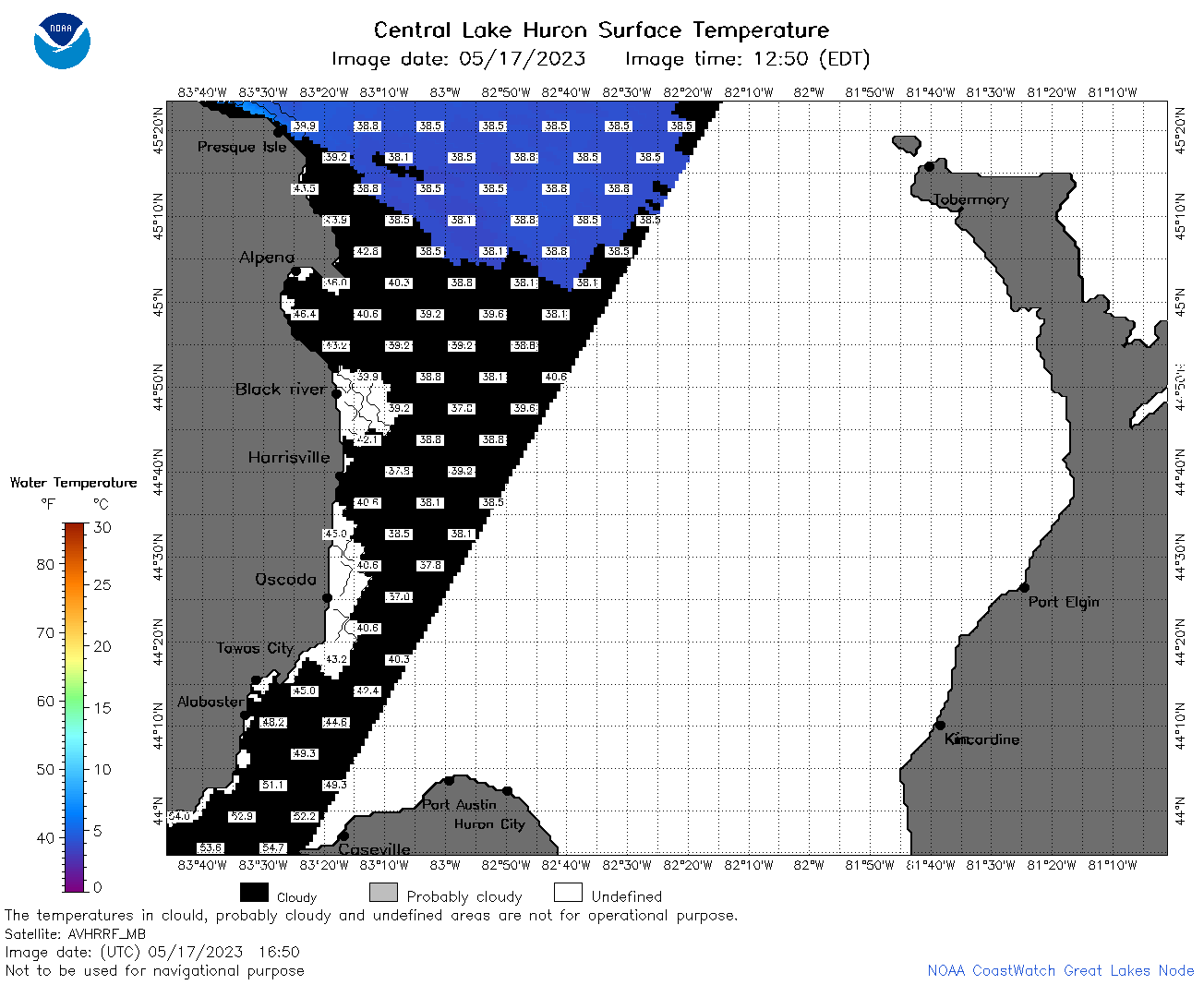 | h2_2023_05_17_1650.png | 17-May-2023 20:26 | 40842 | |
 | h2_2023_05_17_1710.png | 17-May-2023 22:25 | 45055 | |
 | h2_2023_05_17_1800.png | 17-May-2023 20:28 | 102302 | |
 | h2_2023_05_17_1850.png | 17-May-2023 21:28 | 100523 | |
 | h2_2023_137.png | 18-May-2023 09:14 | 72503 | |