
Easier access to scientific data

Brought to you by NOAA CoastWatch Great Lakes Node
|
ERDDAP
Easier access to scientific data |
|
Brought to you by NOAA CoastWatch Great Lakes Node |
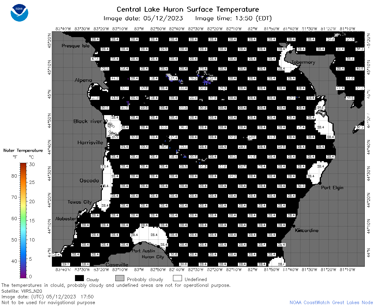
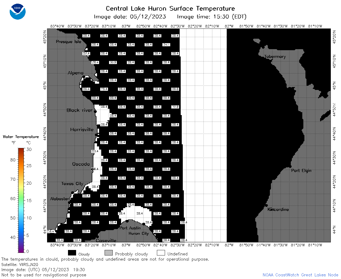
| Dataset Title: | Lake Huron Central Region Surface Temperature Contour Map (2022-present)


|
| Institution: | CoastWatch Great Lakes Node (Dataset ID: LH_NRT_TC_h2) |
| Information: | Summary
| License
| Metadata
| Background | Subset
| Data Access Form
| Make a graph
| Subset
| Data Access Form
| Make a graph
|
![[ICO]](https://apps.glerl.noaa.gov/erddap/images/fileIcons/blank.gif) | Name | Last modified | Size | Description |
|---|---|---|---|---|
![[DIR]](https://apps.glerl.noaa.gov/erddap/images/fileIcons/back.gif) | Parent Directory | - | - | |
![[IMG]](https://apps.glerl.noaa.gov/erddap/images/fileIcons/image2.gif)  | h2_2023_05_12_0120.png | 12-May-2023 05:27 | 42460 | |
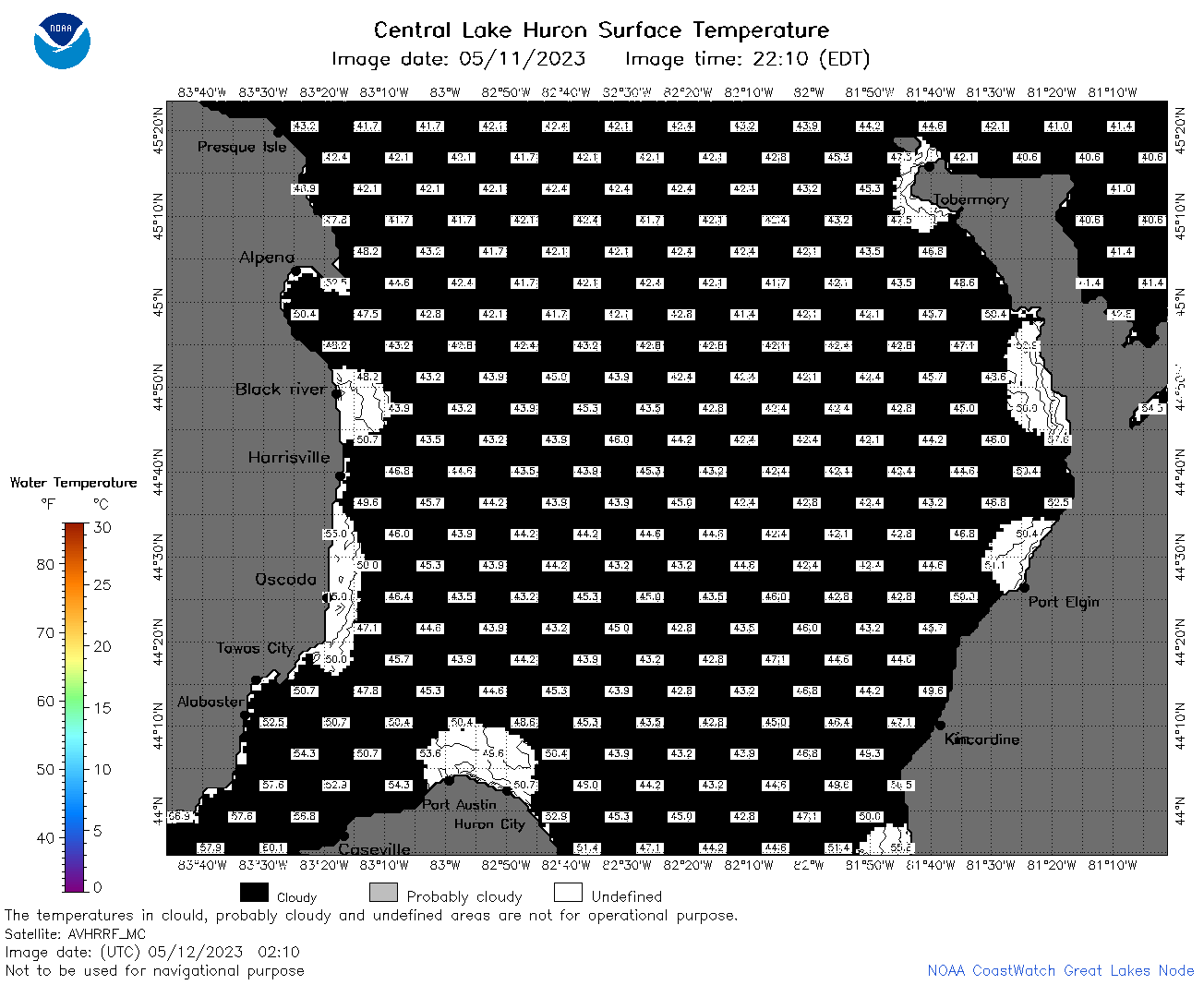 | h2_2023_05_12_0210.png | 12-May-2023 05:30 | 42315 | |
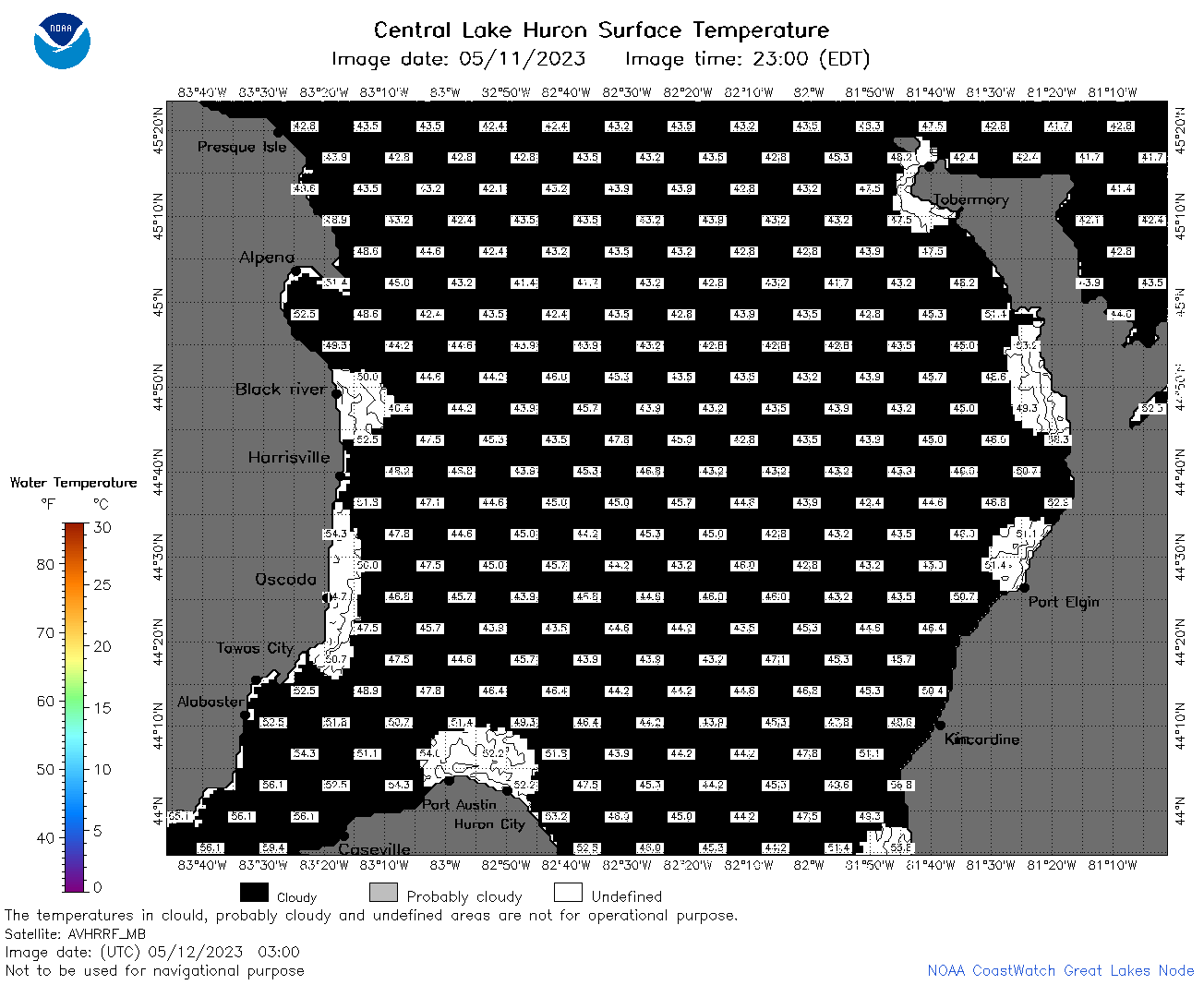 | h2_2023_05_12_0300.png | 12-May-2023 05:34 | 42840 | |
 | h2_2023_05_12_0630.png | 12-May-2023 09:25 | 61924 | |
 | h2_2023_05_12_0720.png | 12-May-2023 11:26 | 91576 | |
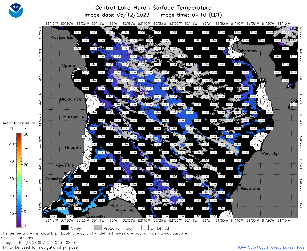 | h2_2023_05_12_0810.png | 12-May-2023 11:28 | 84400 | |
 | h2_2023_05_12_1420.png | 12-May-2023 18:25 | 41408 | |
 | h2_2023_05_12_1510.png | 12-May-2023 18:28 | 49264 | |
 | h2_2023_05_12_1600.png | 12-May-2023 20:26 | 45808 | |
 | h2_2023_05_12_1650.png | 12-May-2023 20:30 | 31969 | |
 | h2_2023_05_12_1700.png | 12-May-2023 19:25 | 37878 | |
 | h2_2023_05_12_1750.png | 12-May-2023 20:32 | 40444 | |
 | h2_2023_05_12_1840.png | 12-May-2023 21:27 | 39785 | |
 | h2_2023_05_12_1930.png | 12-May-2023 22:27 | 37851 | |
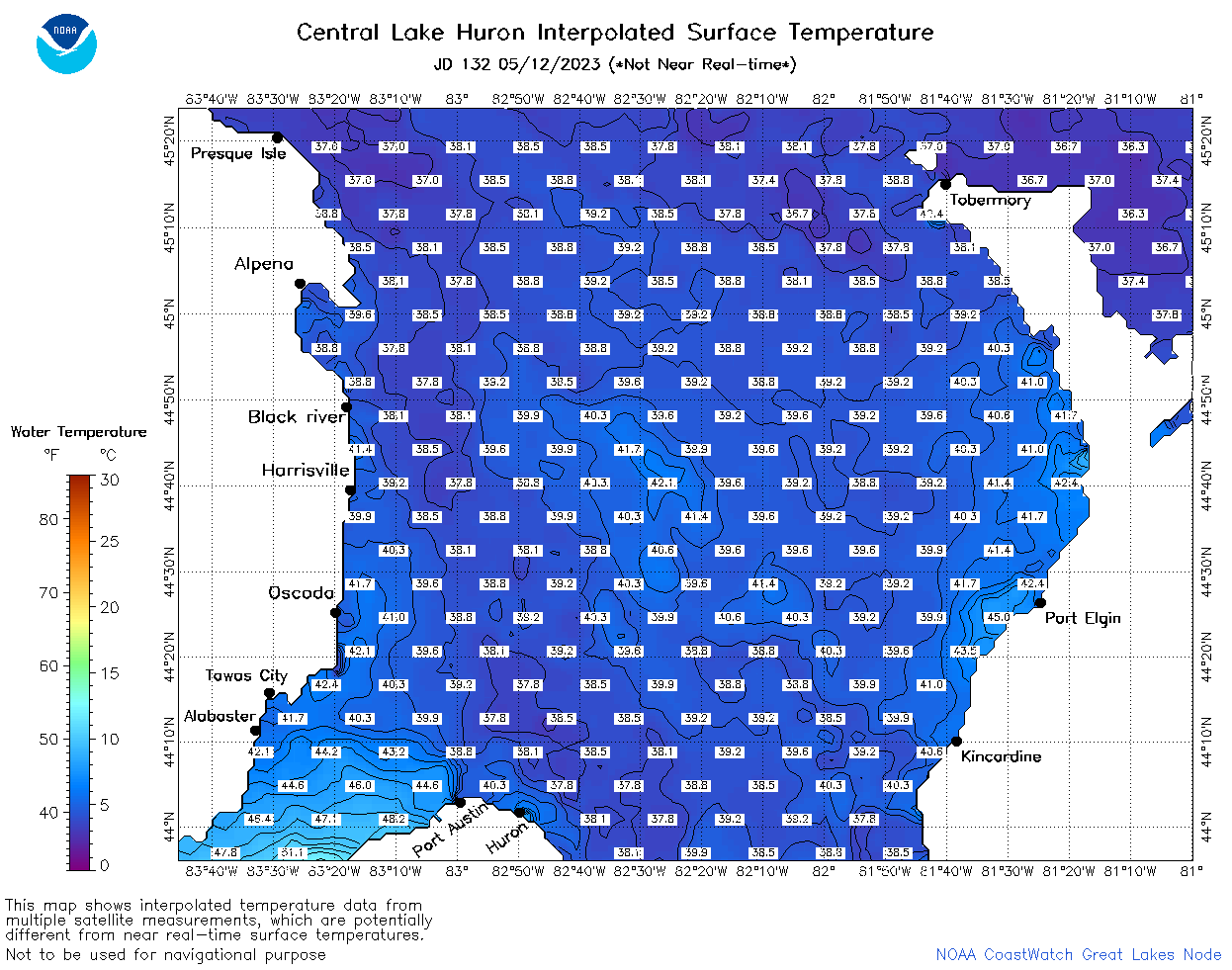 | h2_2023_132.png | 13-May-2023 09:14 | 77356 | |