
Easier access to scientific data

Brought to you by NOAA CoastWatch Great Lakes Node
|
ERDDAP
Easier access to scientific data |
|
Brought to you by NOAA CoastWatch Great Lakes Node |
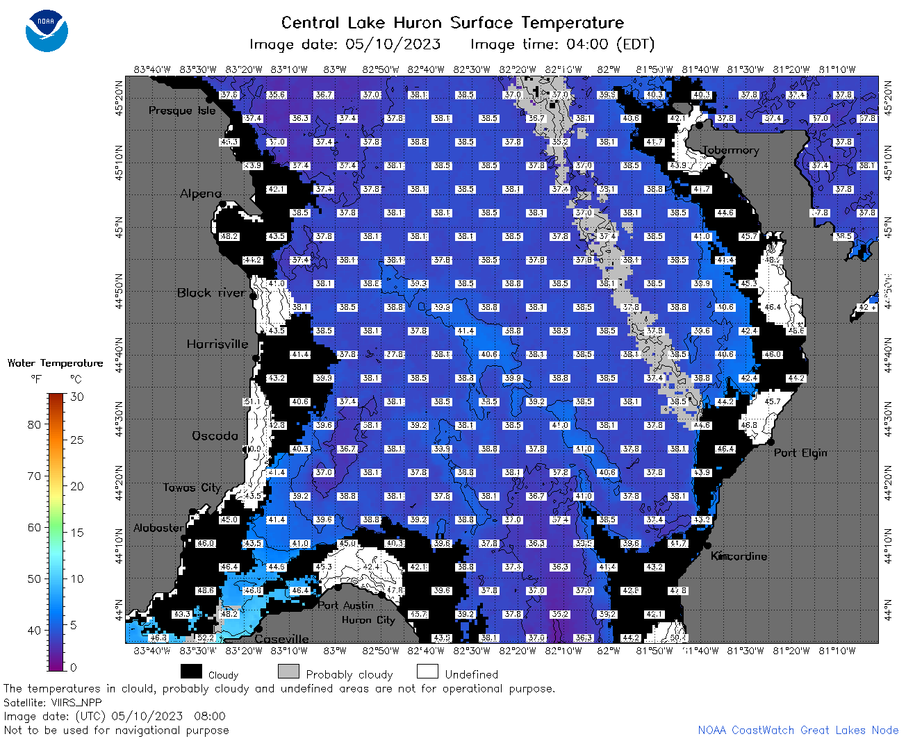
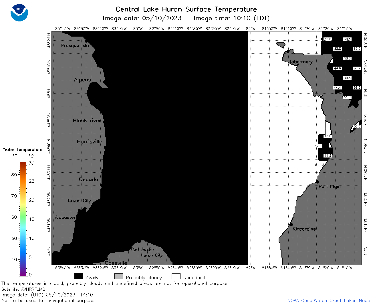
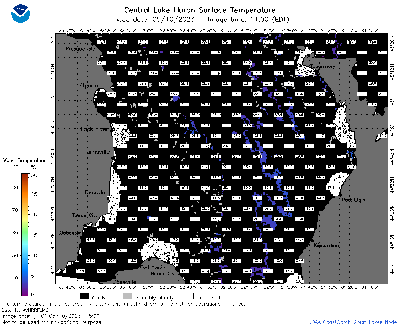
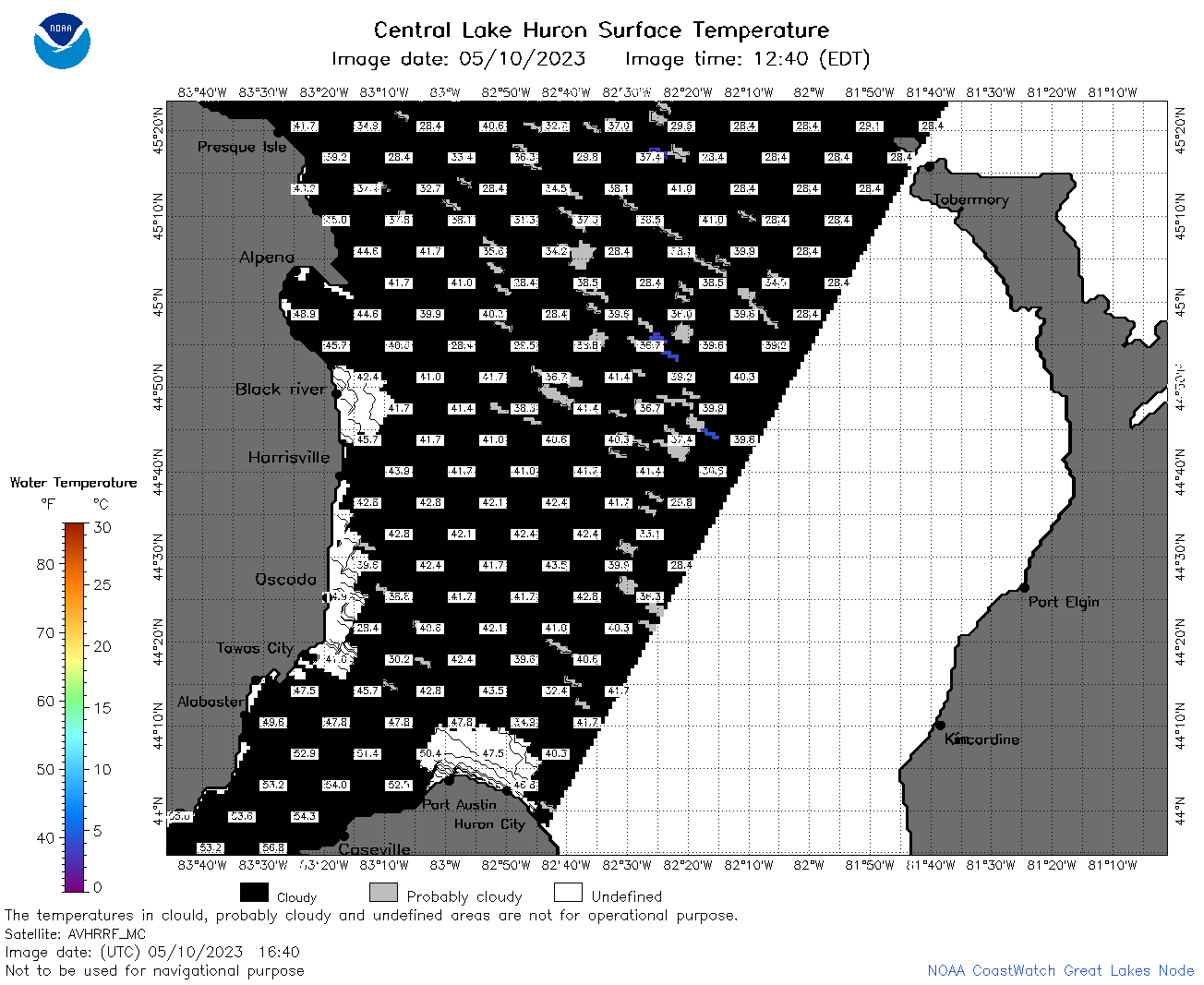
| Dataset Title: | Lake Huron Central Region Surface Temperature Contour Map (2022-present)


|
| Institution: | CoastWatch Great Lakes Node (Dataset ID: LH_NRT_TC_h2) |
| Information: | Summary
| License
| Metadata
| Background | Subset
| Data Access Form
| Make a graph
| Subset
| Data Access Form
| Make a graph
|
![[ICO]](https://apps.glerl.noaa.gov/erddap/images/fileIcons/blank.gif) | Name | Last modified | Size | Description |
|---|---|---|---|---|
![[DIR]](https://apps.glerl.noaa.gov/erddap/images/fileIcons/back.gif) | Parent Directory | - | - | |
![[IMG]](https://apps.glerl.noaa.gov/erddap/images/fileIcons/image2.gif) 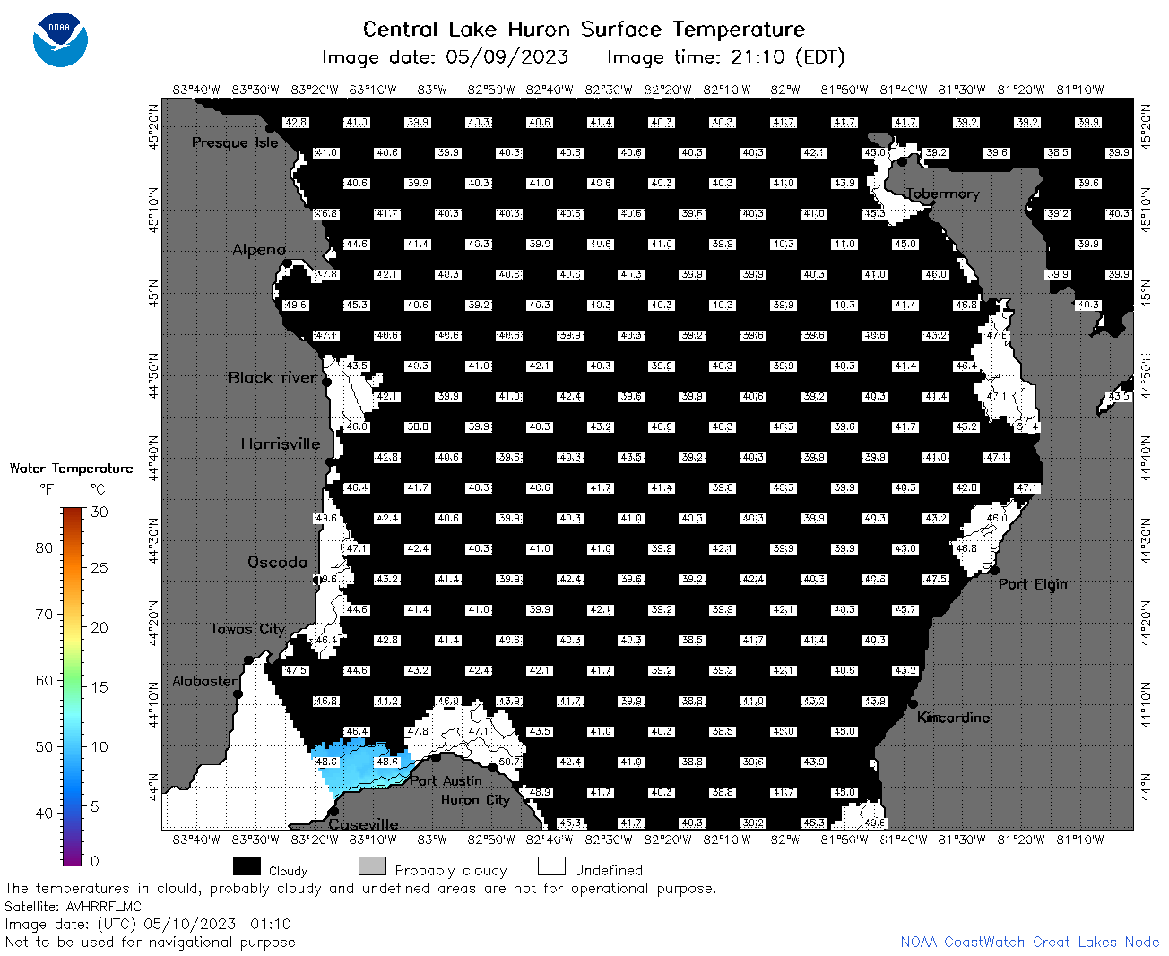 | h2_2023_05_10_0110.png | 10-May-2023 05:25 | 43323 | |
 | h2_2023_05_10_0200.png | 10-May-2023 05:28 | 46408 | |
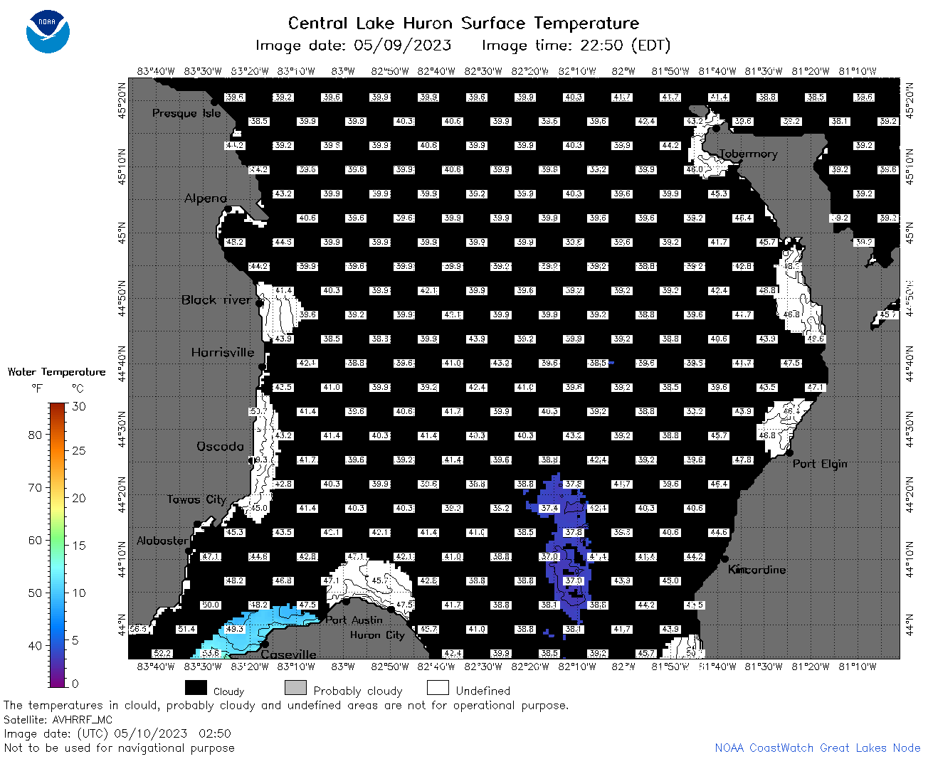 | h2_2023_05_10_0250.png | 10-May-2023 05:30 | 45614 | |
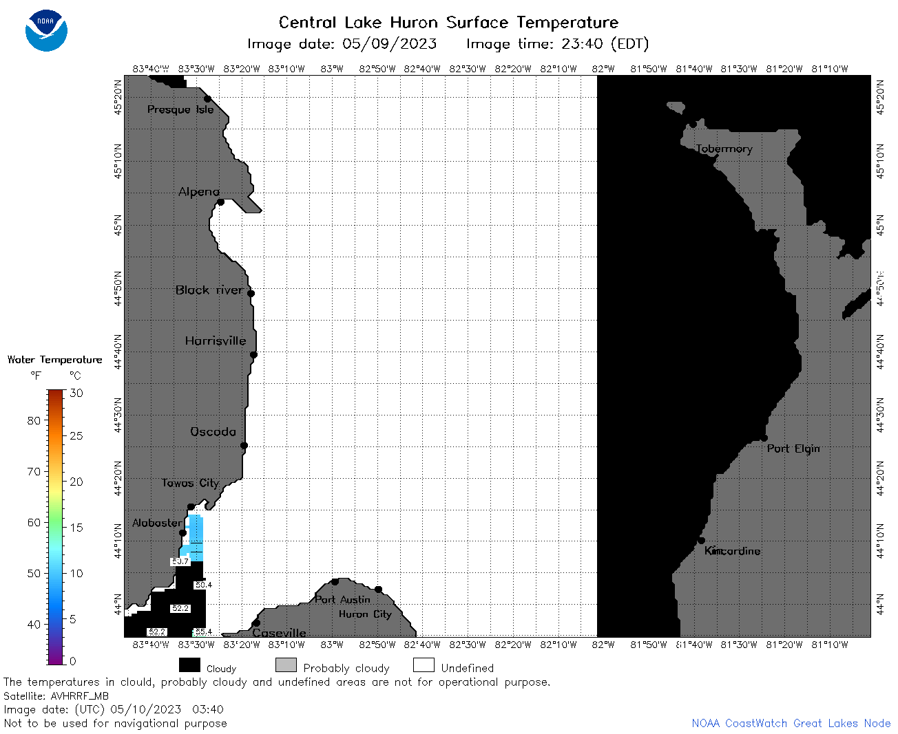 | h2_2023_05_10_0340.png | 10-May-2023 06:26 | 33878 | |
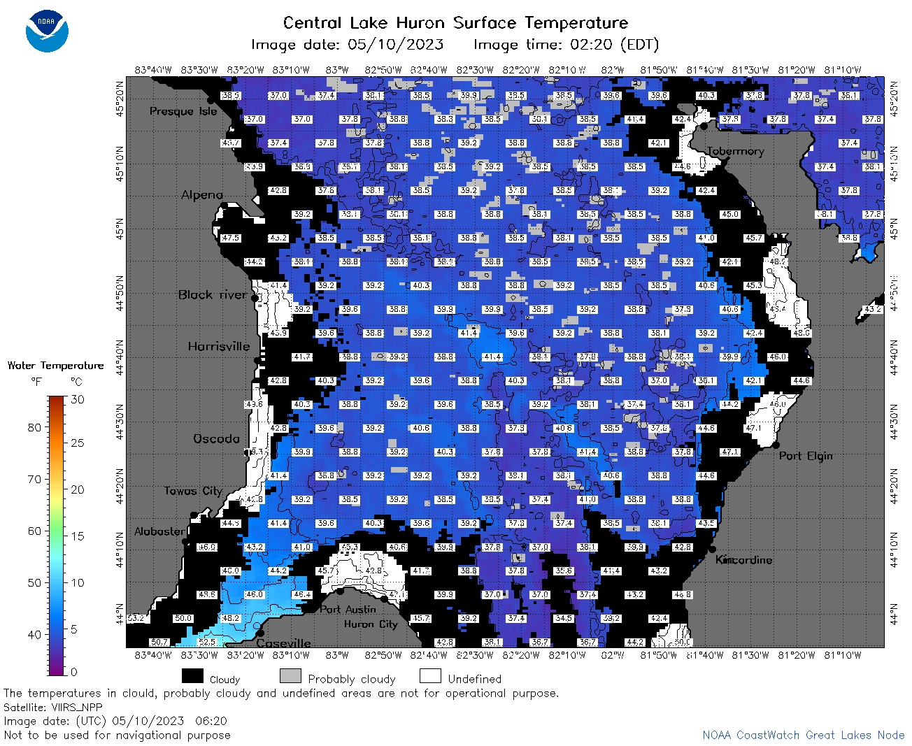 | h2_2023_05_10_0620.png | 10-May-2023 10:25 | 100175 | |
 | h2_2023_05_10_0710.png | 10-May-2023 10:30 | 92848 | |
 | h2_2023_05_10_0800.png | 10-May-2023 11:29 | 103429 | |
 | h2_2023_05_10_0840.png | 10-May-2023 12:25 | 38651 | |
 | h2_2023_05_10_0850.png | 10-May-2023 11:31 | 77611 | |
 | h2_2023_05_10_1410.png | 10-May-2023 17:25 | 33391 | |
 | h2_2023_05_10_1500.png | 10-May-2023 19:26 | 54915 | |
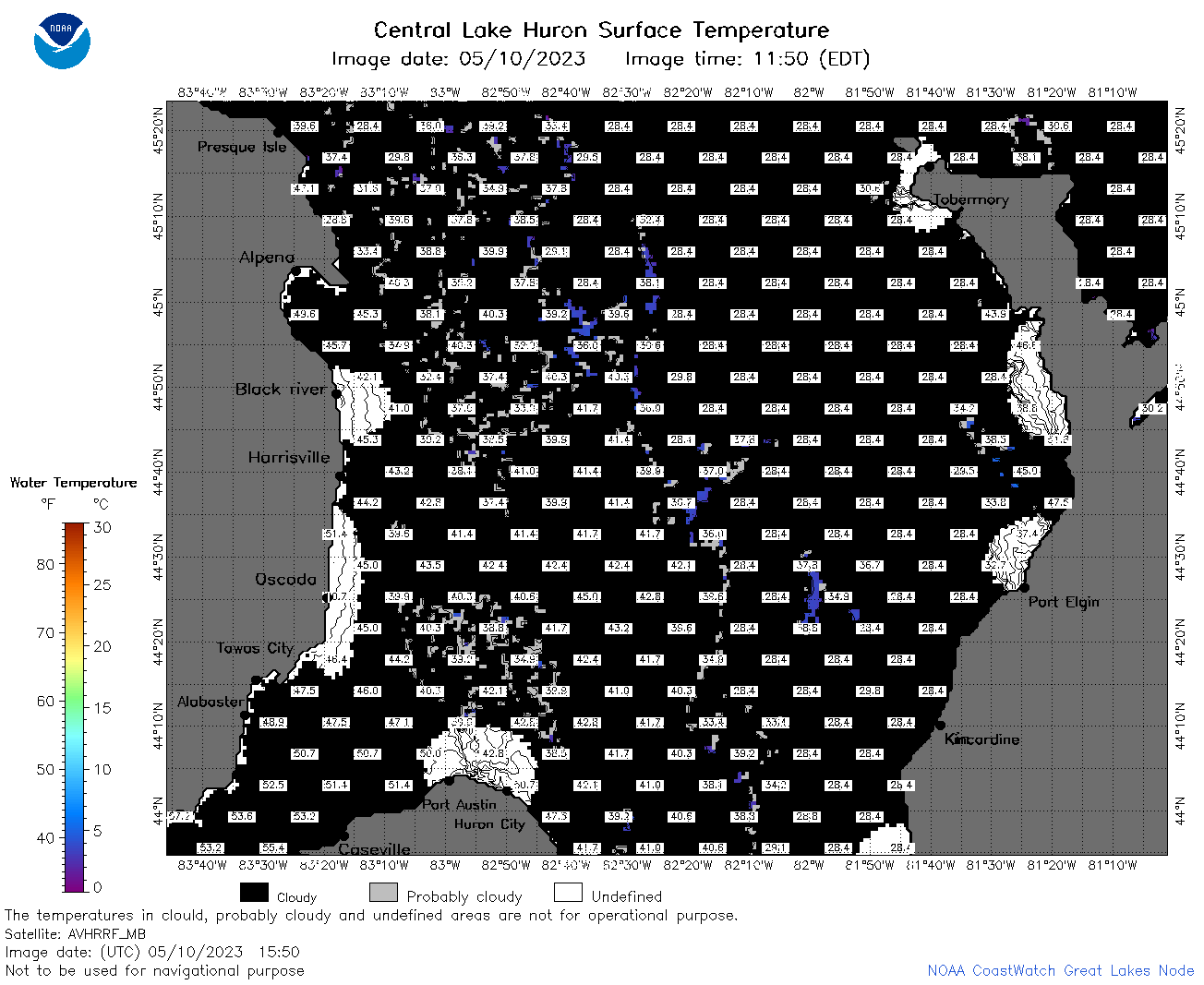 | h2_2023_05_10_1550.png | 10-May-2023 19:30 | 52738 | |
 | h2_2023_05_10_1640.png | 10-May-2023 20:26 | 45350 | |
 | h2_2023_130.png | 11-May-2023 09:14 | 76282 | |