
Easier access to scientific data

Brought to you by NOAA CoastWatch Great Lakes Node
|
ERDDAP
Easier access to scientific data |
|
Brought to you by NOAA CoastWatch Great Lakes Node |
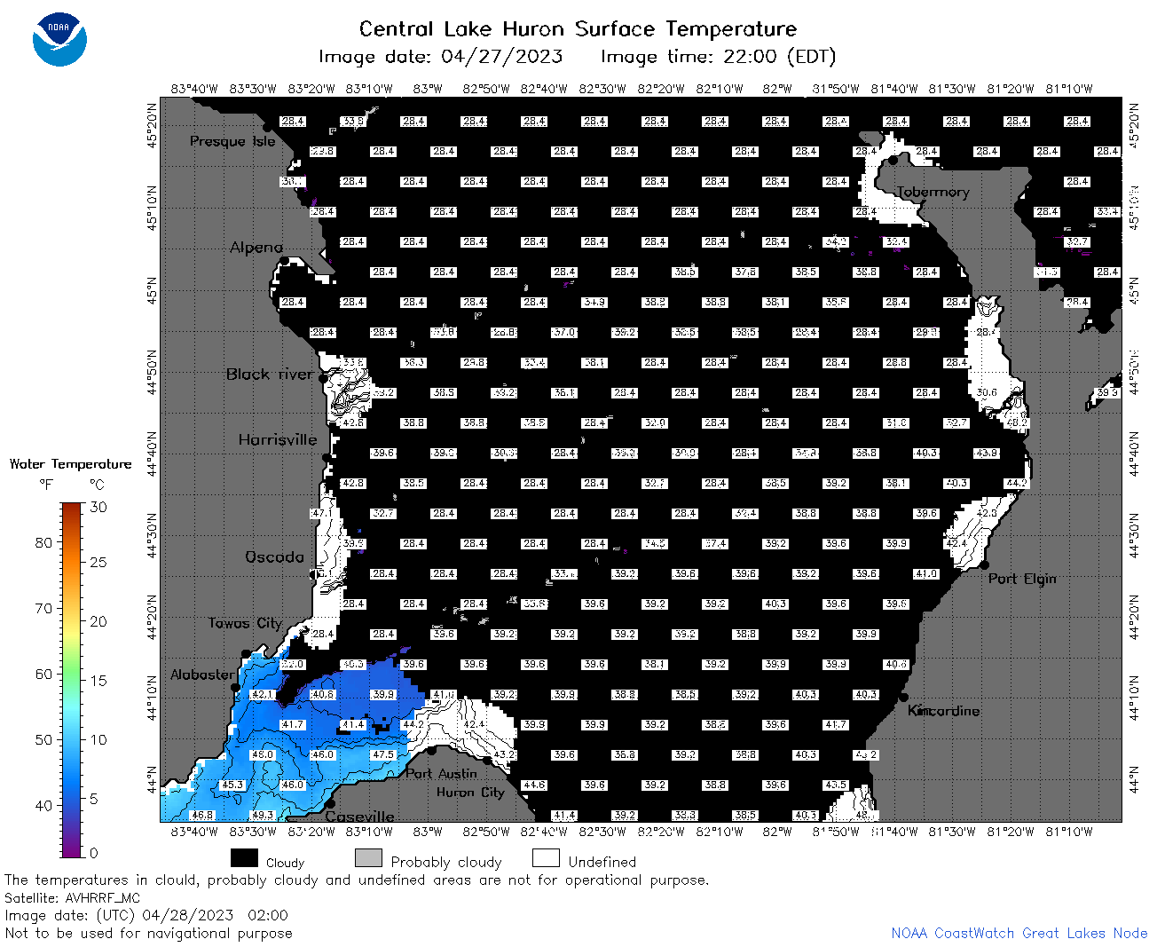
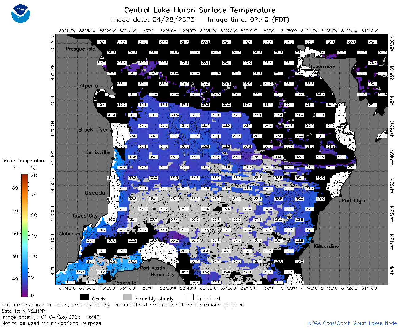
| Dataset Title: | Lake Huron Central Region Surface Temperature Contour Map (2022-present)


|
| Institution: | CoastWatch Great Lakes Node (Dataset ID: LH_NRT_TC_h2) |
| Information: | Summary
| License
| Metadata
| Background | Subset
| Data Access Form
| Make a graph
| Subset
| Data Access Form
| Make a graph
|
![[ICO]](https://apps.glerl.noaa.gov/erddap/images/fileIcons/blank.gif) | Name | Last modified | Size | Description |
|---|---|---|---|---|
![[DIR]](https://apps.glerl.noaa.gov/erddap/images/fileIcons/back.gif) | Parent Directory | - | - | |
![[IMG]](https://apps.glerl.noaa.gov/erddap/images/fileIcons/image2.gif)  | h2_2023_04_28_0110.png | 28-Apr-2023 05:27 | 40884 | |
 | h2_2023_04_28_0200.png | 28-Apr-2023 05:30 | 50574 | |
 | h2_2023_04_28_0250.png | 28-Apr-2023 05:34 | 51556 | |
 | h2_2023_04_28_0340.png | 28-Apr-2023 06:26 | 34732 | |
 | h2_2023_04_28_0640.png | 28-Apr-2023 18:25 | 89502 | |
 | h2_2023_04_28_0730.png | 28-Apr-2023 18:28 | 90094 | |
 | h2_2023_04_28_0820.png | 28-Apr-2023 18:30 | 76165 | |
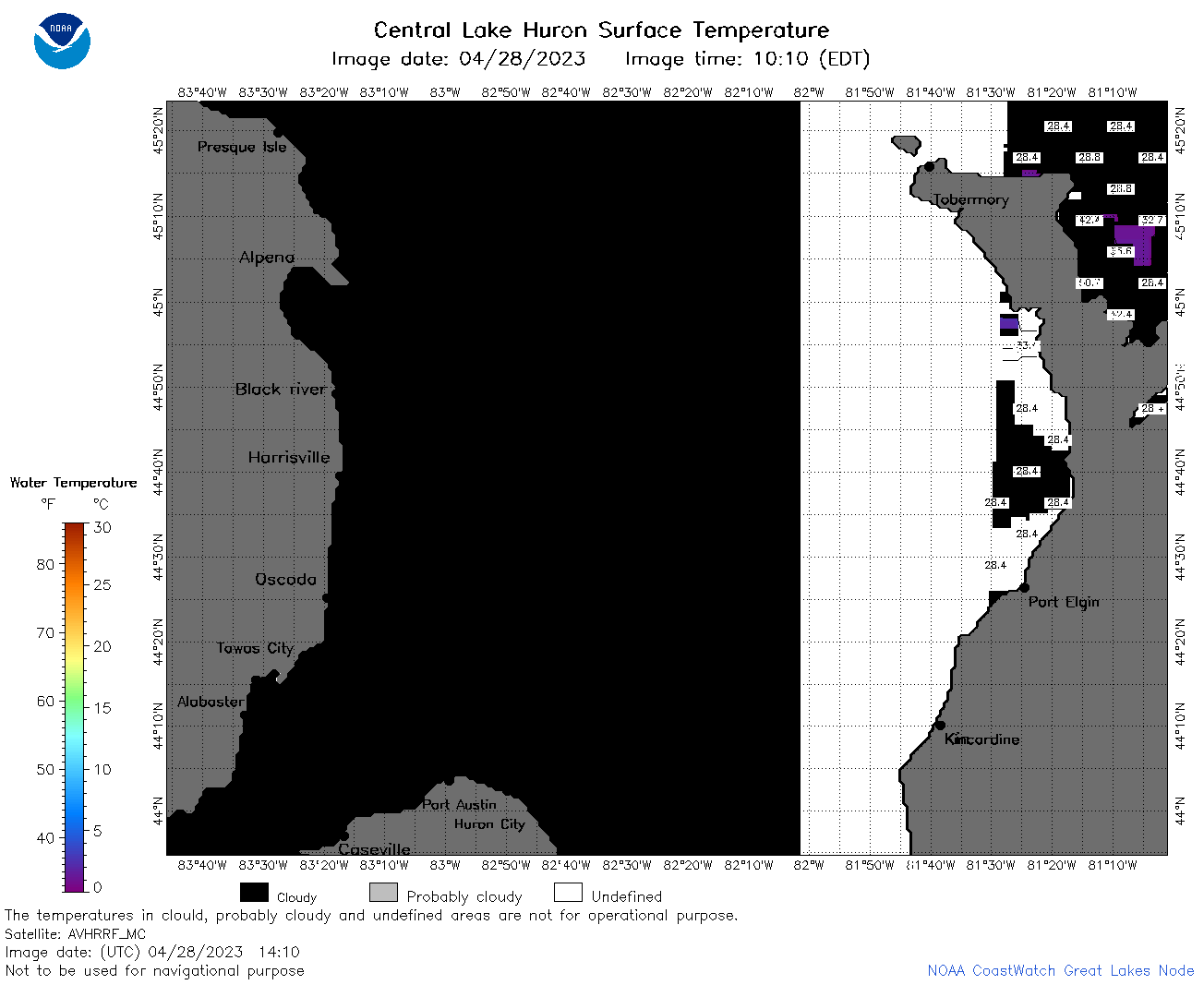 | h2_2023_04_28_1410.png | 28-Apr-2023 18:34 | 34116 | |
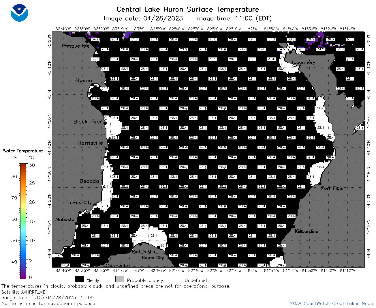 | h2_2023_04_28_1500.png | 28-Apr-2023 18:36 | 37945 | |
 | h2_2023_04_28_1550.png | 28-Apr-2023 19:25 | 35903 | |
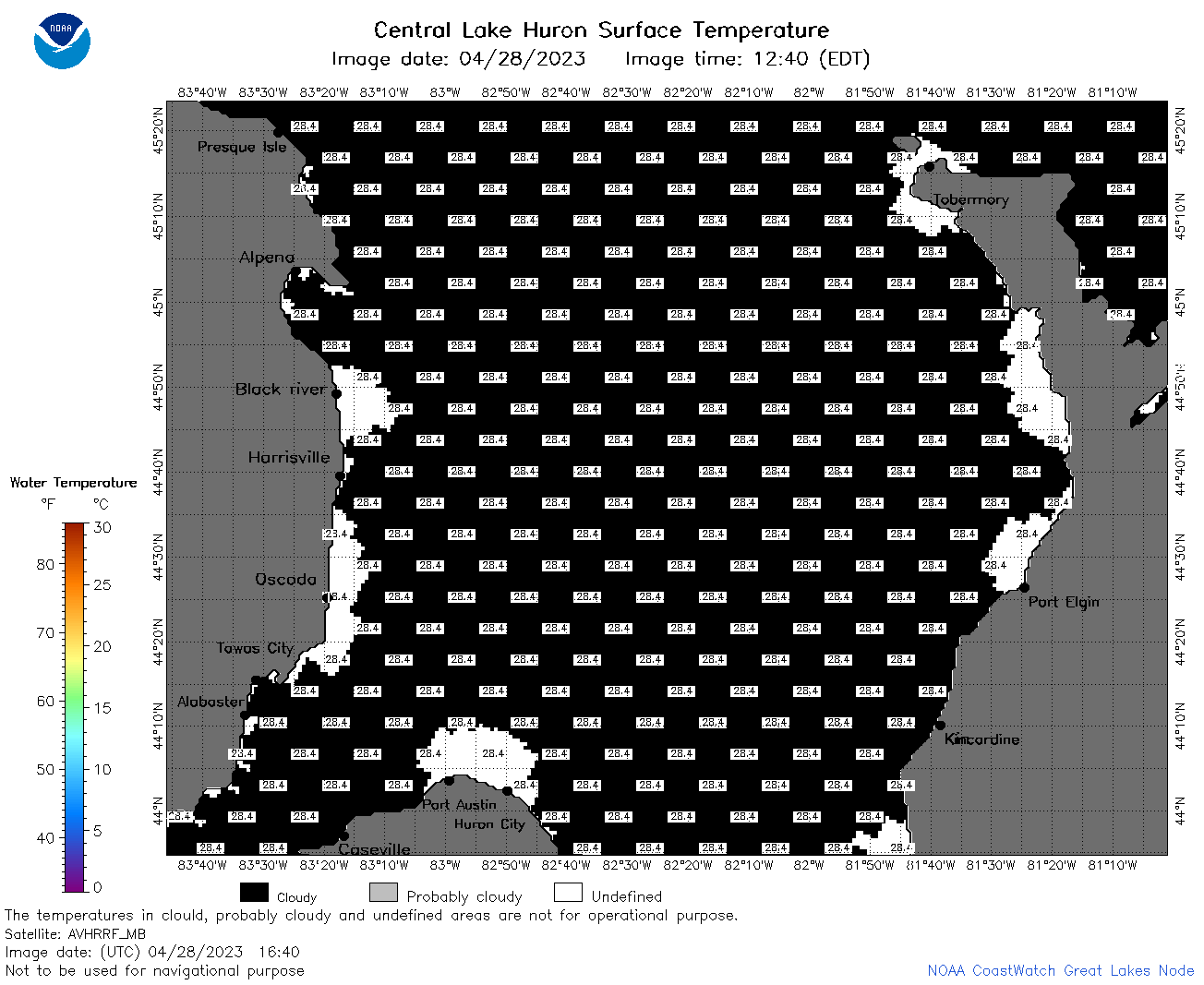 | h2_2023_04_28_1640.png | 28-Apr-2023 19:28 | 35546 | |
 | h2_2023_04_28_1710.png | 28-Apr-2023 20:25 | 34884 | |
 | h2_2023_04_28_1720.png | 28-Apr-2023 19:30 | 35260 | |
 | h2_2023_04_28_1810.png | 28-Apr-2023 22:25 | 35370 | |
 | h2_2023_04_28_1900.png | 28-Apr-2023 22:28 | 35316 | |