
Easier access to scientific data

Brought to you by NOAA CoastWatch Great Lakes Node
|
ERDDAP
Easier access to scientific data |
|
Brought to you by NOAA CoastWatch Great Lakes Node |
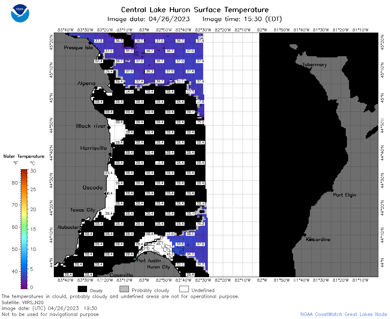
| Dataset Title: | Lake Huron Central Region Surface Temperature Contour Map (2022-present)


|
| Institution: | CoastWatch Great Lakes Node (Dataset ID: LH_NRT_TC_h2) |
| Information: | Summary
| License
| Metadata
| Background | Subset
| Data Access Form
| Make a graph
| Subset
| Data Access Form
| Make a graph
|
![[ICO]](https://apps.glerl.noaa.gov/erddap/images/fileIcons/blank.gif) | Name | Last modified | Size | Description |
|---|---|---|---|---|
![[DIR]](https://apps.glerl.noaa.gov/erddap/images/fileIcons/back.gif) | Parent Directory | - | - | |
![[IMG]](https://apps.glerl.noaa.gov/erddap/images/fileIcons/image2.gif) 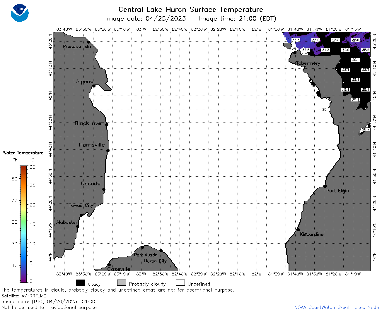 | h2_2023_04_26_0100.png | 26-Apr-2023 16:25 | 35272 | |
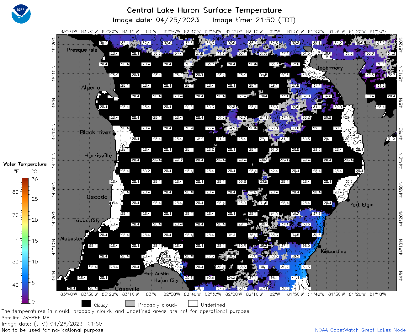 | h2_2023_04_26_0150.png | 26-Apr-2023 16:27 | 74693 | |
 | h2_2023_04_26_0240.png | 26-Apr-2023 16:30 | 70778 | |
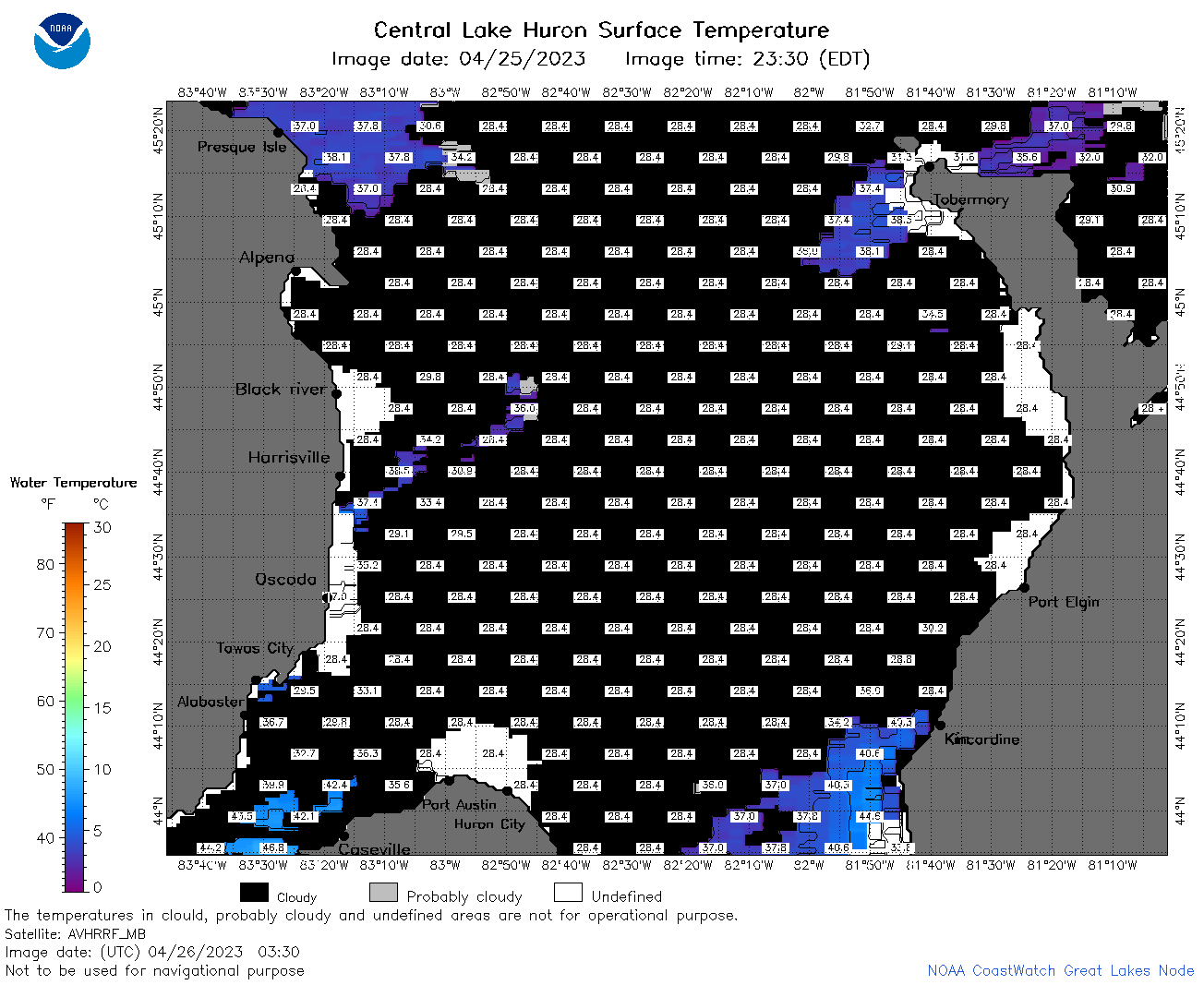 | h2_2023_04_26_0330.png | 26-Apr-2023 16:32 | 48653 | |
 | h2_2023_04_26_0630.png | 26-Apr-2023 16:34 | 80328 | |
 | h2_2023_04_26_0720.png | 26-Apr-2023 16:37 | 100926 | |
 | h2_2023_04_26_0810.png | 26-Apr-2023 16:39 | 97412 | |
 | h2_2023_04_26_1450.png | 26-Apr-2023 20:26 | 63239 | |
 | h2_2023_04_26_1540.png | 26-Apr-2023 18:26 | 73119 | |
 | h2_2023_04_26_1630.png | 26-Apr-2023 20:30 | 68962 | |
 | h2_2023_04_26_1700.png | 26-Apr-2023 20:34 | 77521 | |
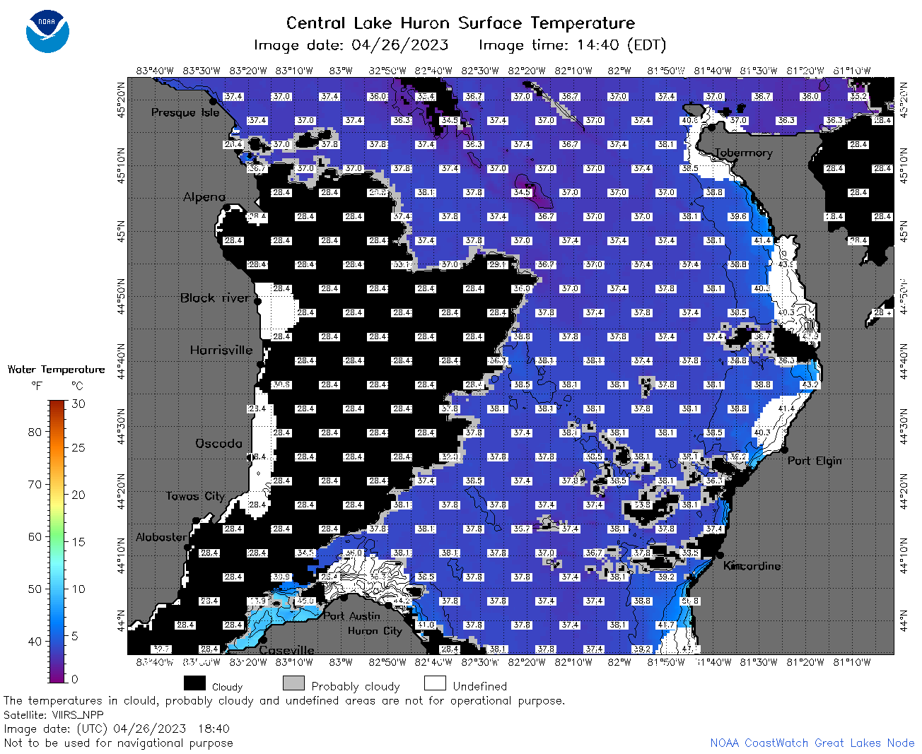 | h2_2023_04_26_1840.png | 26-Apr-2023 21:28 | 82310 | |
 | h2_2023_04_26_1930.png | 26-Apr-2023 22:26 | 45710 | |