
Easier access to scientific data

Brought to you by NOAA CoastWatch Great Lakes Node
|
ERDDAP
Easier access to scientific data |
|
Brought to you by NOAA CoastWatch Great Lakes Node |
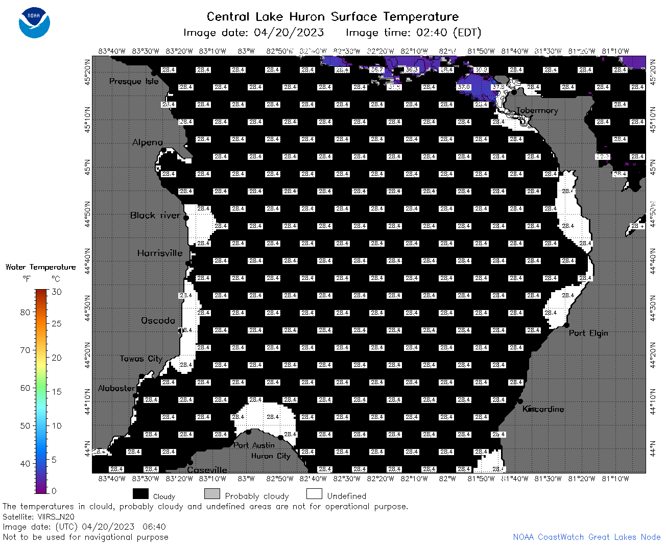
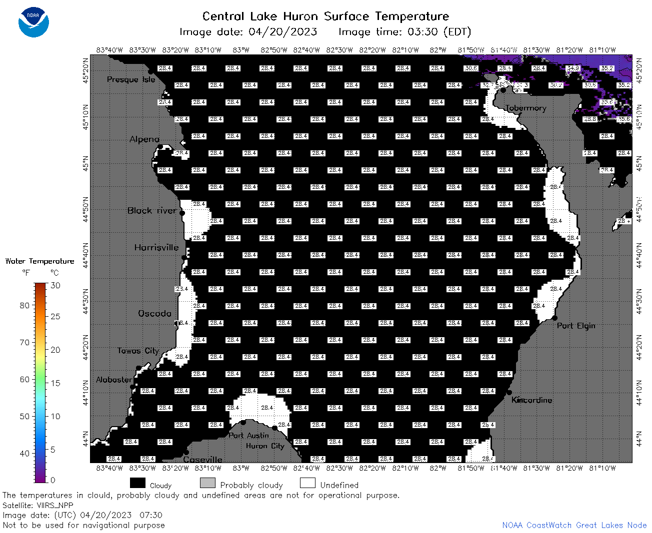
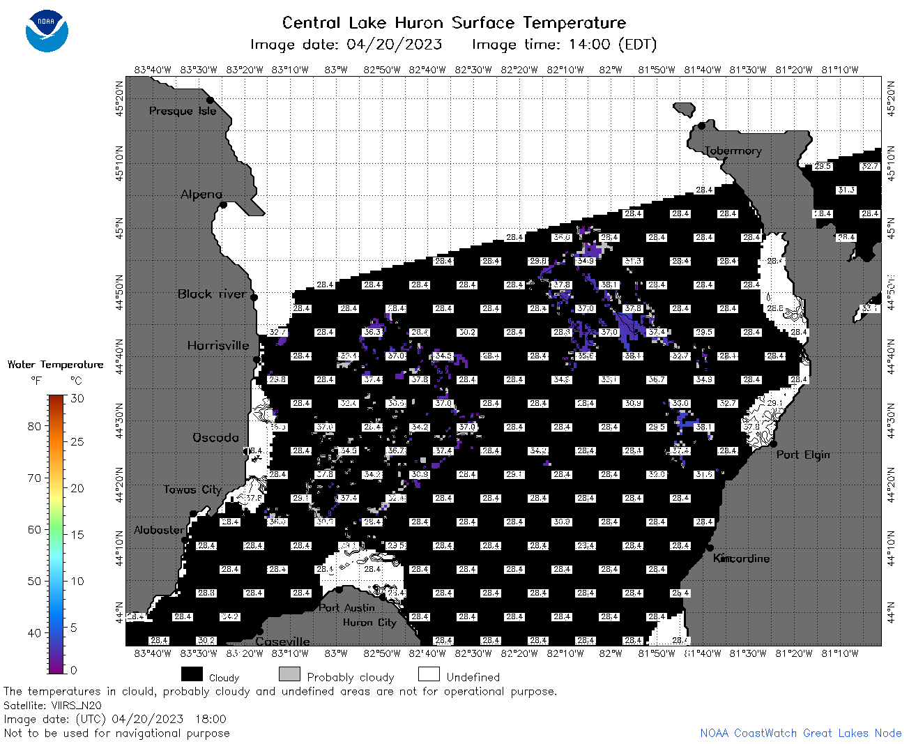
| Dataset Title: | Lake Huron Central Region Surface Temperature Contour Map (2022-present)


|
| Institution: | CoastWatch Great Lakes Node (Dataset ID: LH_NRT_TC_h2) |
| Information: | Summary
| License
| Metadata
| Background | Subset
| Data Access Form
| Make a graph
| Subset
| Data Access Form
| Make a graph
|
![[ICO]](https://apps.glerl.noaa.gov/erddap/images/fileIcons/blank.gif) | Name | Last modified | Size | Description |
|---|---|---|---|---|
![[DIR]](https://apps.glerl.noaa.gov/erddap/images/fileIcons/back.gif) | Parent Directory | - | - | |
![[IMG]](https://apps.glerl.noaa.gov/erddap/images/fileIcons/image2.gif)  | h2_2023_04_20_0120.png | 20-Apr-2023 05:26 | 35659 | |
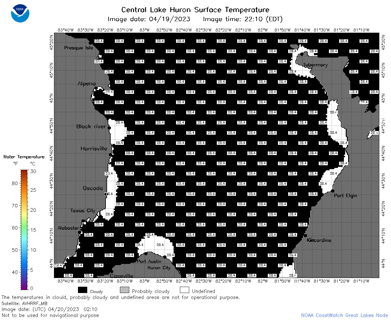 | h2_2023_04_20_0210.png | 20-Apr-2023 05:30 | 35438 | |
 | h2_2023_04_20_0300.png | 20-Apr-2023 06:26 | 35686 | |
 | h2_2023_04_20_0640.png | 20-Apr-2023 10:26 | 40192 | |
 | h2_2023_04_20_0730.png | 20-Apr-2023 13:26 | 39692 | |
 | h2_2023_04_20_0820.png | 20-Apr-2023 11:26 | 36659 | |
 | h2_2023_04_20_1430.png | 20-Apr-2023 17:27 | 35574 | |
 | h2_2023_04_20_1520.png | 20-Apr-2023 19:26 | 35818 | |
 | h2_2023_04_20_1610.png | 20-Apr-2023 19:30 | 37210 | |
 | h2_2023_04_20_1720.png | 20-Apr-2023 23:26 | 36966 | |
 | h2_2023_04_20_1800.png | 20-Apr-2023 21:28 | 47840 | |
 | h2_2023_04_20_1810.png | 20-Apr-2023 20:27 | 36724 | |
 | h2_2023_04_20_1900.png | 20-Apr-2023 22:26 | 41582 | |
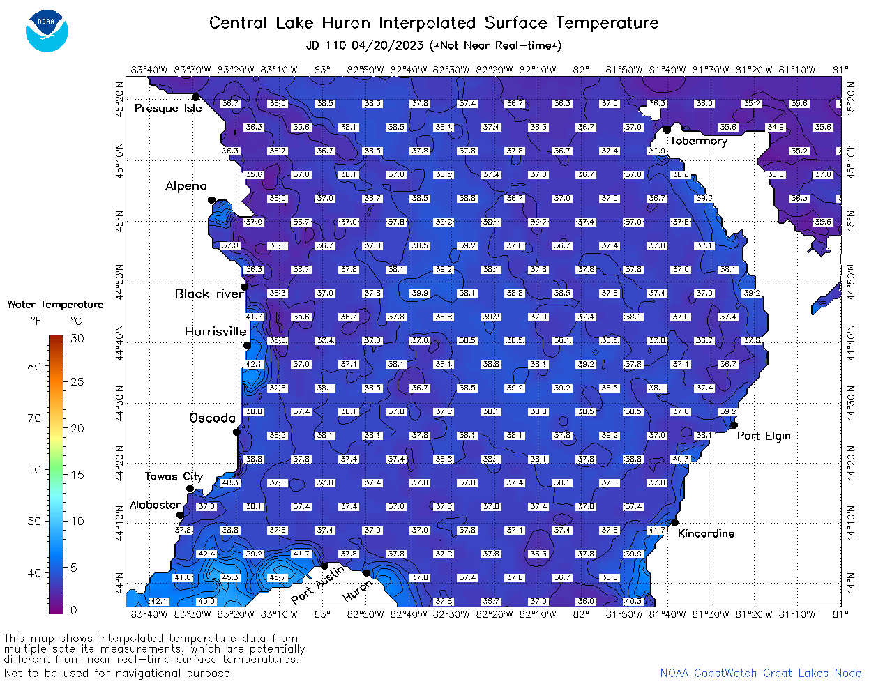 | h2_2023_110.png | 21-Apr-2023 09:14 | 76758 | |