
Easier access to scientific data

Brought to you by NOAA CoastWatch Great Lakes Node
|
ERDDAP
Easier access to scientific data |
|
Brought to you by NOAA CoastWatch Great Lakes Node |
| Dataset Title: | Lake Huron Central Region Surface Temperature Contour Map (2022-present)


|
| Institution: | CoastWatch Great Lakes Node (Dataset ID: LH_NRT_TC_h2) |
| Information: | Summary
| License
| Metadata
| Background | Subset
| Data Access Form
| Make a graph
| Subset
| Data Access Form
| Make a graph
|
![[ICO]](https://apps.glerl.noaa.gov/erddap/images/fileIcons/blank.gif) | Name | Last modified | Size | Description |
|---|---|---|---|---|
![[DIR]](https://apps.glerl.noaa.gov/erddap/images/fileIcons/back.gif) | Parent Directory | - | - | |
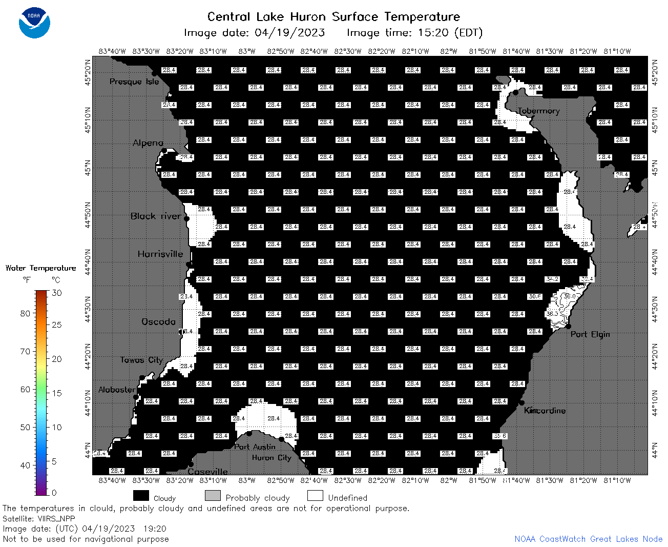
![[IMG]](https://apps.glerl.noaa.gov/erddap/images/fileIcons/image2.gif) 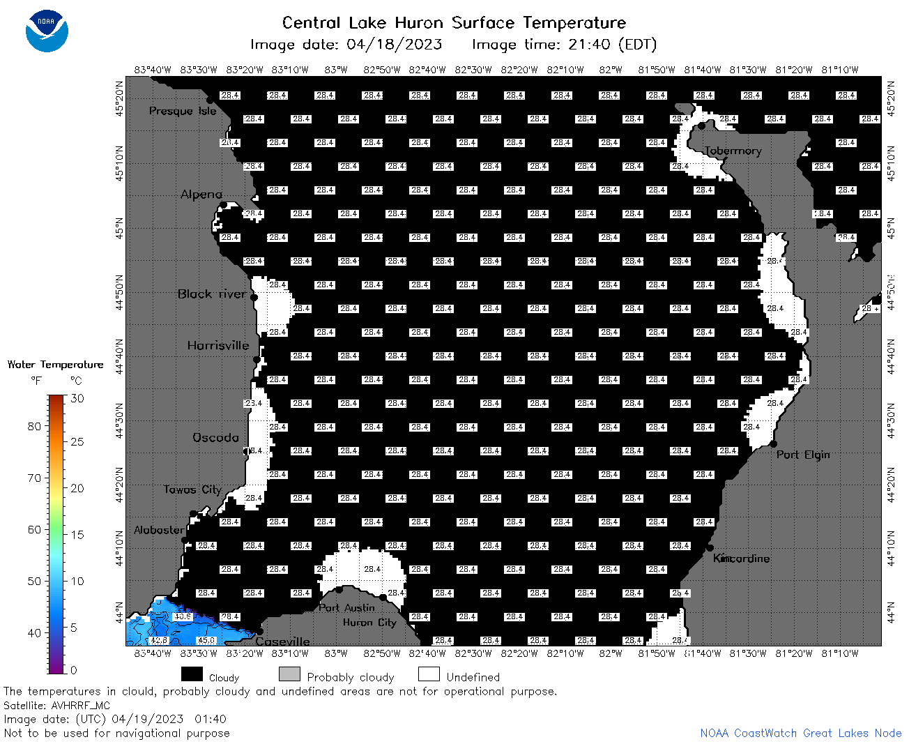 | h2_2023_04_19_0140.png | 19-Apr-2023 05:26 | 38783 | |
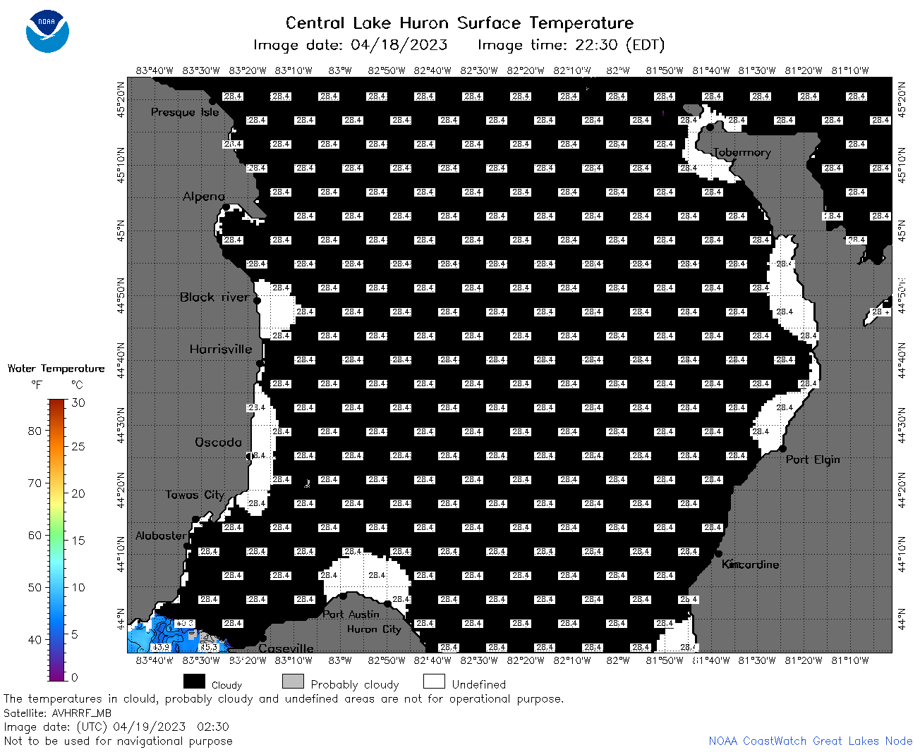 | h2_2023_04_19_0230.png | 19-Apr-2023 05:30 | 38321 | |
 | h2_2023_04_19_0320.png | 19-Apr-2023 06:26 | 36533 | |
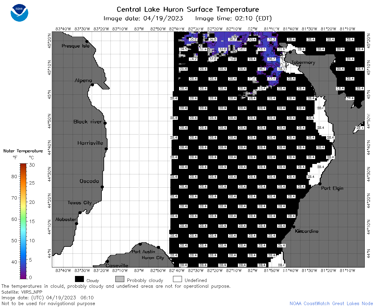 | h2_2023_04_19_0610.png | 19-Apr-2023 10:25 | 44541 | |
 | h2_2023_04_19_0700.png | 19-Apr-2023 10:28 | 80364 | |
 | h2_2023_04_19_0750.png | 19-Apr-2023 11:26 | 84695 | |
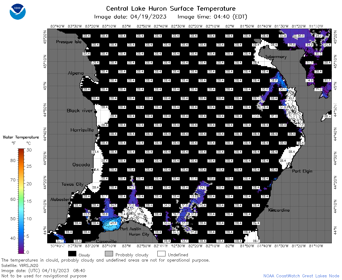 | h2_2023_04_19_0840.png | 19-Apr-2023 12:26 | 56390 | |
 | h2_2023_04_19_1450.png | 19-Apr-2023 17:26 | 36964 | |
 | h2_2023_04_19_1540.png | 19-Apr-2023 19:26 | 36707 | |
 | h2_2023_04_19_1630.png | 19-Apr-2023 19:28 | 35916 | |
 | h2_2023_04_19_1740.png | 19-Apr-2023 22:26 | 45236 | |
 | h2_2023_04_19_1820.png | 19-Apr-2023 21:27 | 39718 | |
 | h2_2023_04_19_1920.png | 19-Apr-2023 22:29 | 35845 | |
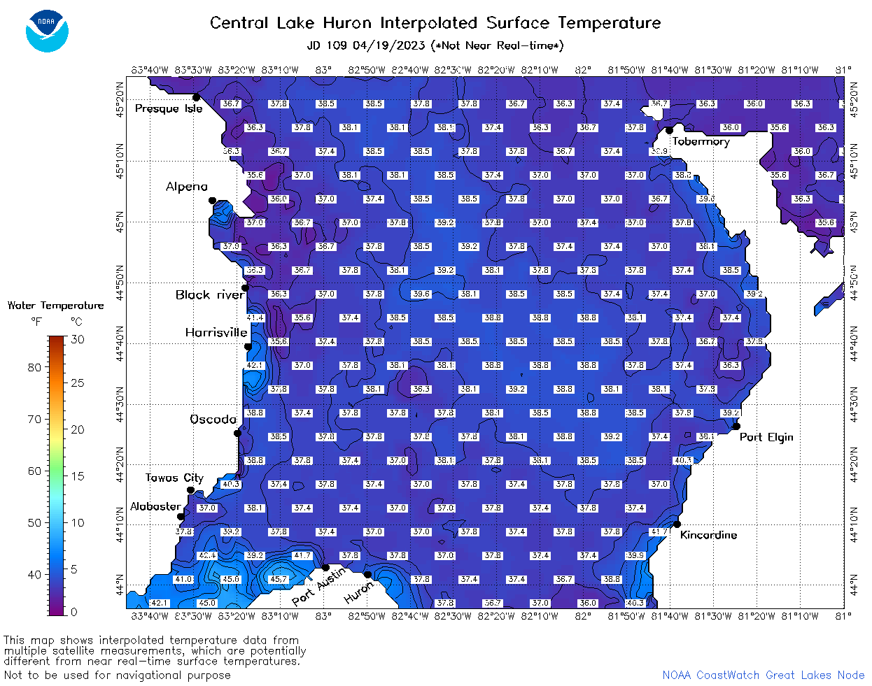 | h2_2023_109.png | 20-Apr-2023 09:14 | 72875 | |