
Easier access to scientific data

Brought to you by NOAA CoastWatch Great Lakes Node
|
ERDDAP
Easier access to scientific data |
|
Brought to you by NOAA CoastWatch Great Lakes Node |
| Dataset Title: | Lake Huron Central Region Surface Temperature Contour Map (2022-present)


|
| Institution: | CoastWatch Great Lakes Node (Dataset ID: LH_NRT_TC_h2) |
| Information: | Summary
| License
| Metadata
| Background | Subset
| Data Access Form
| Make a graph
| Subset
| Data Access Form
| Make a graph
|
![[ICO]](https://apps.glerl.noaa.gov/erddap/images/fileIcons/blank.gif) | Name | Last modified | Size | Description |
|---|---|---|---|---|
![[DIR]](https://apps.glerl.noaa.gov/erddap/images/fileIcons/back.gif) | Parent Directory | - | - | |
![[IMG]](https://apps.glerl.noaa.gov/erddap/images/fileIcons/image2.gif)  | h2_2023_04_14_0150.png | 14-Apr-2023 05:28 | 44102 | |
 | h2_2023_04_14_0230.png | 14-Apr-2023 05:30 | 33968 | |
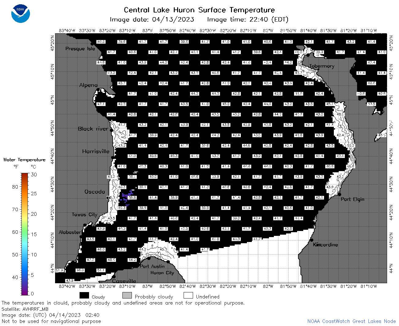 | h2_2023_04_14_0240.png | 14-Apr-2023 05:32 | 44171 | |
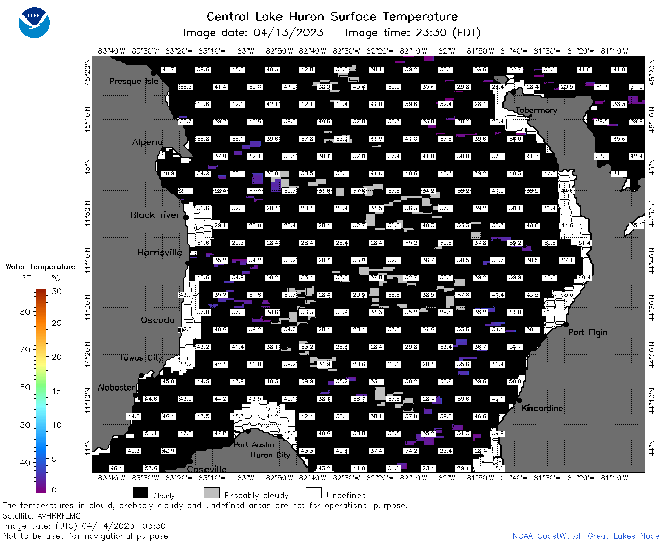 | h2_2023_04_14_0330.png | 14-Apr-2023 06:26 | 49304 | |
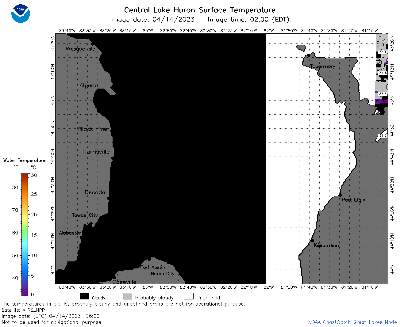 | h2_2023_04_14_0600.png | 14-Apr-2023 10:25 | 33547 | |
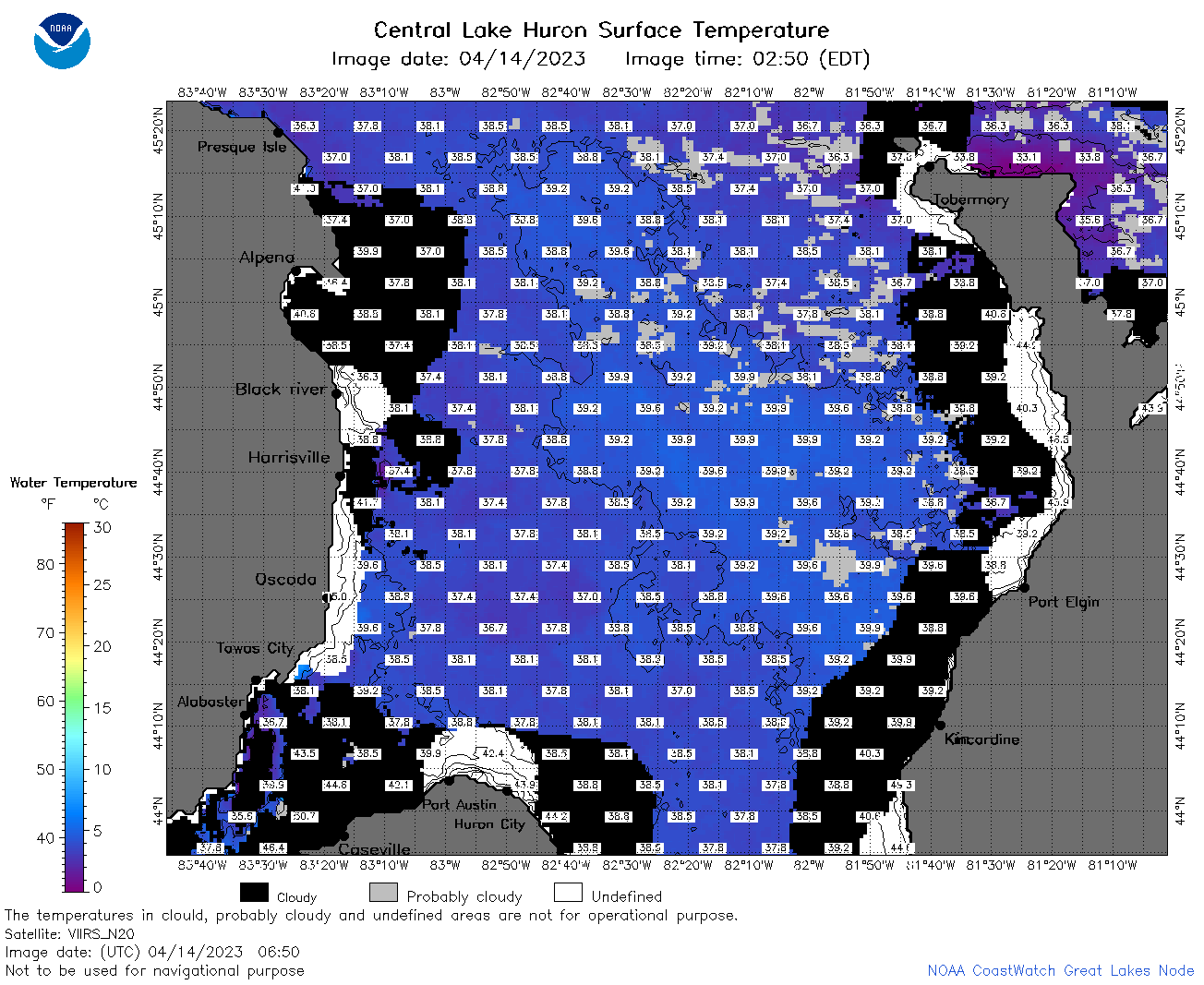 | h2_2023_04_14_0650.png | 14-Apr-2023 09:26 | 93015 | |
 | h2_2023_04_14_0740.png | 14-Apr-2023 11:26 | 85266 | |
 | h2_2023_04_14_0830.png | 14-Apr-2023 11:30 | 77281 | |
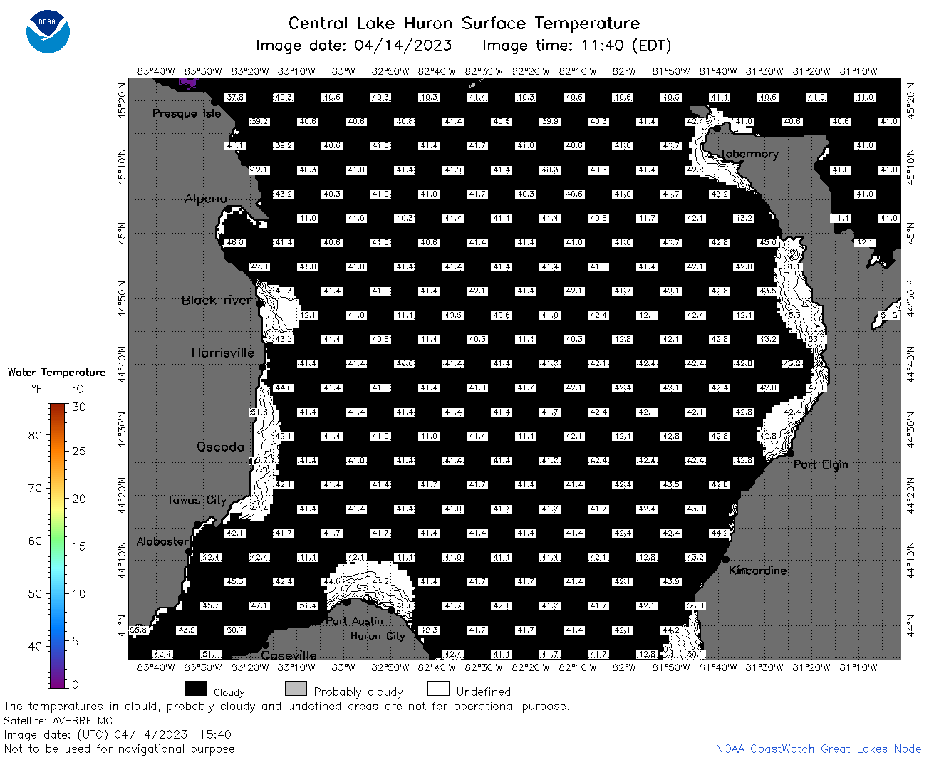
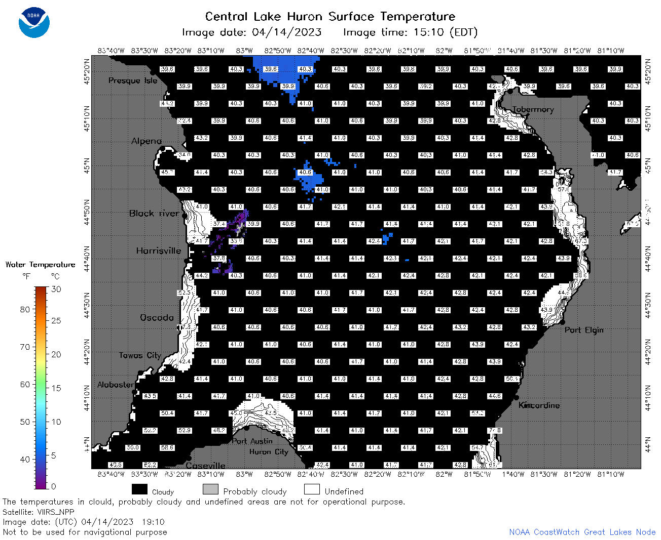
 | h2_2023_04_14_1450.png | 14-Apr-2023 17:26 | 42588 | |
 | h2_2023_04_14_1540.png | 14-Apr-2023 19:26 | 43180 | |
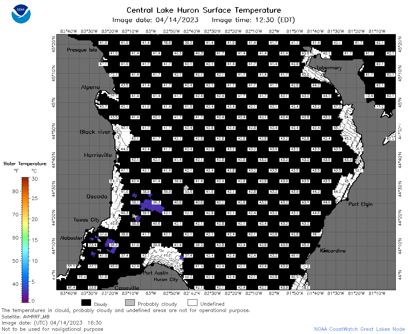 | h2_2023_04_14_1630.png | 14-Apr-2023 19:28 | 44740 | |
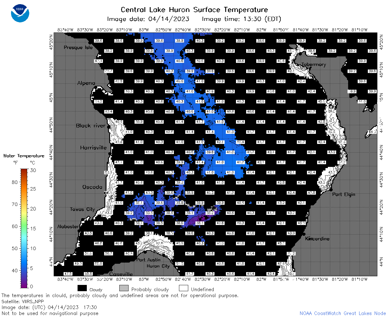 | h2_2023_04_14_1730.png | 14-Apr-2023 20:26 | 57741 | |
 | h2_2023_04_14_1820.png | 14-Apr-2023 21:28 | 61835 | |
 | h2_2023_04_14_1910.png | 14-Apr-2023 22:26 | 46465 | |
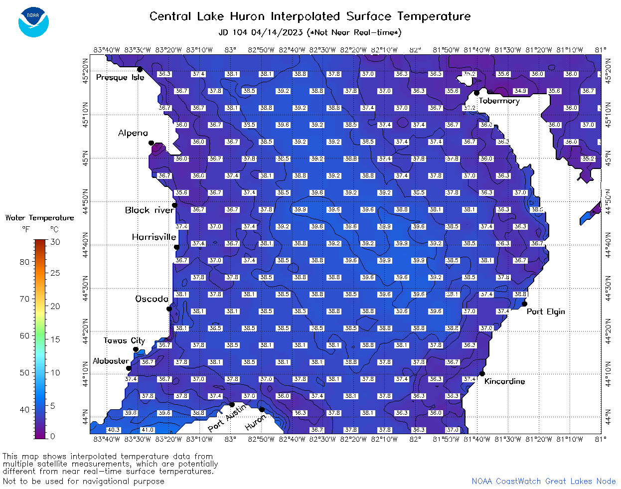 | h2_2023_104.png | 15-Apr-2023 09:14 | 68564 | |