
Easier access to scientific data

Brought to you by NOAA CoastWatch Great Lakes Node
|
ERDDAP
Easier access to scientific data |
|
Brought to you by NOAA CoastWatch Great Lakes Node |
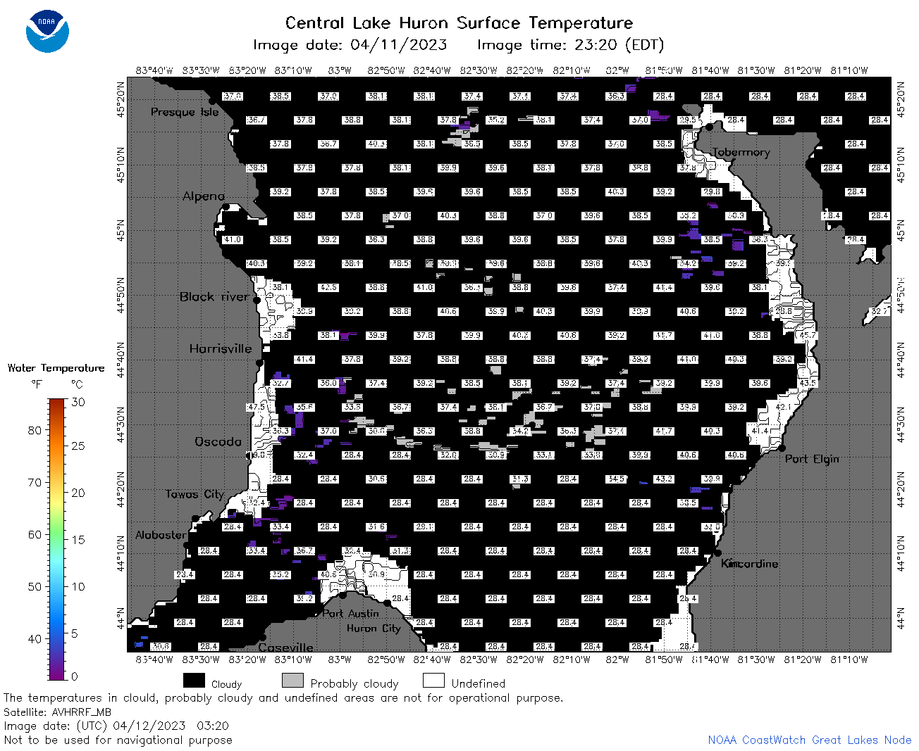
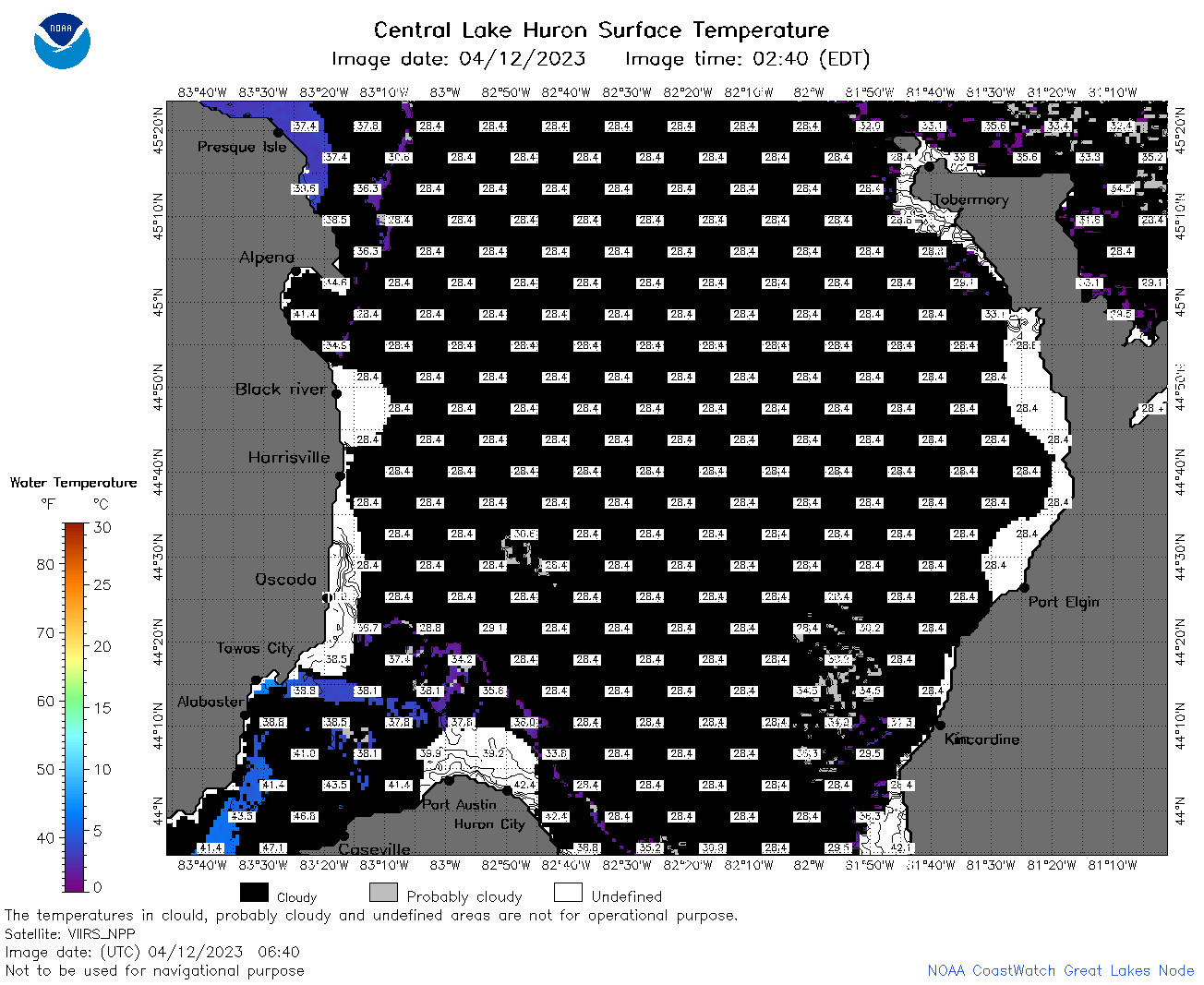
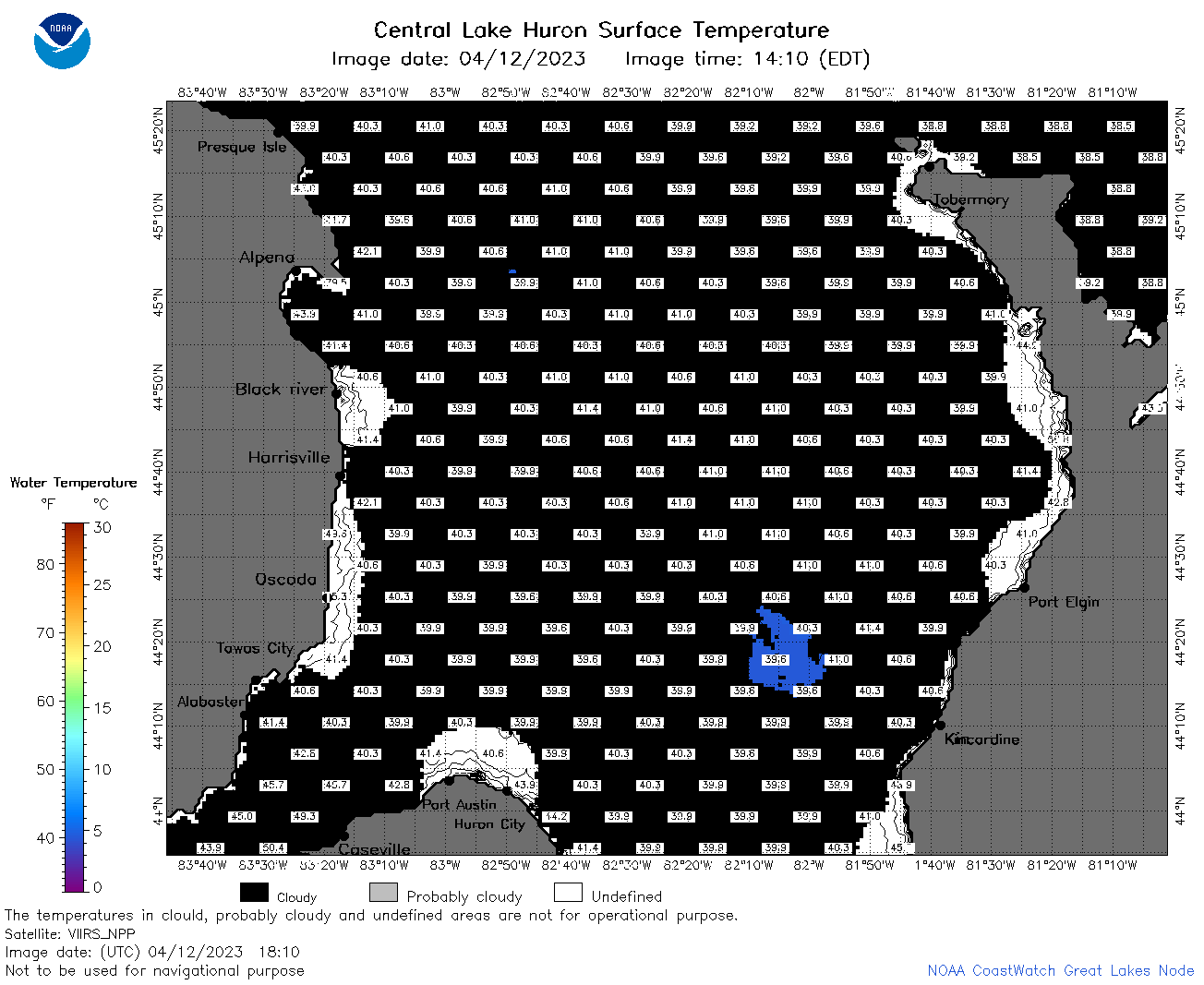
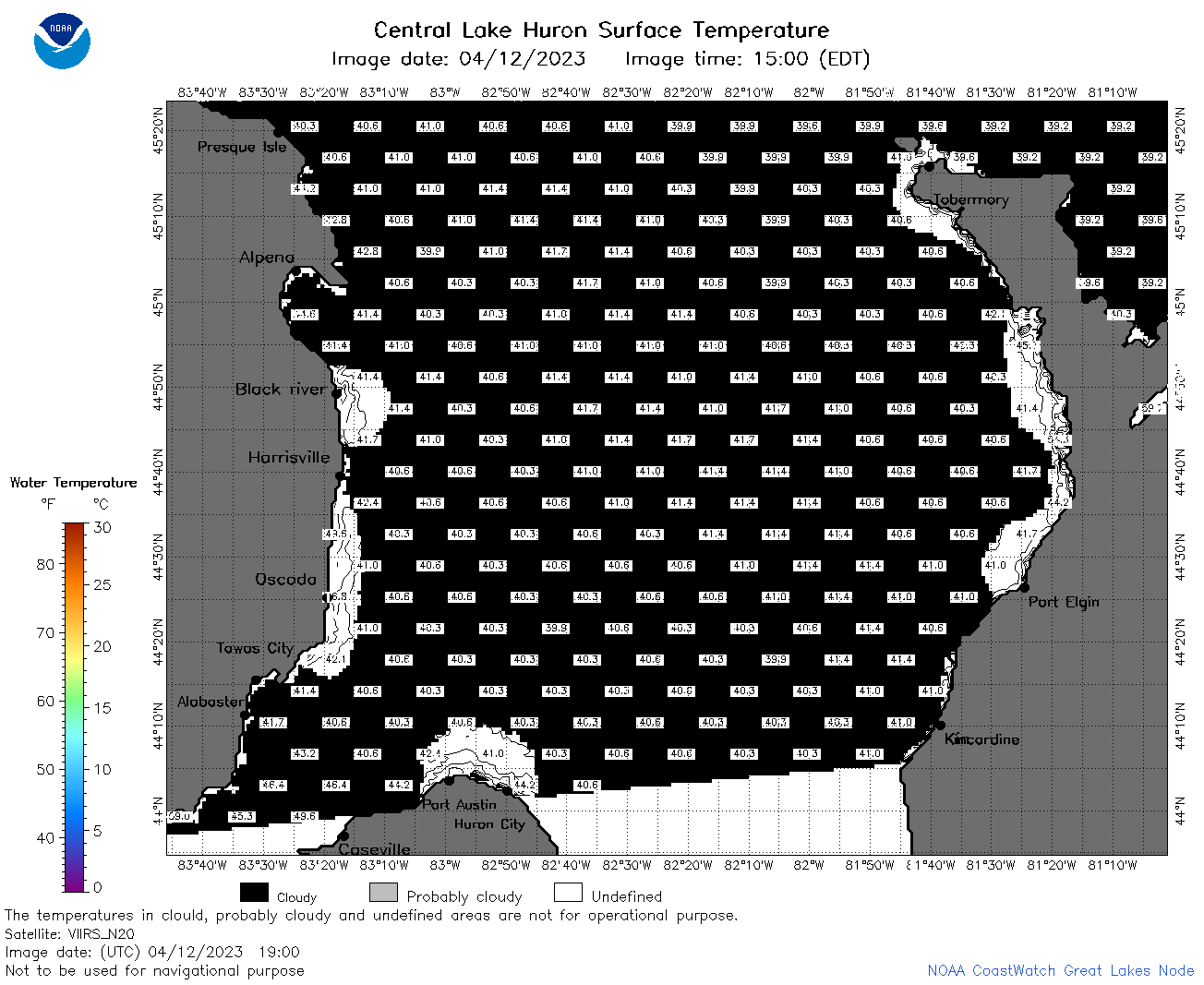
| Dataset Title: | Lake Huron Central Region Surface Temperature Contour Map (2022-present)


|
| Institution: | CoastWatch Great Lakes Node (Dataset ID: LH_NRT_TC_h2) |
| Information: | Summary
| License
| Metadata
| Background | Subset
| Data Access Form
| Make a graph
| Subset
| Data Access Form
| Make a graph
|
![[ICO]](https://apps.glerl.noaa.gov/erddap/images/fileIcons/blank.gif) | Name | Last modified | Size | Description |
|---|---|---|---|---|
![[DIR]](https://apps.glerl.noaa.gov/erddap/images/fileIcons/back.gif) | Parent Directory | - | - | |
![[IMG]](https://apps.glerl.noaa.gov/erddap/images/fileIcons/image2.gif)  | h2_2023_04_12_0140.png | 12-Apr-2023 05:26 | 48638 | |
 | h2_2023_04_12_0230.png | 12-Apr-2023 05:28 | 51979 | |
 | h2_2023_04_12_0320.png | 12-Apr-2023 06:26 | 47059 | |
 | h2_2023_04_12_0640.png | 12-Apr-2023 10:26 | 51003 | |
 | h2_2023_04_12_0730.png | 12-Apr-2023 10:28 | 63145 | |
 | h2_2023_04_12_0820.png | 12-Apr-2023 12:26 | 83668 | |
 | h2_2023_04_12_1440.png | 12-Apr-2023 18:26 | 40693 | |
 | h2_2023_04_12_1530.png | 12-Apr-2023 18:31 | 40912 | |
 | h2_2023_04_12_1620.png | 12-Apr-2023 20:26 | 41308 | |
 | h2_2023_04_12_1710.png | 12-Apr-2023 20:32 | 42576 | |
 | h2_2023_04_12_1720.png | 12-Apr-2023 20:35 | 33945 | |
 | h2_2023_04_12_1810.png | 12-Apr-2023 22:26 | 43080 | |
 | h2_2023_04_12_1850.png | 12-Apr-2023 21:26 | 32879 | |
 | h2_2023_04_12_1900.png | 12-Apr-2023 21:28 | 41393 | |
 | h2_2023_102.png | 13-Apr-2023 09:14 | 64280 | |