
Easier access to scientific data

Brought to you by NOAA CoastWatch Great Lakes Node
|
ERDDAP
Easier access to scientific data |
|
Brought to you by NOAA CoastWatch Great Lakes Node |
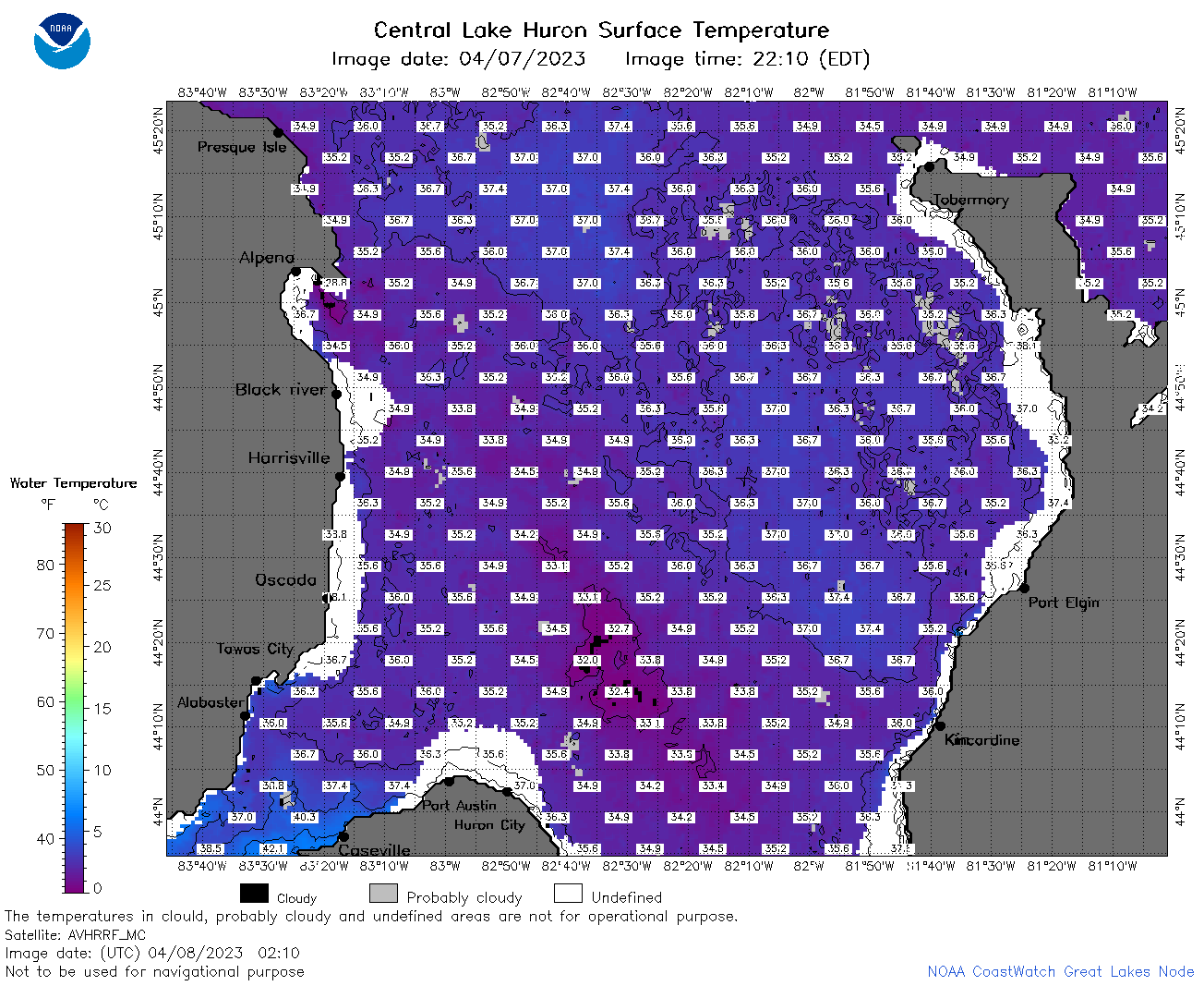
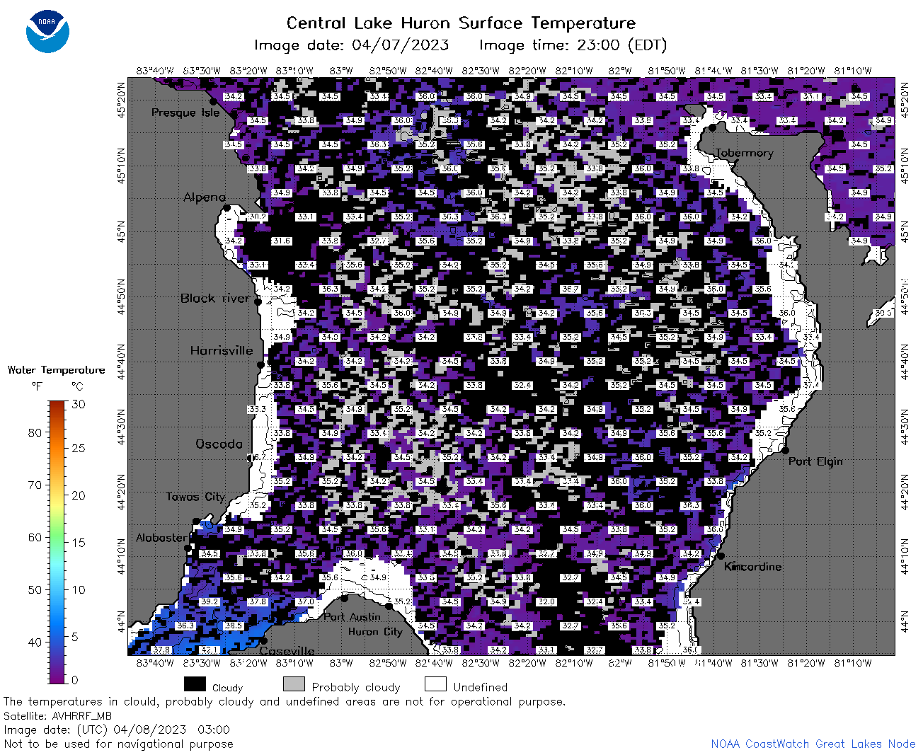
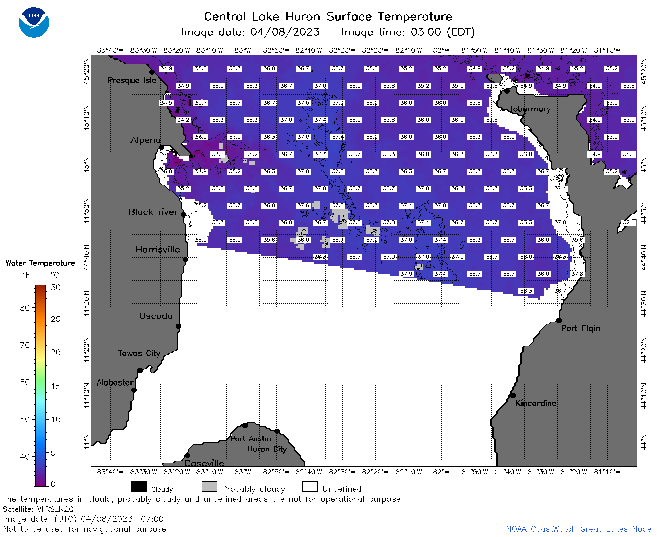
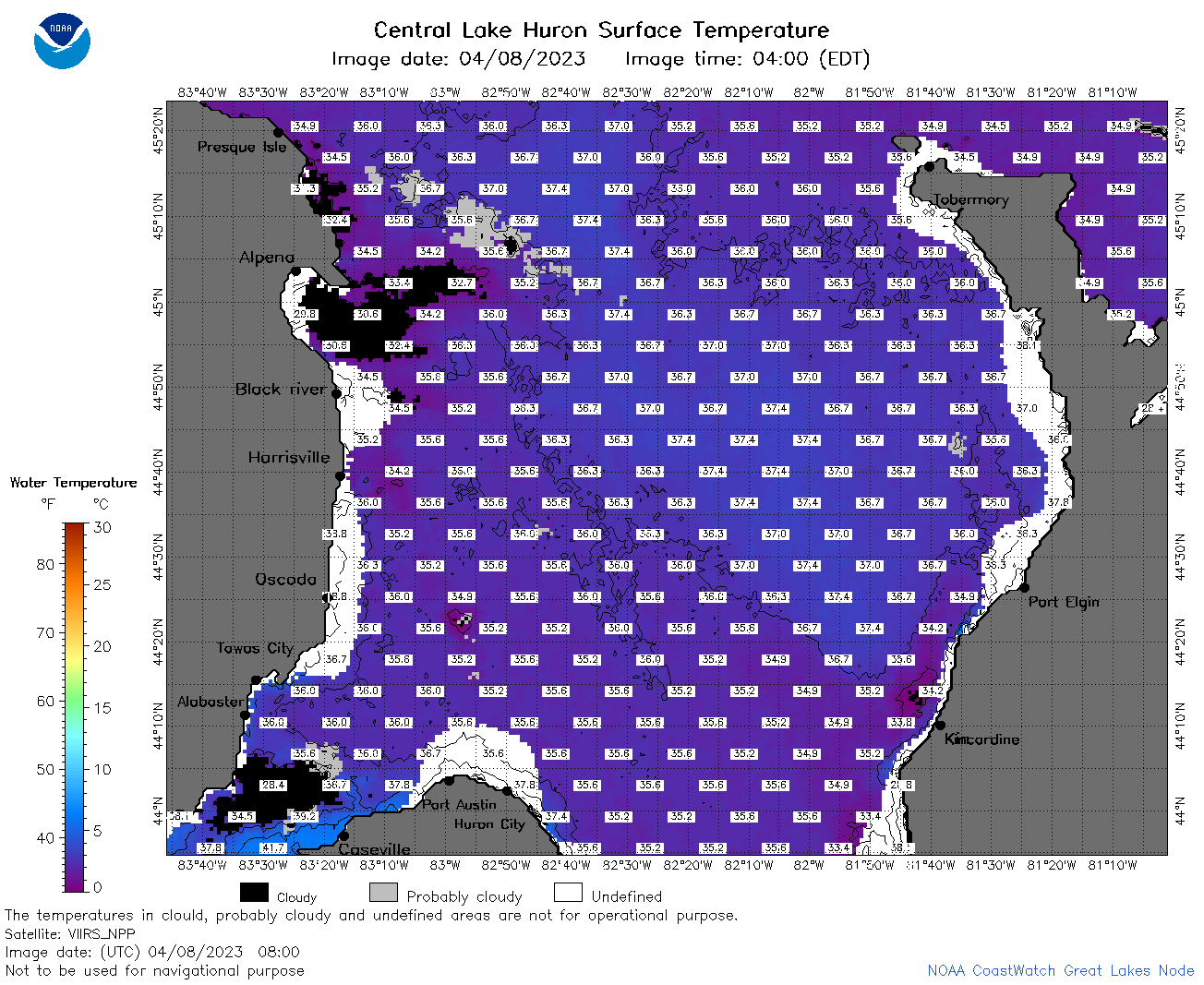
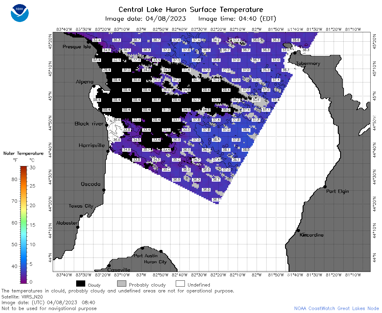
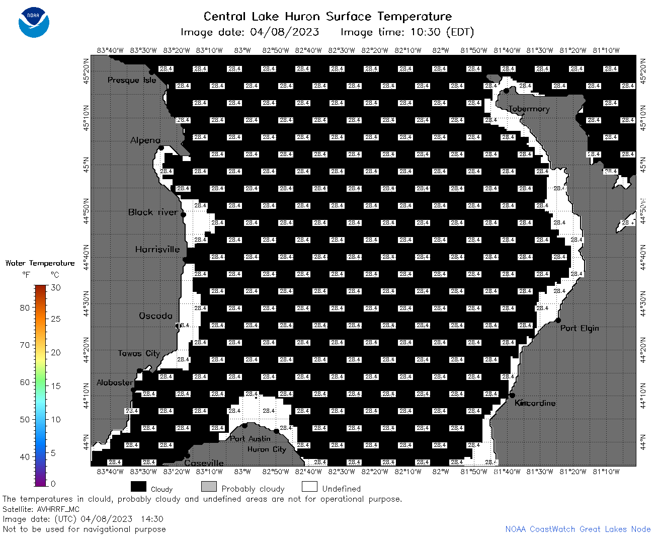
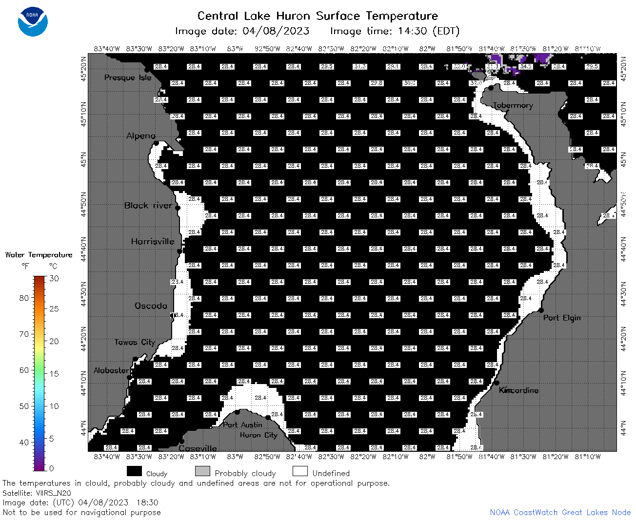
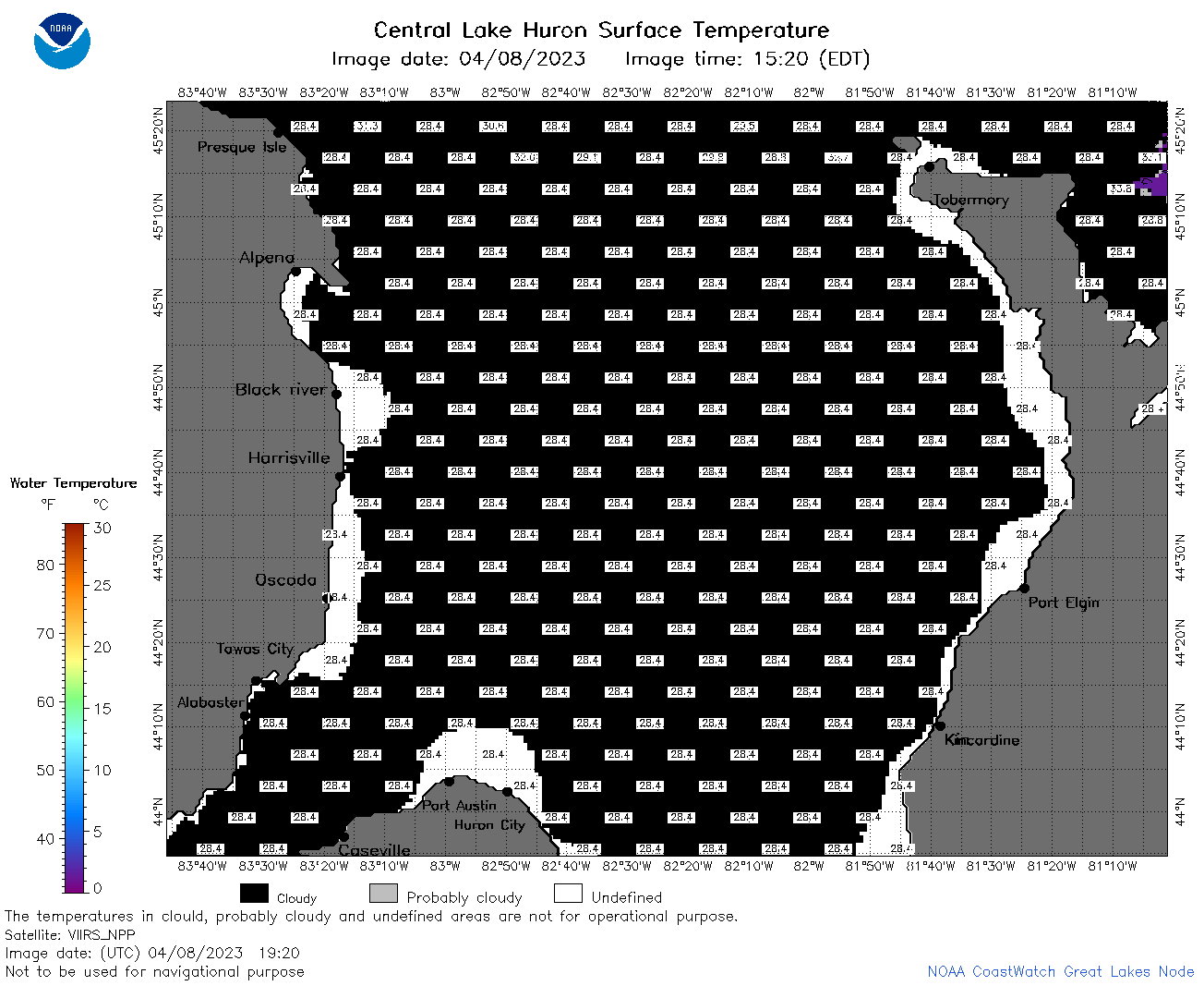
| Dataset Title: | Lake Huron Central Region Surface Temperature Contour Map (2022-present)


|
| Institution: | CoastWatch Great Lakes Node (Dataset ID: LH_NRT_TC_h2) |
| Information: | Summary
| License
| Metadata
| Background | Subset
| Data Access Form
| Make a graph
| Subset
| Data Access Form
| Make a graph
|
![[ICO]](https://apps.glerl.noaa.gov/erddap/images/fileIcons/blank.gif) | Name | Last modified | Size | Description |
|---|---|---|---|---|
![[DIR]](https://apps.glerl.noaa.gov/erddap/images/fileIcons/back.gif) | Parent Directory | - | - | |
![[IMG]](https://apps.glerl.noaa.gov/erddap/images/fileIcons/image2.gif)  | h2_2023_04_08_0120.png | 08-Apr-2023 05:25 | 120320 | |
 | h2_2023_04_08_0210.png | 08-Apr-2023 05:28 | 115971 | |
 | h2_2023_04_08_0300.png | 08-Apr-2023 05:30 | 94585 | |
 | h2_2023_04_08_0620.png | 08-Apr-2023 10:27 | 107351 | |
 | h2_2023_04_08_0700.png | 08-Apr-2023 10:30 | 65688 | |
 | h2_2023_04_08_0710.png | 08-Apr-2023 10:32 | 61917 | |
 | h2_2023_04_08_0800.png | 08-Apr-2023 11:26 | 102957 | |
 | h2_2023_04_08_0840.png | 08-Apr-2023 12:25 | 67500 | |
 | h2_2023_04_08_0850.png | 08-Apr-2023 12:28 | 48541 | |
 | h2_2023_04_08_1430.png | 08-Apr-2023 18:27 | 36153 | |
 | h2_2023_04_08_1510.png | 08-Apr-2023 18:30 | 36466 | |
 | h2_2023_04_08_1610.png | 08-Apr-2023 20:26 | 36462 | |
 | h2_2023_04_08_1740.png | 08-Apr-2023 21:26 | 36390 | |
 | h2_2023_04_08_1830.png | 08-Apr-2023 21:28 | 38109 | |
 | h2_2023_04_08_1920.png | 08-Apr-2023 22:26 | 36876 | |
 | h2_2023_098.png | 09-Apr-2023 09:14 | 56624 | |