
Easier access to scientific data

Brought to you by NOAA CoastWatch Great Lakes Node
|
ERDDAP
Easier access to scientific data |
|
Brought to you by NOAA CoastWatch Great Lakes Node |
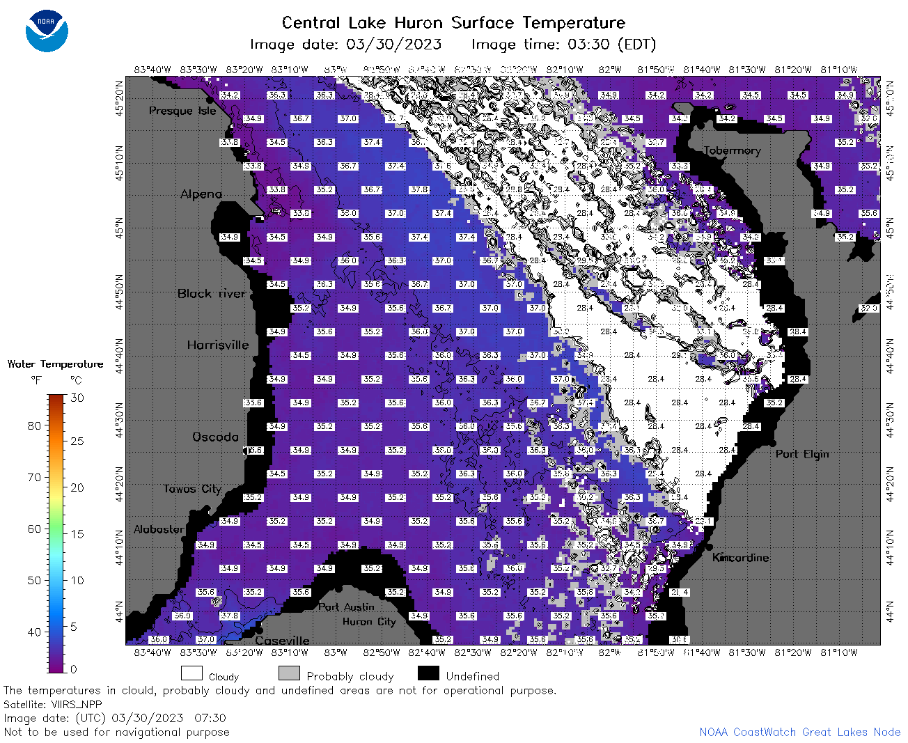
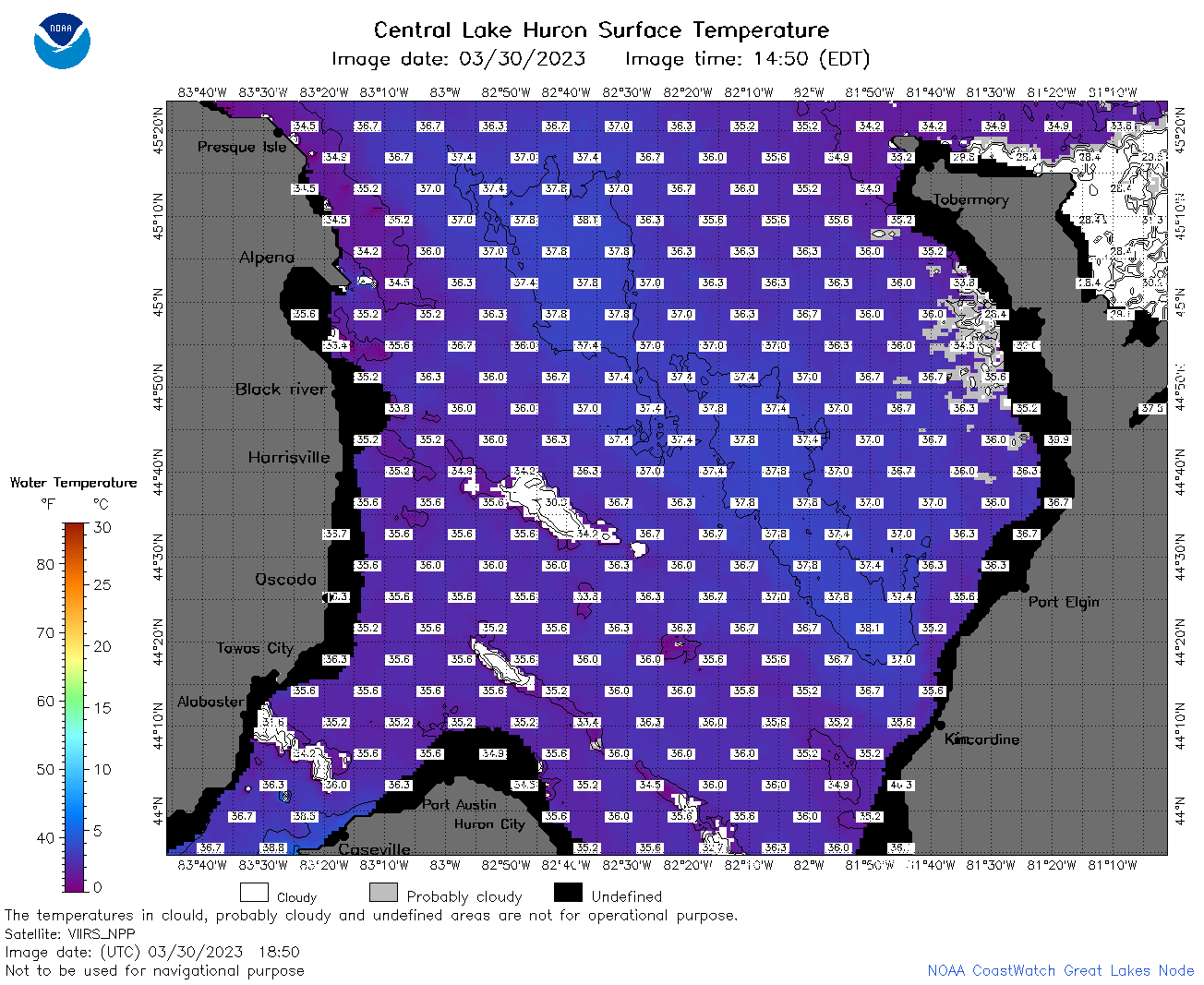
| Dataset Title: | Lake Huron Central Region Surface Temperature Contour Map (2022-present)


|
| Institution: | CoastWatch Great Lakes Node (Dataset ID: LH_NRT_TC_h2) |
| Information: | Summary
| License
| Metadata
| Background | Subset
| Data Access Form
| Make a graph
| Subset
| Data Access Form
| Make a graph
|
![[ICO]](https://apps.glerl.noaa.gov/erddap/images/fileIcons/blank.gif) | Name | Last modified | Size | Description |
|---|---|---|---|---|
![[DIR]](https://apps.glerl.noaa.gov/erddap/images/fileIcons/back.gif) | Parent Directory | - | - | |
![[IMG]](https://apps.glerl.noaa.gov/erddap/images/fileIcons/image2.gif) 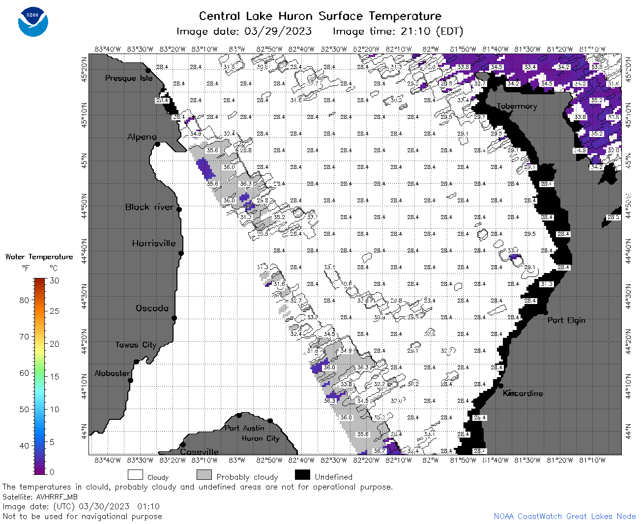 | h2_2023_03_30_0110.png | 30-Mar-2023 05:27 | 60927 | |
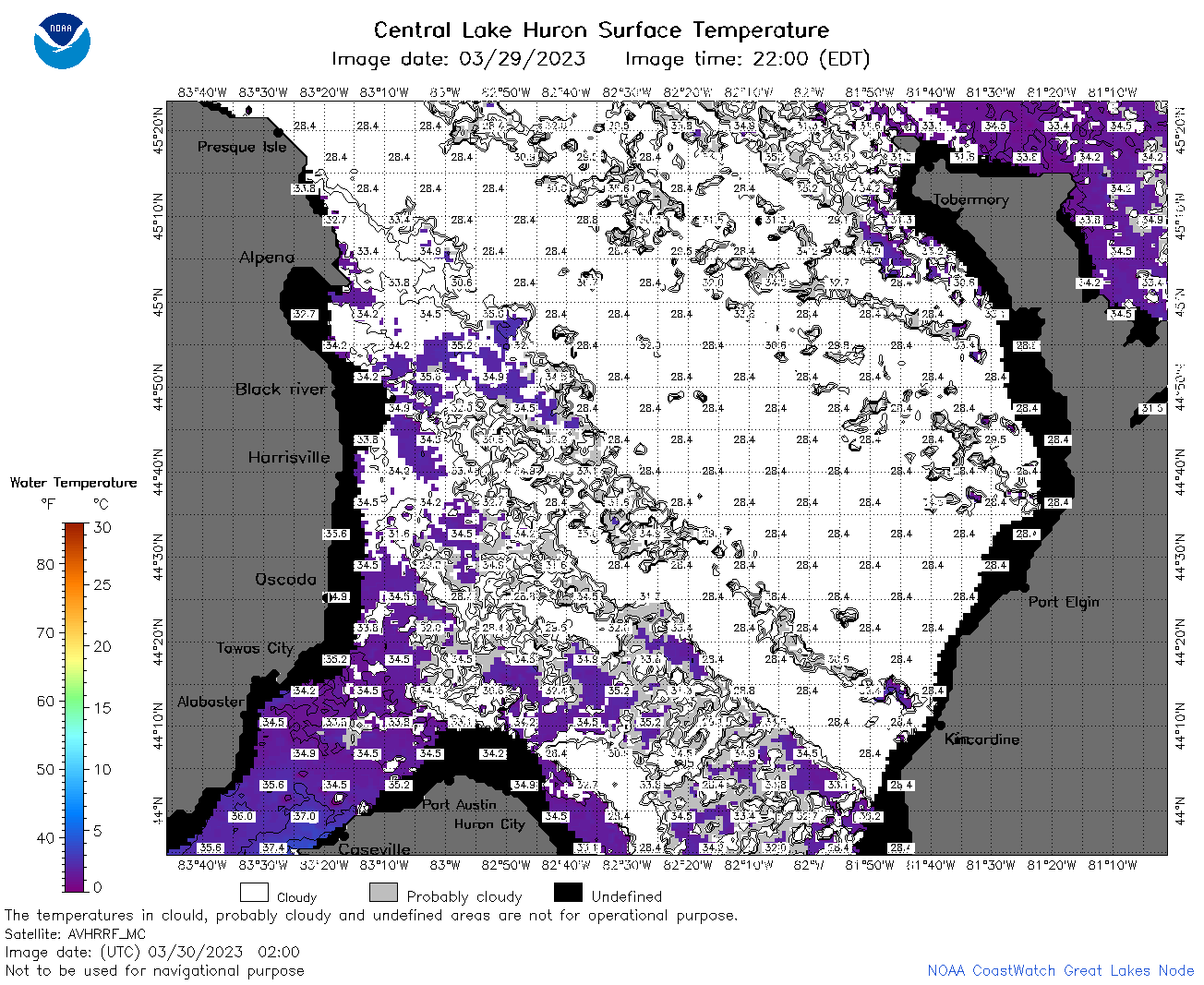 | h2_2023_03_30_0200.png | 30-Mar-2023 05:30 | 103263 | |
 | h2_2023_03_30_0250.png | 30-Mar-2023 05:34 | 85679 | |
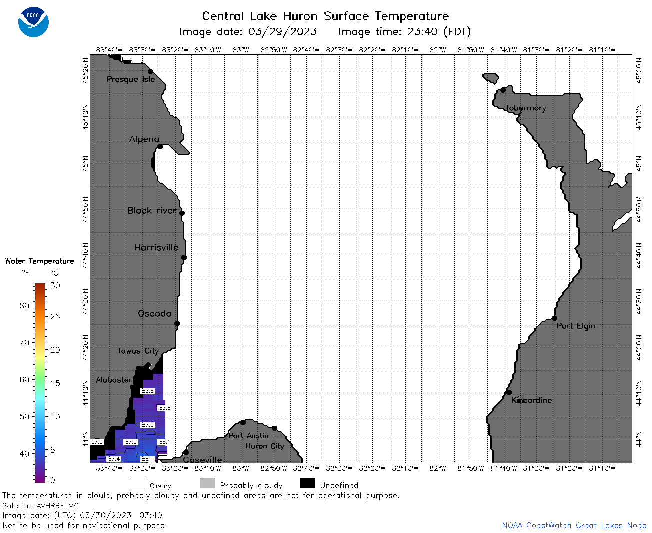 | h2_2023_03_30_0340.png | 30-Mar-2023 06:26 | 33478 | |
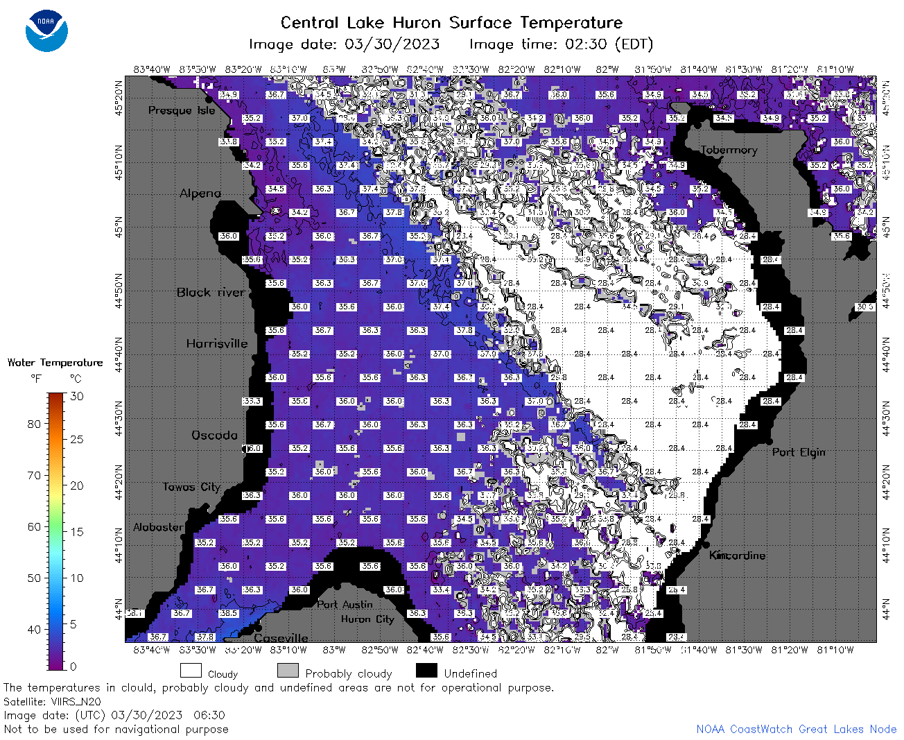 | h2_2023_03_30_0630.png | 30-Mar-2023 10:26 | 124997 | |
 | h2_2023_03_30_0730.png | 30-Mar-2023 12:26 | 111364 | |
 | h2_2023_03_30_0810.png | 30-Mar-2023 11:28 | 114918 | |
 | h2_2023_03_30_1410.png | 30-Mar-2023 19:25 | 33827 | |
 | h2_2023_03_30_1500.png | 30-Mar-2023 18:26 | 87001 | |
 | h2_2023_03_30_1550.png | 30-Mar-2023 20:26 | 92766 | |
 | h2_2023_03_30_1640.png | 30-Mar-2023 19:28 | 79489 | |
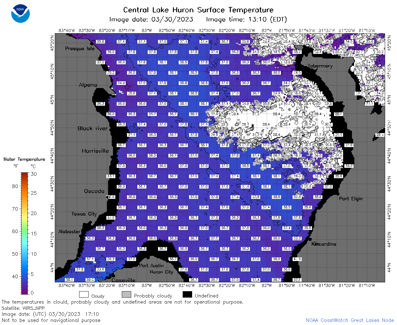 | h2_2023_03_30_1710.png | 30-Mar-2023 20:28 | 103225 | |
 | h2_2023_03_30_1800.png | 30-Mar-2023 21:27 | 87801 | |
 | h2_2023_03_30_1850.png | 30-Mar-2023 22:26 | 87871 | |
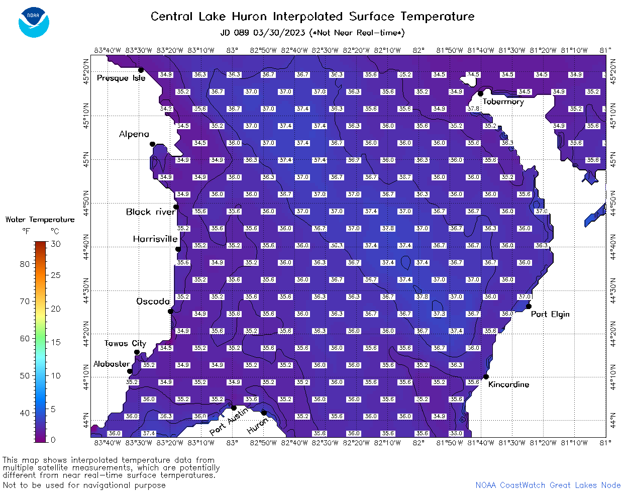 | h2_2023_089.png | 31-Mar-2023 09:14 | 59333 | |