
Easier access to scientific data

Brought to you by NOAA CoastWatch Great Lakes Node
|
ERDDAP
Easier access to scientific data |
|
Brought to you by NOAA CoastWatch Great Lakes Node |
| Dataset Title: | Lake Huron Central Region Surface Temperature Contour Map (2022-present)


|
| Institution: | CoastWatch Great Lakes Node (Dataset ID: LH_NRT_TC_h2) |
| Information: | Summary
| License
| Metadata
| Background | Subset
| Data Access Form
| Make a graph
| Subset
| Data Access Form
| Make a graph
|
![[ICO]](https://apps.glerl.noaa.gov/erddap/images/fileIcons/blank.gif) | Name | Last modified | Size | Description |
|---|---|---|---|---|
![[DIR]](https://apps.glerl.noaa.gov/erddap/images/fileIcons/back.gif) | Parent Directory | - | - | |
![[IMG]](https://apps.glerl.noaa.gov/erddap/images/fileIcons/image2.gif) 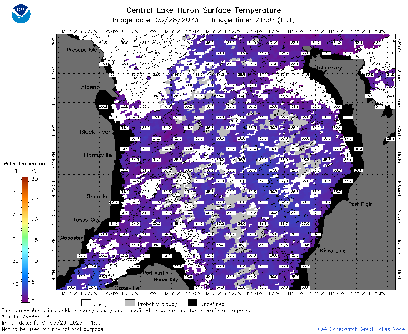 | h2_2023_03_29_0130.png | 29-Mar-2023 05:27 | 115088 | |
 | h2_2023_03_29_0220.png | 29-Mar-2023 05:30 | 112481 | |
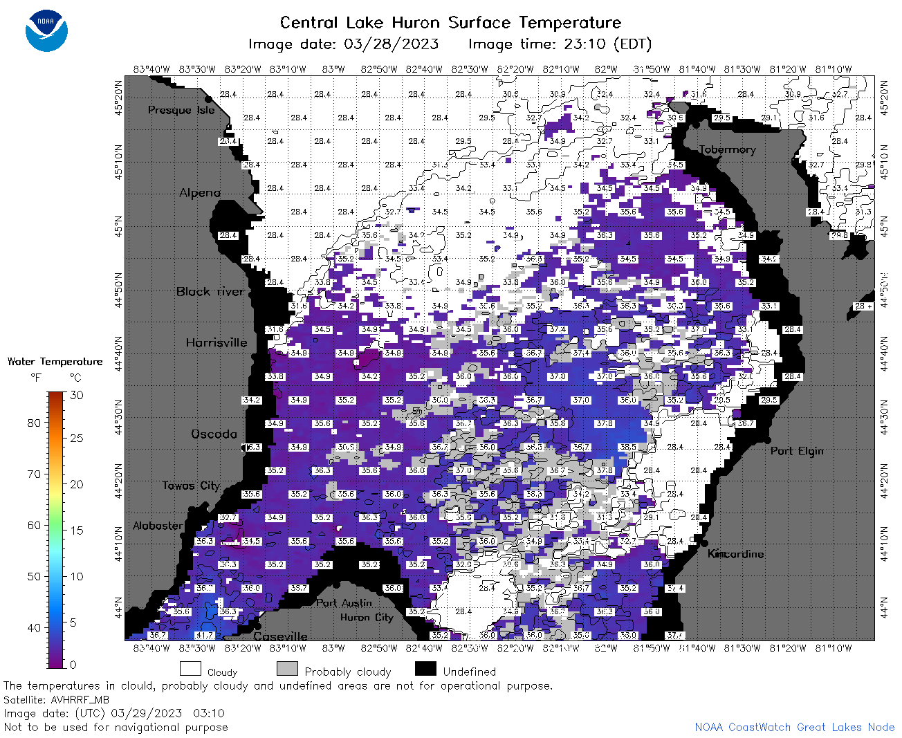 | h2_2023_03_29_0310.png | 29-Mar-2023 05:32 | 91069 | |
 | h2_2023_03_29_0600.png | 29-Mar-2023 10:25 | 32088 | |
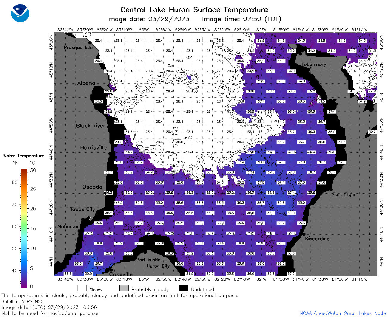 | h2_2023_03_29_0650.png | 29-Mar-2023 10:28 | 83822 | |
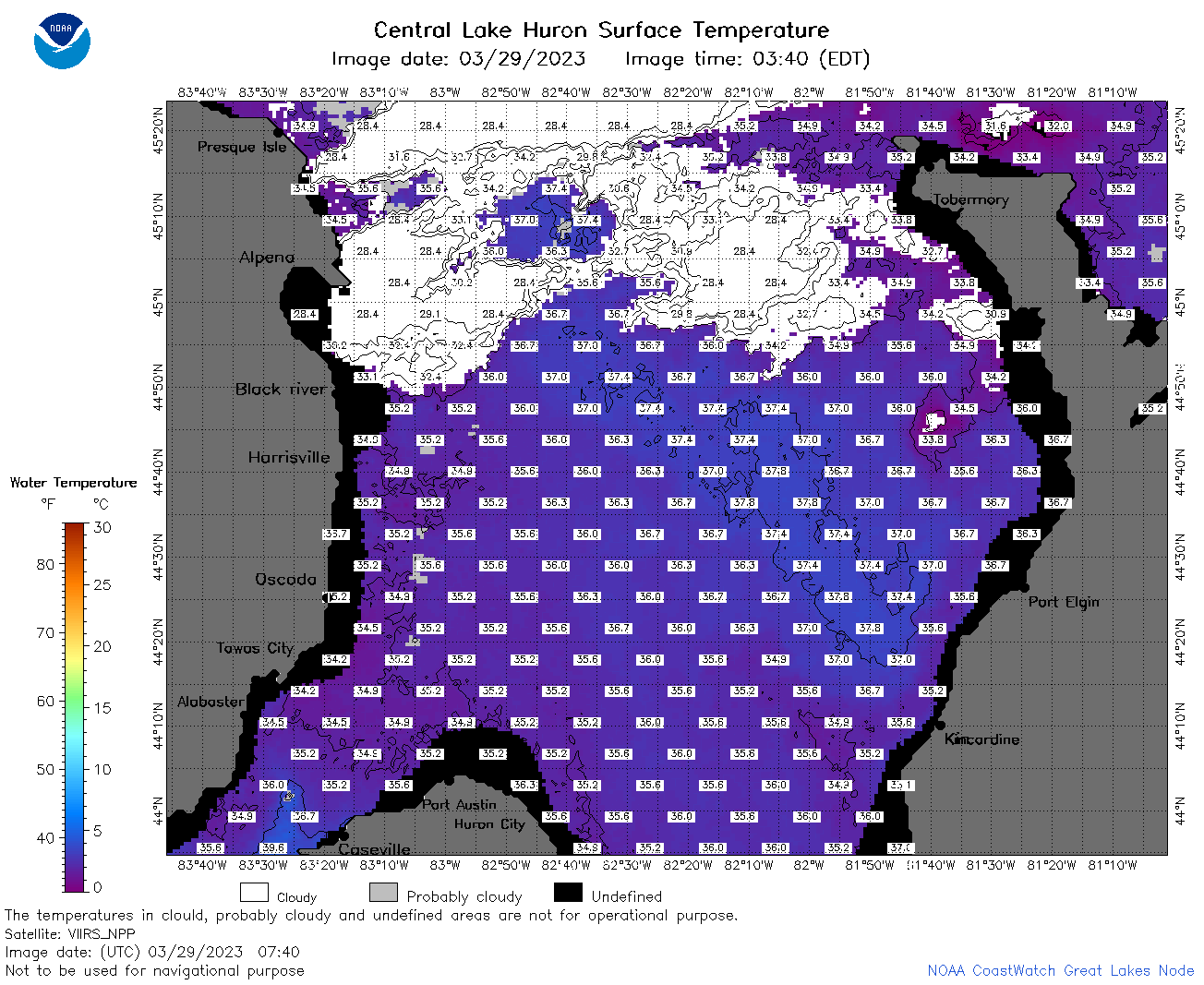 | h2_2023_03_29_0740.png | 29-Mar-2023 11:26 | 95320 | |
 | h2_2023_03_29_0830.png | 29-Mar-2023 12:26 | 89695 | |
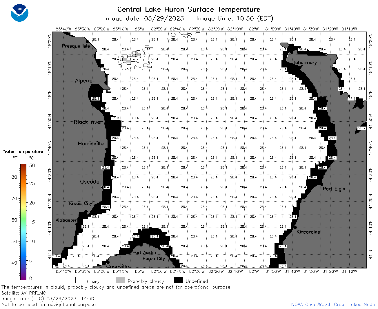 | h2_2023_03_29_1430.png | 29-Mar-2023 18:25 | 39106 | |
 | h2_2023_03_29_1520.png | 29-Mar-2023 18:28 | 58592 | |
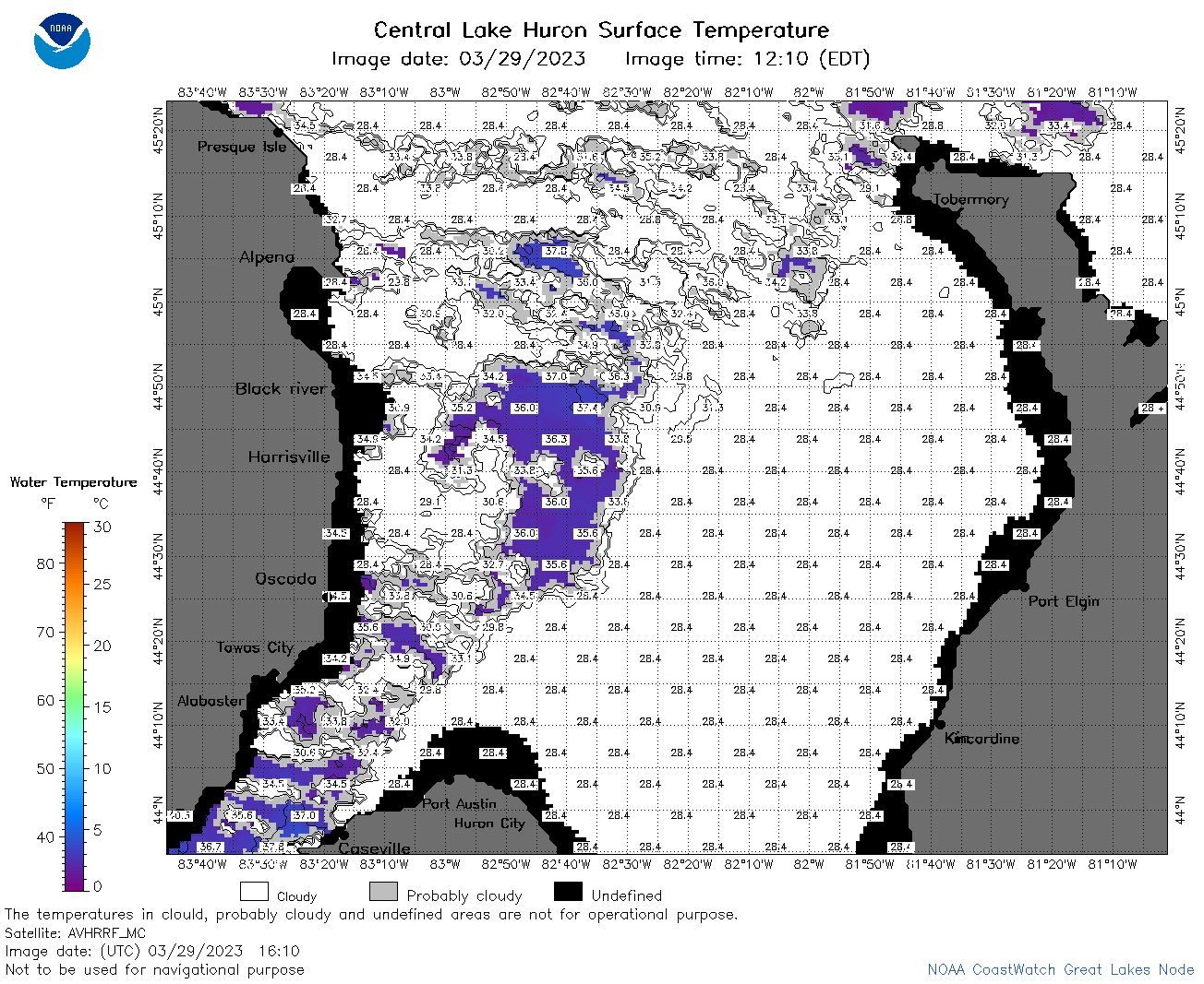 | h2_2023_03_29_1610.png | 29-Mar-2023 20:26 | 73301 | |
 | h2_2023_03_29_1730.png | 29-Mar-2023 20:32 | 99369 | |
 | h2_2023_03_29_1820.png | 29-Mar-2023 21:26 | 105797 | |
 | h2_2023_03_29_1910.png | 29-Mar-2023 23:26 | 93775 | |
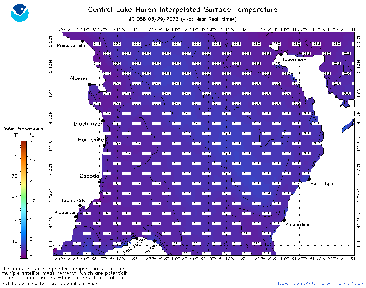 | h2_2023_088.png | 30-Mar-2023 09:14 | 59693 | |