
Easier access to scientific data

Brought to you by NOAA CoastWatch Great Lakes Node
|
ERDDAP
Easier access to scientific data |
|
Brought to you by NOAA CoastWatch Great Lakes Node |
| Dataset Title: | Lake Huron Central Region Surface Temperature Contour Map (2022-present)


|
| Institution: | CoastWatch Great Lakes Node (Dataset ID: LH_NRT_TC_h2) |
| Information: | Summary
| License
| Metadata
| Background | Subset
| Data Access Form
| Make a graph
| Subset
| Data Access Form
| Make a graph
|
![[ICO]](https://apps.glerl.noaa.gov/erddap/images/fileIcons/blank.gif) | Name | Last modified | Size | Description |
|---|---|---|---|---|
![[DIR]](https://apps.glerl.noaa.gov/erddap/images/fileIcons/back.gif) | Parent Directory | - | - | |
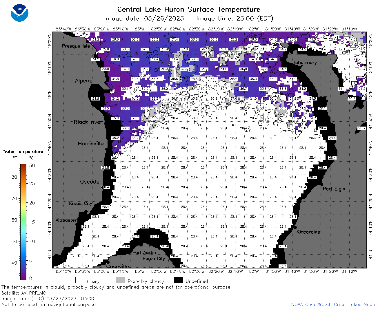
![[IMG]](https://apps.glerl.noaa.gov/erddap/images/fileIcons/image2.gif)  | h2_2023_03_27_0120.png | 27-Mar-2023 05:26 | 90485 | |
 | h2_2023_03_27_0210.png | 27-Mar-2023 05:28 | 96959 | |
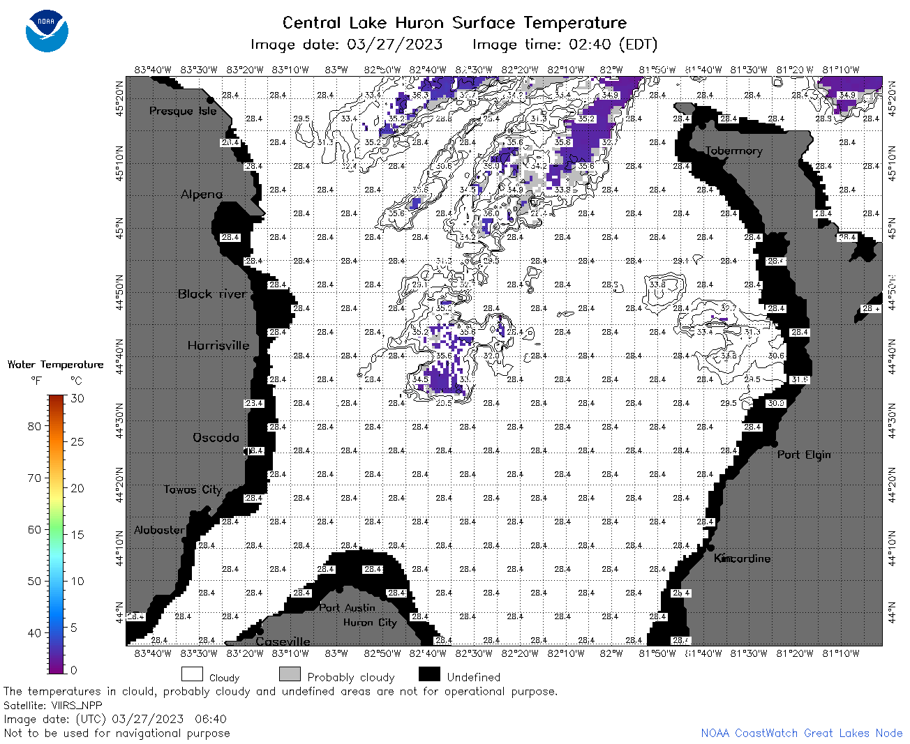
 | h2_2023_03_27_0300.png | 27-Mar-2023 05:30 | 71740 | |
 | h2_2023_03_27_0640.png | 27-Mar-2023 11:26 | 57923 | |
 | h2_2023_03_27_0730.png | 27-Mar-2023 11:28 | 63187 | |
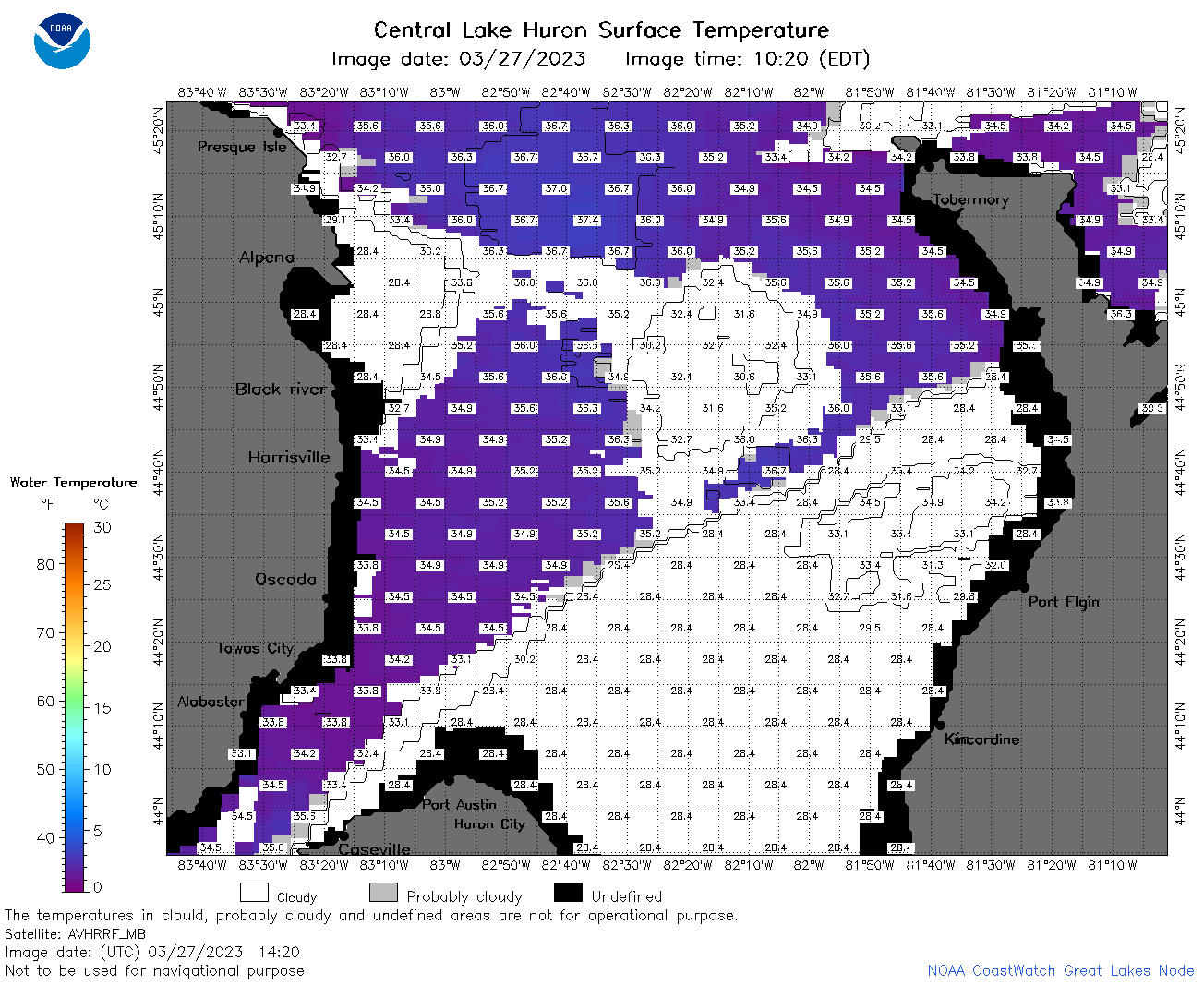
 | h2_2023_03_27_0820.png | 27-Mar-2023 12:26 | 82548 | |
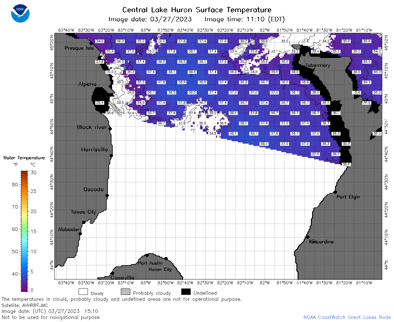
 | h2_2023_03_27_1420.png | 27-Mar-2023 17:25 | 59445 | |
 | h2_2023_03_27_1510.png | 27-Mar-2023 19:25 | 58071 | |
 | h2_2023_03_27_1520.png | 27-Mar-2023 19:28 | 56664 | |
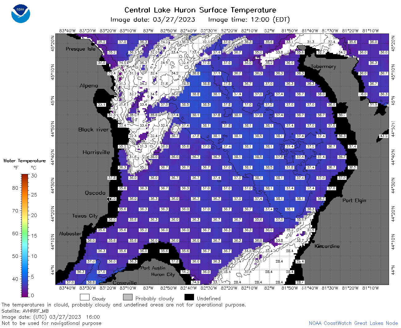 | h2_2023_03_27_1600.png | 27-Mar-2023 19:30 | 85448 | |
 | h2_2023_03_27_1710.png | 27-Mar-2023 20:25 | 91324 | |
 | h2_2023_03_27_1810.png | 27-Mar-2023 21:30 | 83606 | |
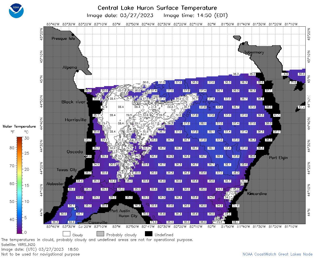 | h2_2023_03_27_1850.png | 27-Mar-2023 21:32 | 69590 | |
 | h2_2023_03_27_1900.png | 27-Mar-2023 21:34 | 46940 | |
 | h2_2023_086.png | 28-Mar-2023 09:14 | 60923 | |