
Easier access to scientific data

Brought to you by NOAA CoastWatch Great Lakes Node
|
ERDDAP
Easier access to scientific data |
|
Brought to you by NOAA CoastWatch Great Lakes Node |
| Dataset Title: | Lake Huron Central Region Surface Temperature Contour Map (2022-present)


|
| Institution: | CoastWatch Great Lakes Node (Dataset ID: LH_NRT_TC_h2) |
| Information: | Summary
| License
| Metadata
| Background | Subset
| Data Access Form
| Make a graph
| Subset
| Data Access Form
| Make a graph
|
![[ICO]](https://apps.glerl.noaa.gov/erddap/images/fileIcons/blank.gif) | Name | Last modified | Size | Description |
|---|---|---|---|---|
![[DIR]](https://apps.glerl.noaa.gov/erddap/images/fileIcons/back.gif) | Parent Directory | - | - | |
![[IMG]](https://apps.glerl.noaa.gov/erddap/images/fileIcons/image2.gif) 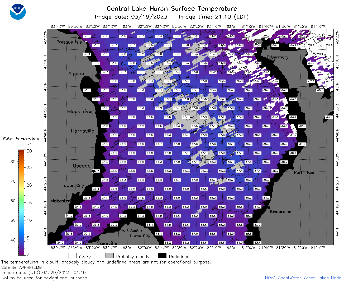 | h2_2023_03_20_0110.png | 22-Mar-2023 18:39 | 109950 | |
 | h2_2023_03_20_0200.png | 22-Mar-2023 18:41 | 97489 | |
 | h2_2023_03_20_0250.png | 22-Mar-2023 18:45 | 119380 | |
 | h2_2023_03_20_0620.png | 22-Mar-2023 18:51 | 98939 | |
 | h2_2023_03_20_0710.png | 22-Mar-2023 18:54 | 82716 | |
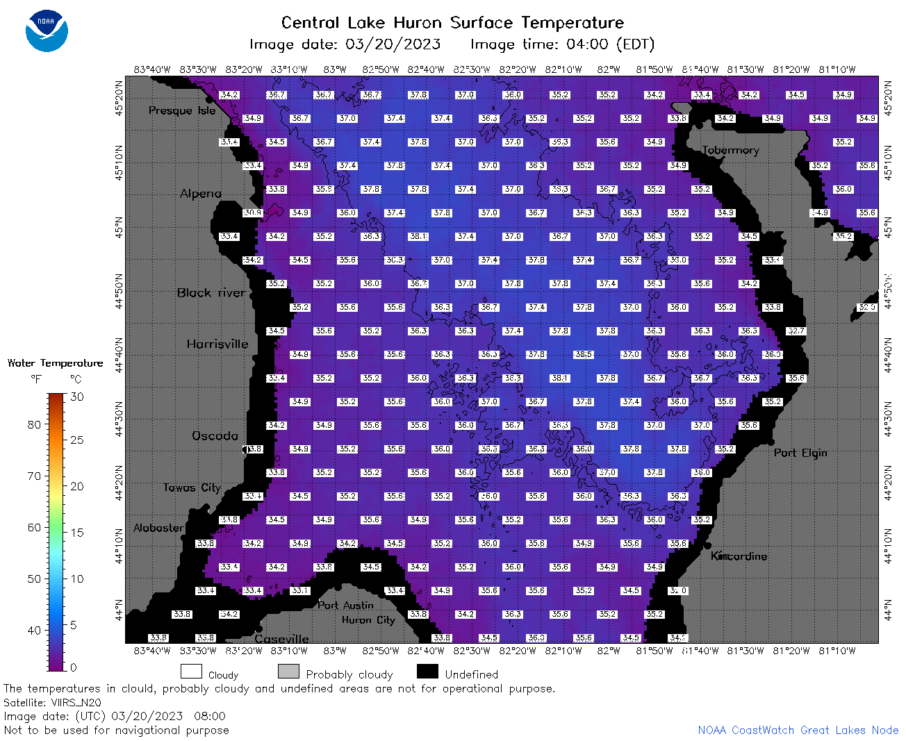 | h2_2023_03_20_0800.png | 22-Mar-2023 18:56 | 87568 | |
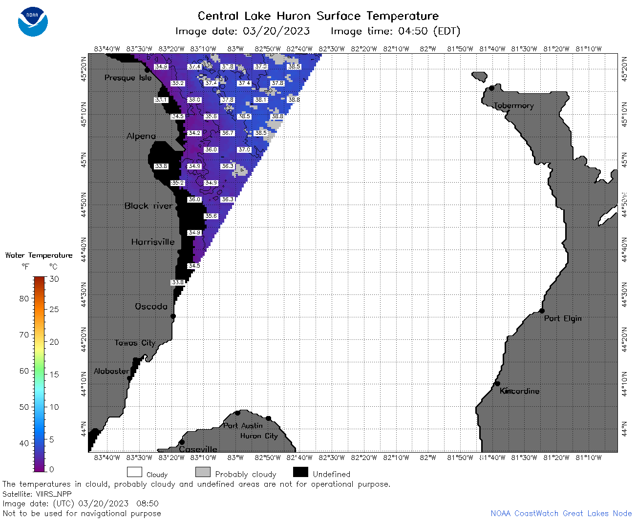 | h2_2023_03_20_0850.png | 22-Mar-2023 18:58 | 44491 | |
 | h2_2023_03_20_1420.png | 22-Mar-2023 19:02 | 53515 | |
 | h2_2023_03_20_1510.png | 22-Mar-2023 19:04 | 69109 | |
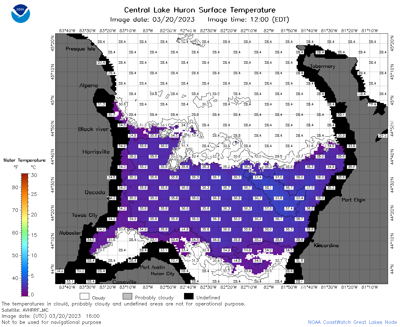 | h2_2023_03_20_1600.png | 22-Mar-2023 19:06 | 64384 | |
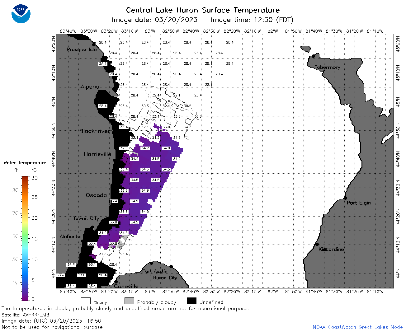 | h2_2023_03_20_1650.png | 22-Mar-2023 19:09 | 40687 | |
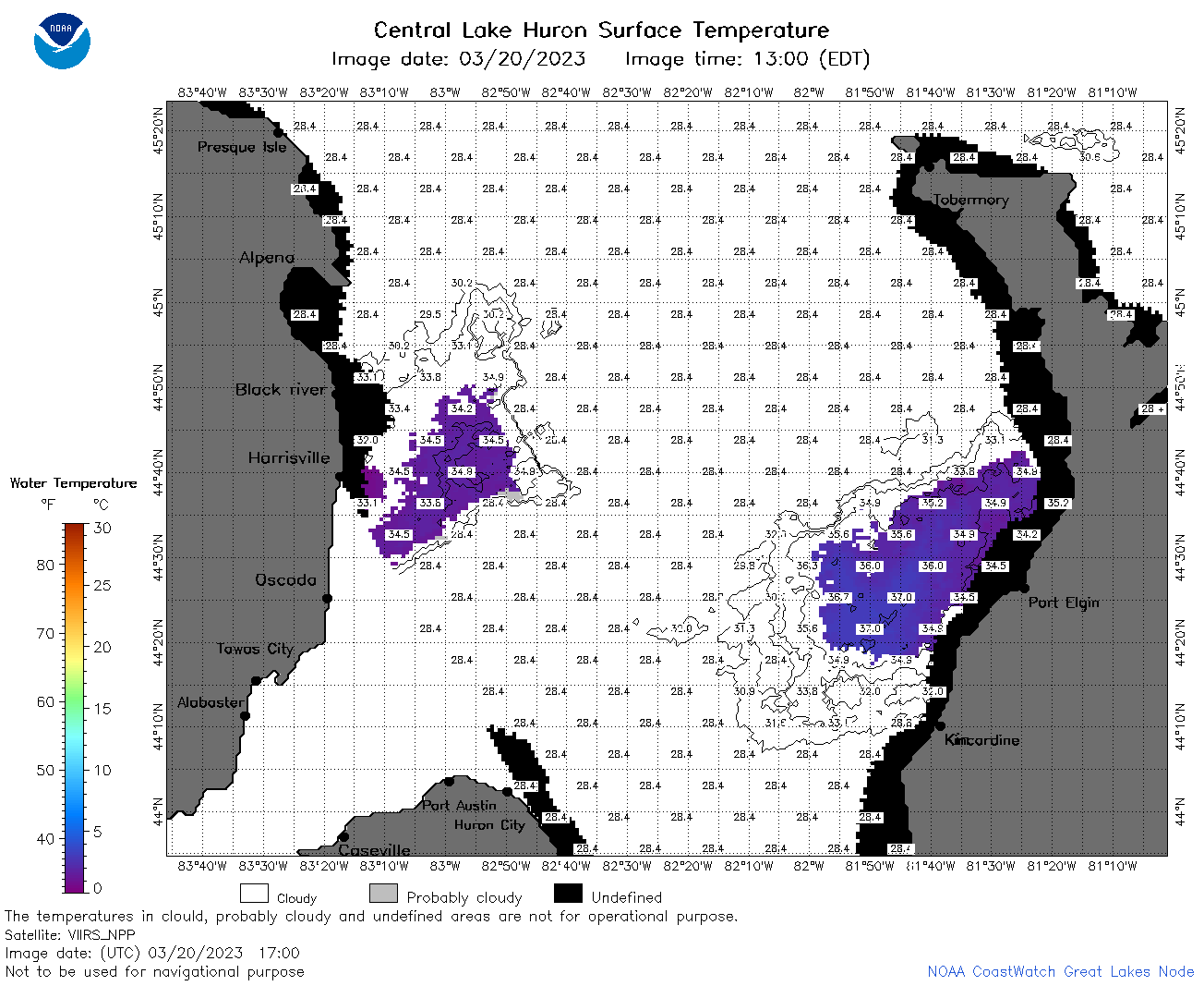 | h2_2023_03_20_1700.png | 22-Mar-2023 19:11 | 52079 | |
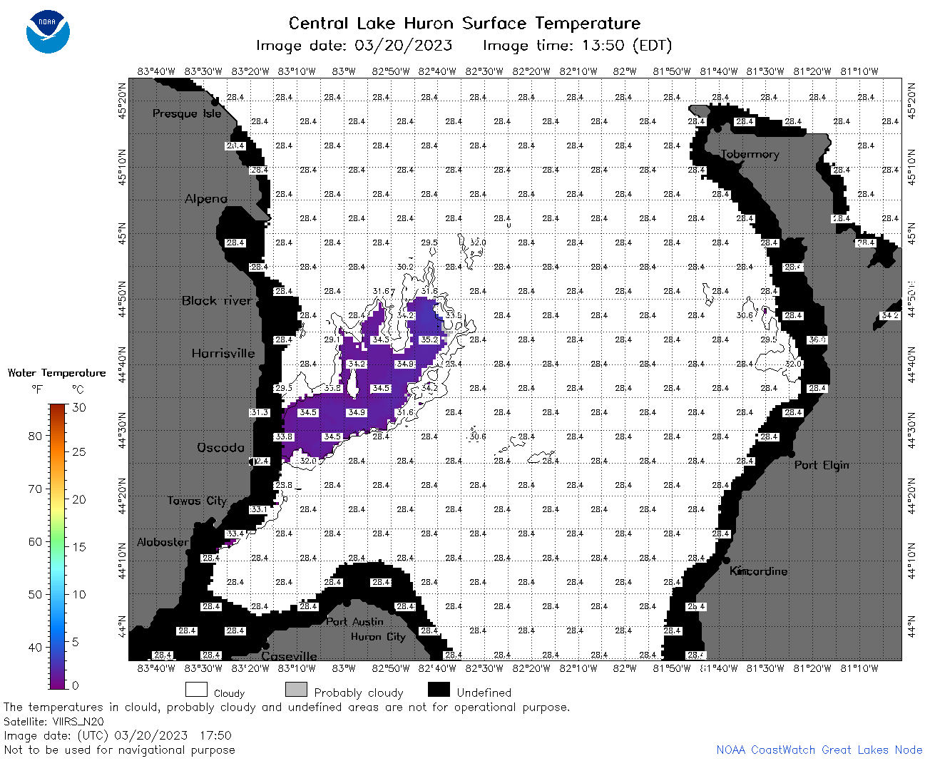 | h2_2023_03_20_1750.png | 22-Mar-2023 19:17 | 46415 | |
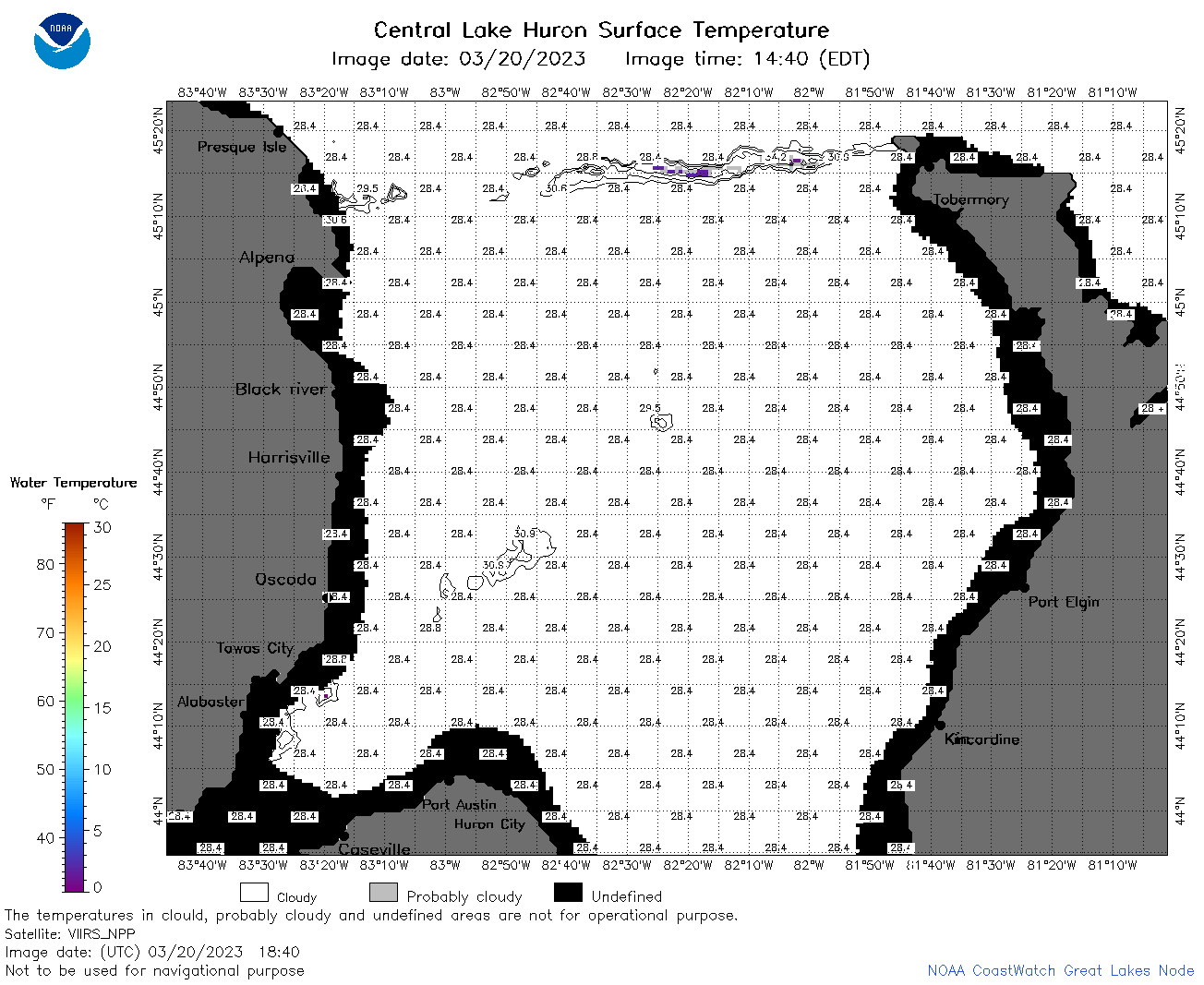 | h2_2023_03_20_1840.png | 22-Mar-2023 19:19 | 41599 | |
 | h2_2023_03_20_1930.png | 22-Mar-2023 19:21 | 39833 | |
 | h2_2023_079.png | 21-Mar-2023 09:14 | 62790 | |