
Easier access to scientific data

Brought to you by NOAA CoastWatch Great Lakes Node
|
ERDDAP
Easier access to scientific data |
|
Brought to you by NOAA CoastWatch Great Lakes Node |
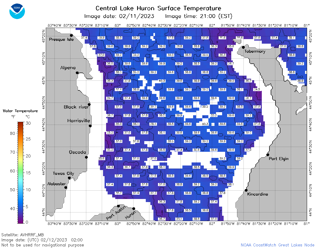
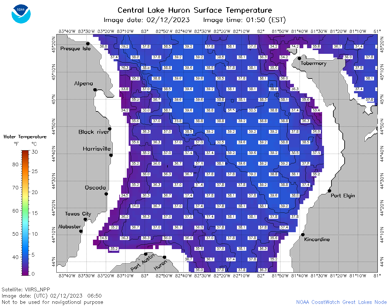
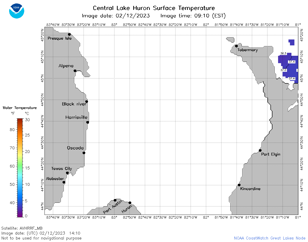
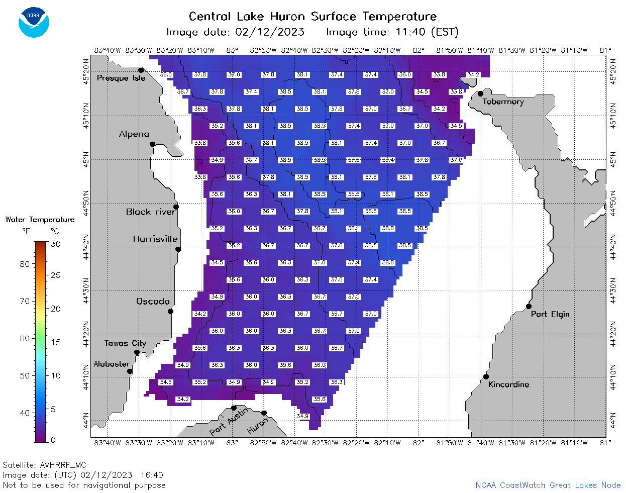
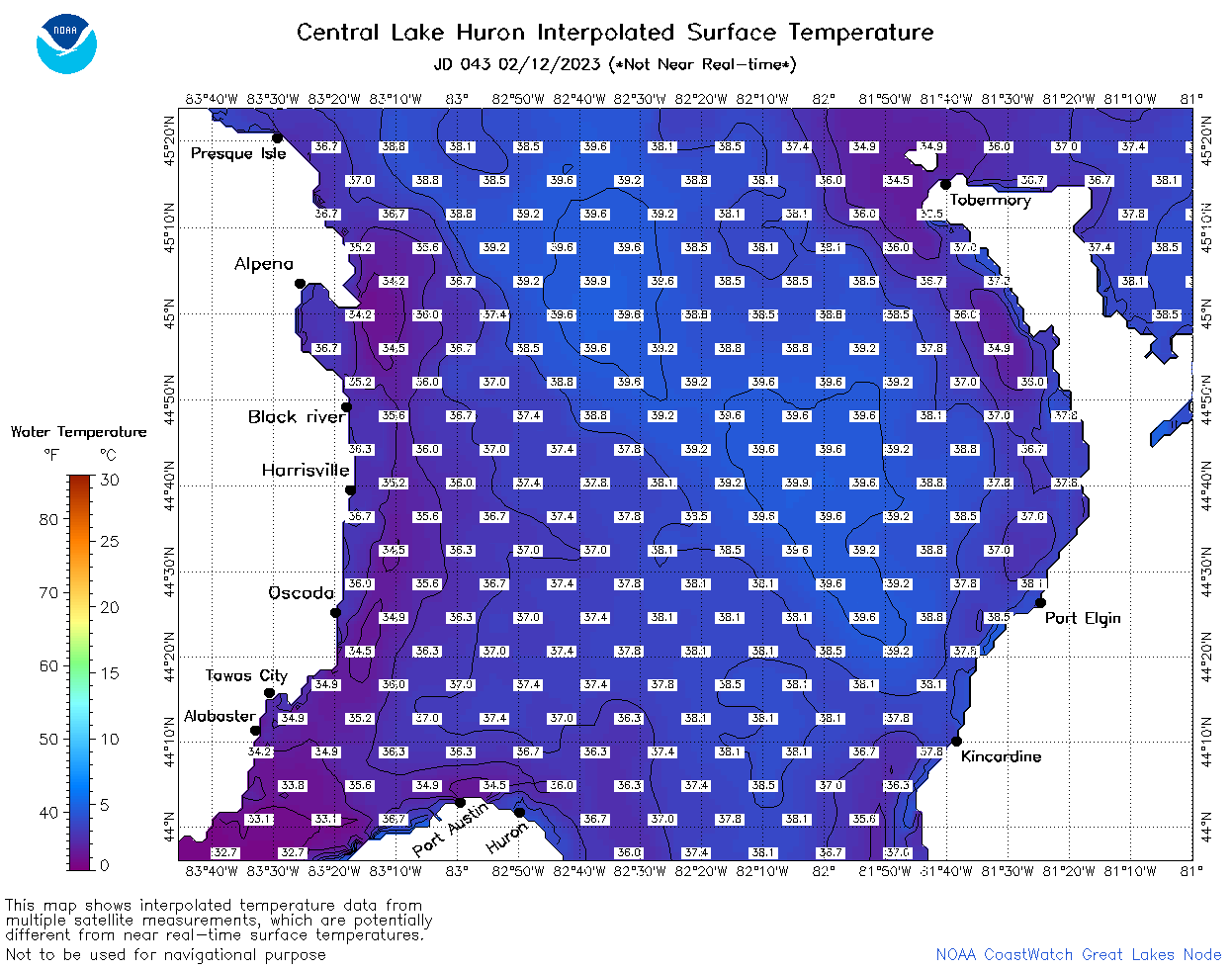
| Dataset Title: | Lake Huron Central Region Surface Temperature Contour Map (2022-present)


|
| Institution: | CoastWatch Great Lakes Node (Dataset ID: LH_NRT_TC_h2) |
| Information: | Summary
| License
| Metadata
| Background | Subset
| Data Access Form
| Make a graph
| Subset
| Data Access Form
| Make a graph
|
![[ICO]](https://apps.glerl.noaa.gov/erddap/images/fileIcons/blank.gif) | Name | Last modified | Size | Description |
|---|---|---|---|---|
![[DIR]](https://apps.glerl.noaa.gov/erddap/images/fileIcons/back.gif) | Parent Directory | - | - | |
![[IMG]](https://apps.glerl.noaa.gov/erddap/images/fileIcons/image2.gif) 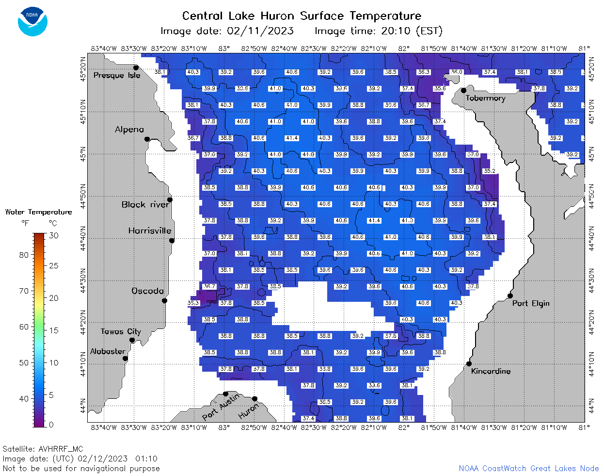 | h2_2023_02_12_0110.png | 12-Feb-2023 06:24 | 55801 | |
 | h2_2023_02_12_0200.png | 12-Feb-2023 06:25 | 60183 | |
 | h2_2023_02_12_0250.png | 12-Feb-2023 06:26 | 55858 | |
 | h2_2023_02_12_0650.png | 12-Feb-2023 10:24 | 59464 | |
 | h2_2023_02_12_0740.png | 12-Feb-2023 11:24 | 61962 | |
 | h2_2023_02_12_0830.png | 12-Feb-2023 12:24 | 59424 | |
 | h2_2023_02_12_1410.png | 12-Feb-2023 17:24 | 29310 | |
 | h2_2023_02_12_1500.png | 12-Feb-2023 19:24 | 53867 | |
 | h2_2023_02_12_1510.png | 12-Feb-2023 19:25 | 33085 | |
 | h2_2023_02_12_1550.png | 12-Feb-2023 19:26 | 56241 | |
 | h2_2023_02_12_1640.png | 12-Feb-2023 20:24 | 46057 | |
 | h2_2023_02_12_1720.png | 12-Feb-2023 20:26 | 58861 | |
 | h2_2023_02_12_1810.png | 12-Feb-2023 21:24 | 58560 | |
 | h2_2023_02_12_1900.png | 12-Feb-2023 21:25 | 58204 | |
 | h2_2023_043.png | 13-Feb-2023 10:14 | 66248 | |