
Easier access to scientific data

Brought to you by NOAA CoastWatch Great Lakes Node
|
ERDDAP
Easier access to scientific data |
|
Brought to you by NOAA CoastWatch Great Lakes Node |
| Dataset Title: | Lake Huron Central Region Surface Temperature Contour Map (2022-present)


|
| Institution: | CoastWatch Great Lakes Node (Dataset ID: LH_NRT_TC_h2) |
| Information: | Summary
| License
| Metadata
| Background | Subset
| Data Access Form
| Make a graph
| Subset
| Data Access Form
| Make a graph
|
![[ICO]](https://apps.glerl.noaa.gov/erddap/images/fileIcons/blank.gif) | Name | Last modified | Size | Description |
|---|---|---|---|---|
![[DIR]](https://apps.glerl.noaa.gov/erddap/images/fileIcons/back.gif) | Parent Directory | - | - | |
![[IMG]](https://apps.glerl.noaa.gov/erddap/images/fileIcons/image2.gif) 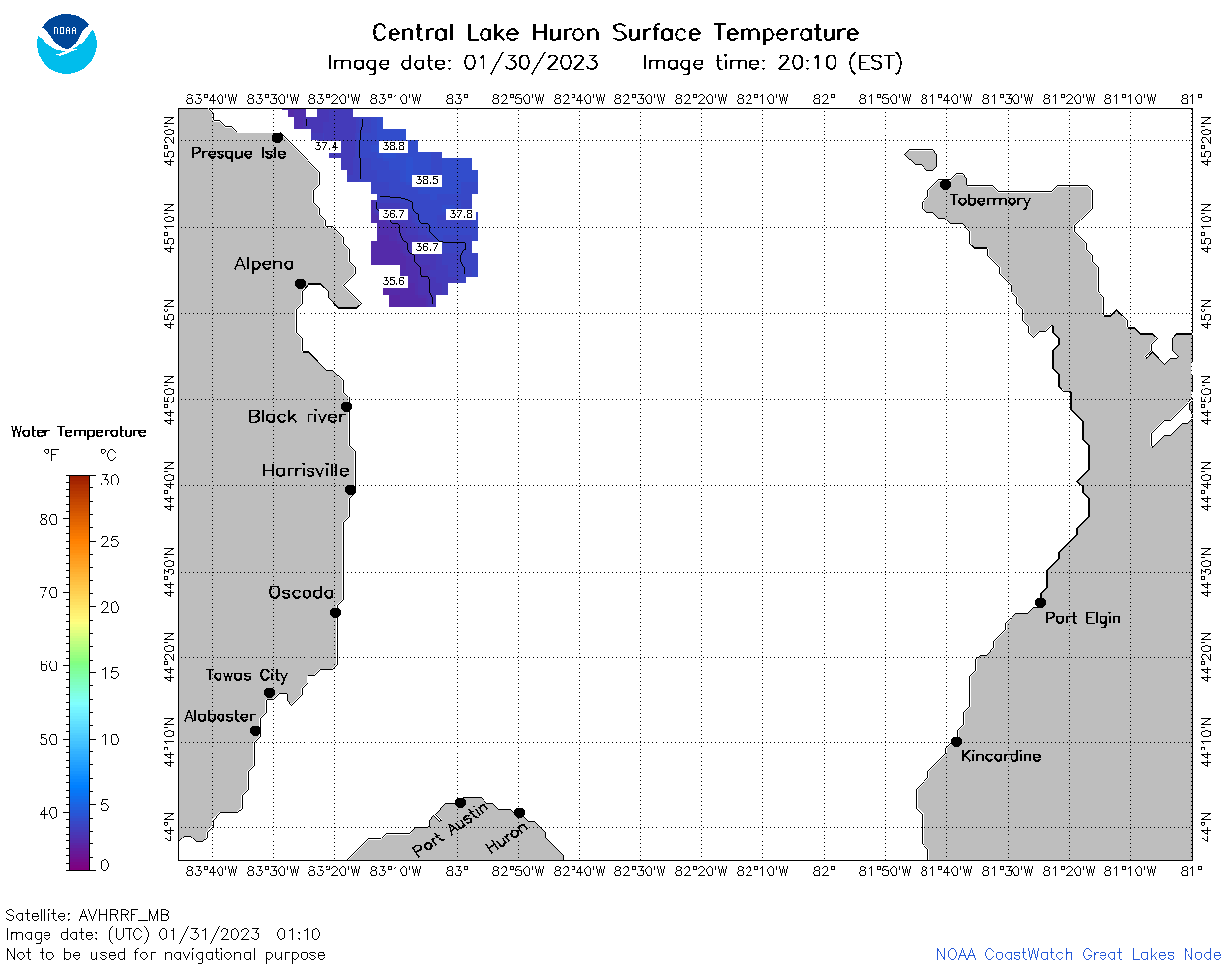 | h2_2023_01_31_0110.png | 31-Jan-2023 06:24 | 30543 | |
 | h2_2023_01_31_0200.png | 31-Jan-2023 06:25 | 35586 | |
 | h2_2023_01_31_0250.png | 31-Jan-2023 06:26 | 36257 | |
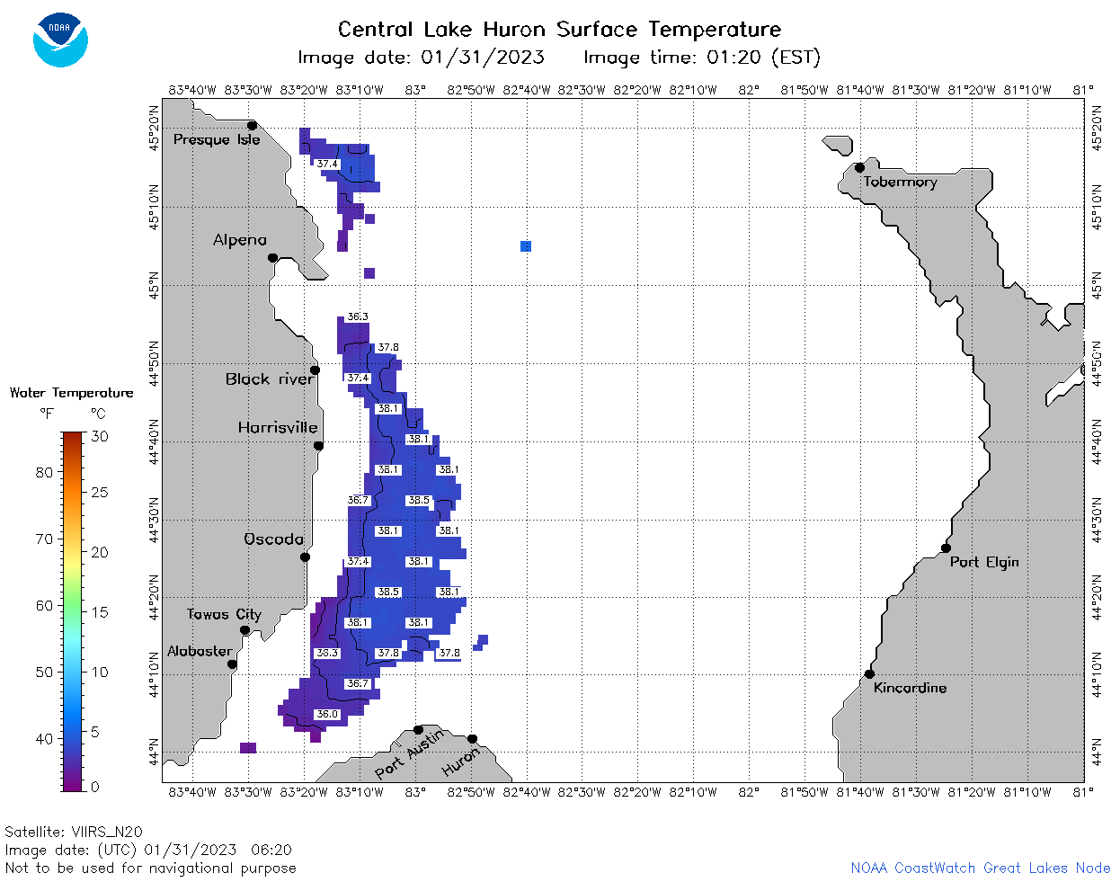 | h2_2023_01_31_0620.png | 31-Jan-2023 09:24 | 34257 | |
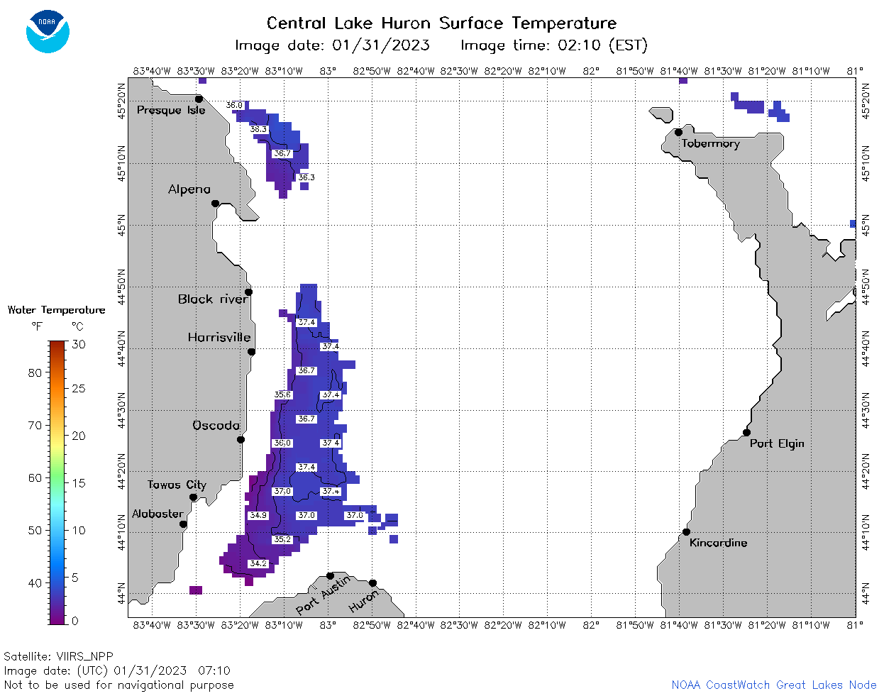 | h2_2023_01_31_0710.png | 31-Jan-2023 11:24 | 34287 | |
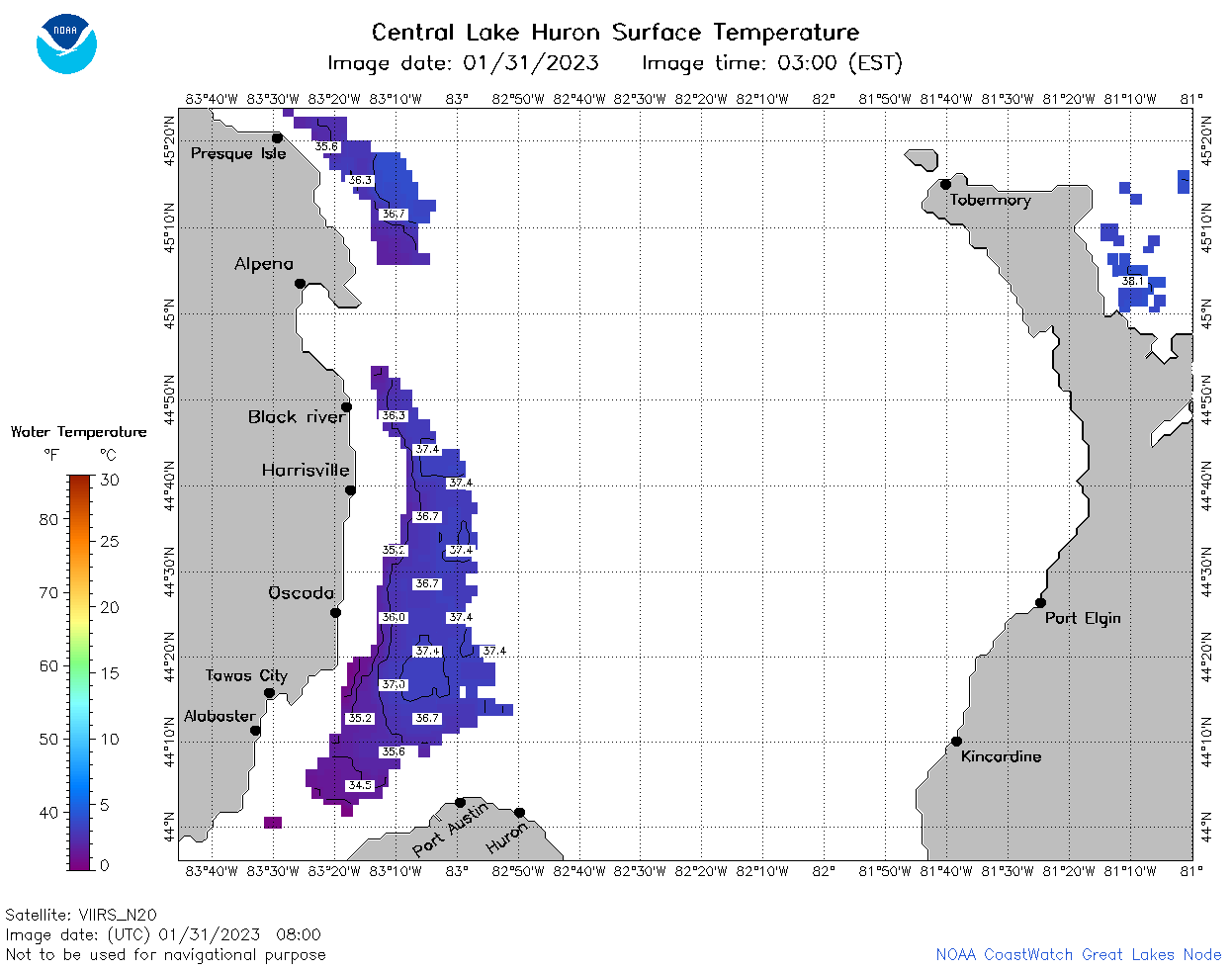 | h2_2023_01_31_0800.png | 31-Jan-2023 10:24 | 34424 | |
 | h2_2023_01_31_0850.png | 31-Jan-2023 12:24 | 29796 | |
 | h2_2023_01_31_1500.png | 31-Jan-2023 18:25 | 36764 | |
 | h2_2023_01_31_1550.png | 31-Jan-2023 19:24 | 36187 | |
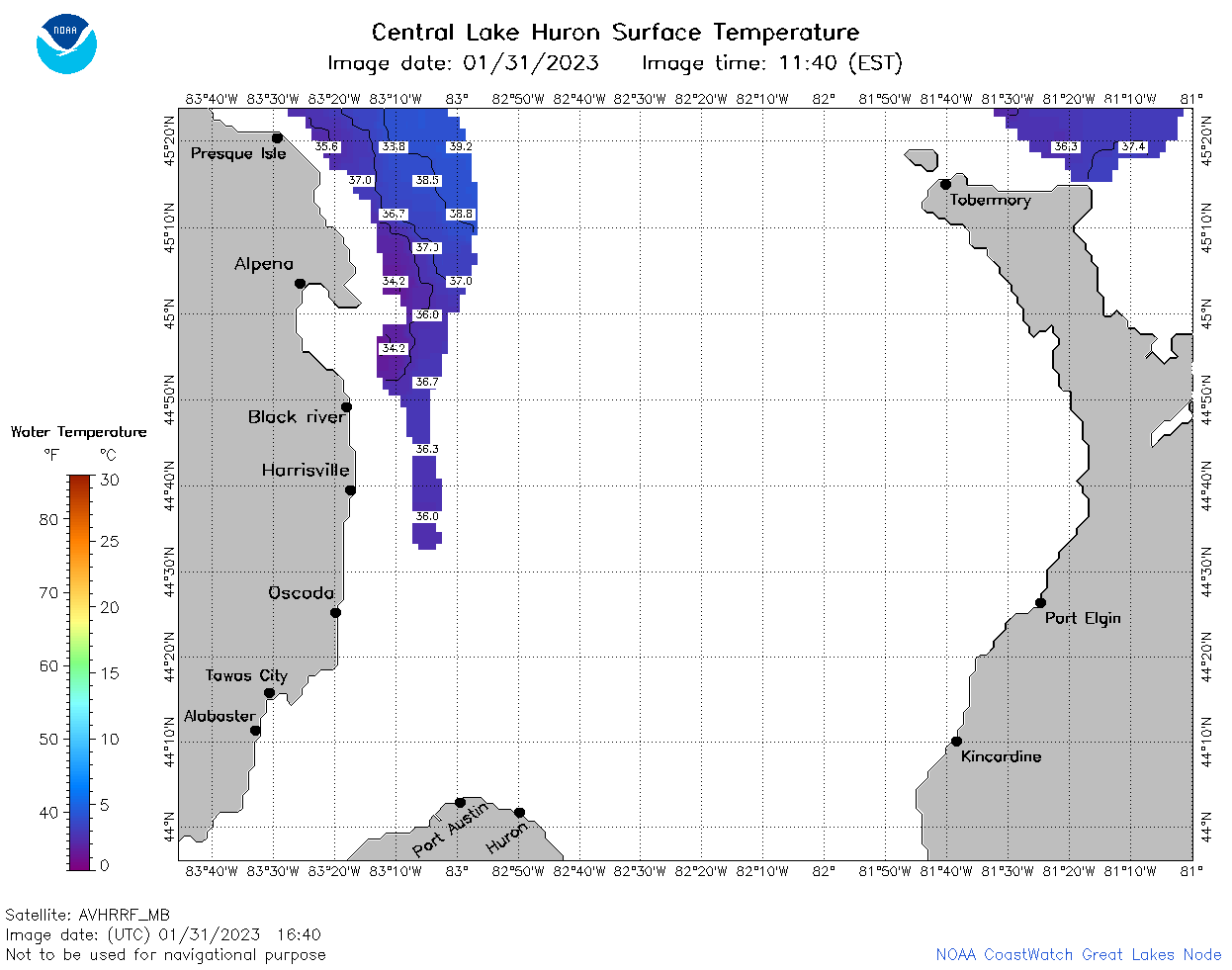 | h2_2023_01_31_1640.png | 31-Jan-2023 19:25 | 32623 | |
 | h2_2023_01_31_1700.png | 31-Jan-2023 21:24 | 33153 | |
 | h2_2023_01_31_1750.png | 31-Jan-2023 20:24 | 33508 | |
 | h2_2023_01_31_1840.png | 31-Jan-2023 21:26 | 33778 | |
 | h2_2023_01_31_1930.png | 31-Jan-2023 21:27 | 32961 | |
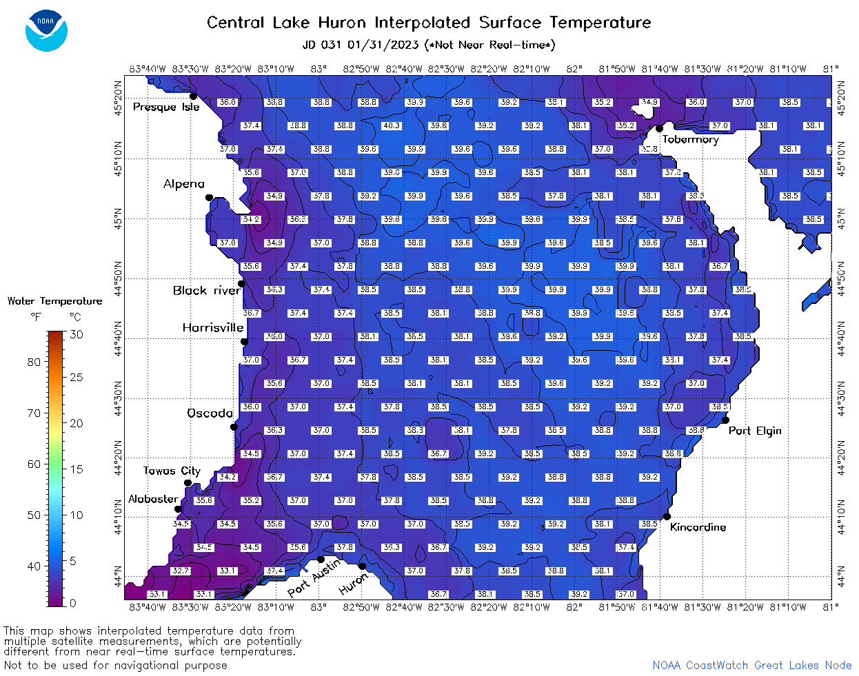 | h2_2023_031.png | 01-Feb-2023 10:14 | 70785 | |