
Easier access to scientific data

Brought to you by NOAA CoastWatch Great Lakes Node
|
ERDDAP
Easier access to scientific data |
|
Brought to you by NOAA CoastWatch Great Lakes Node |
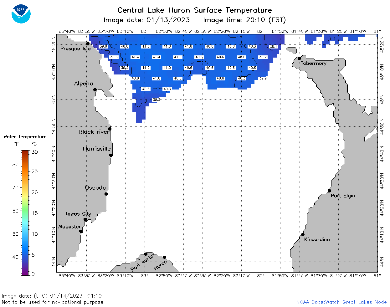
| Dataset Title: | Lake Huron Central Region Surface Temperature Contour Map (2022-present)


|
| Institution: | CoastWatch Great Lakes Node (Dataset ID: LH_NRT_TC_h2) |
| Information: | Summary
| License
| Metadata
| Background | Subset
| Data Access Form
| Make a graph
| Subset
| Data Access Form
| Make a graph
|
![[ICO]](https://apps.glerl.noaa.gov/erddap/images/fileIcons/blank.gif) | Name | Last modified | Size | Description |
|---|---|---|---|---|
![[DIR]](https://apps.glerl.noaa.gov/erddap/images/fileIcons/back.gif) | Parent Directory | - | - | |
![[IMG]](https://apps.glerl.noaa.gov/erddap/images/fileIcons/image2.gif)  | h2_2023_014.png | 15-Jan-2023 10:14 | 64827 | |
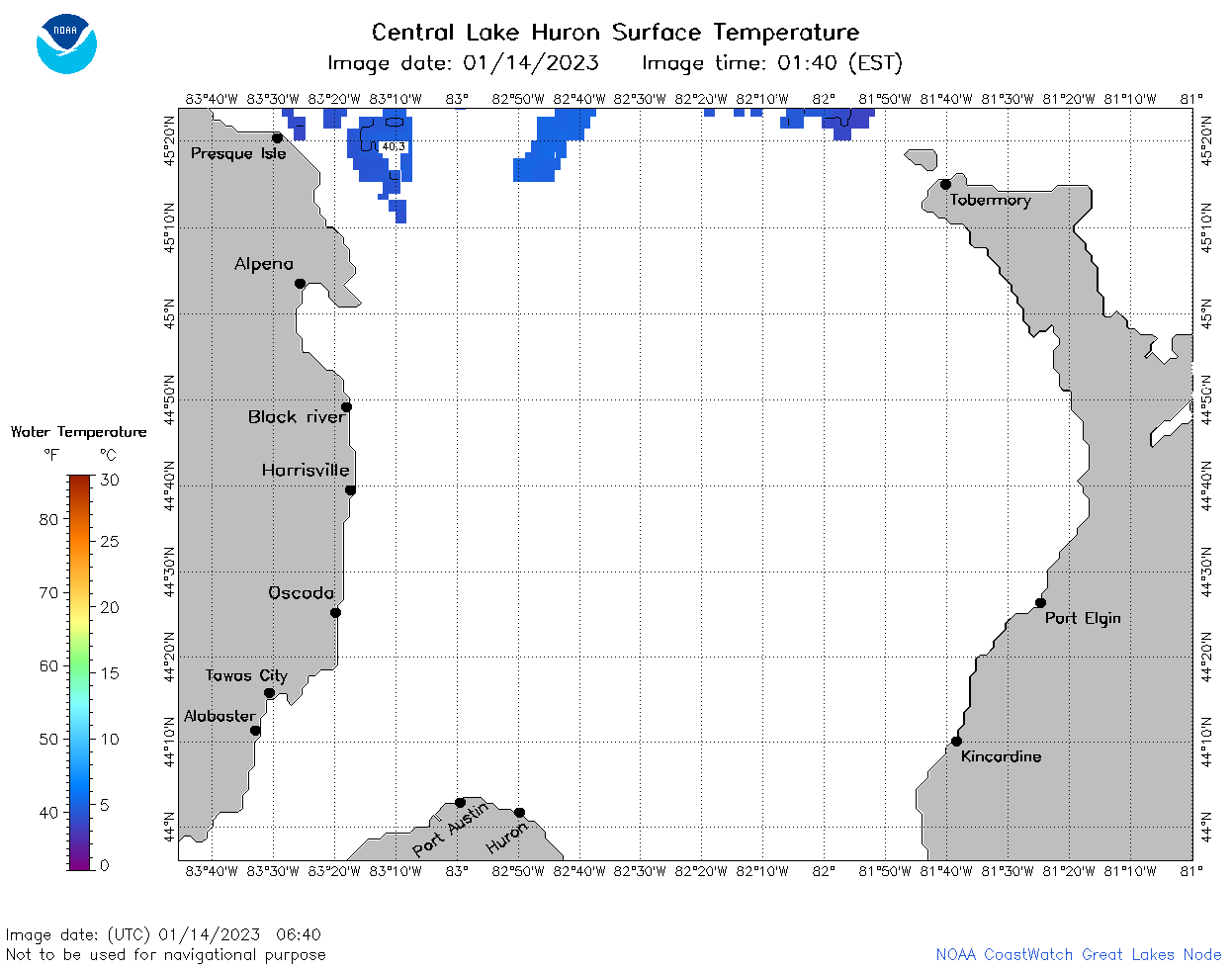
 | h2_2023_01_14_0110.png | 14-Jan-2023 06:24 | 34072 | |
 | h2_2023_01_14_0200.png | 14-Jan-2023 06:25 | 35858 | |
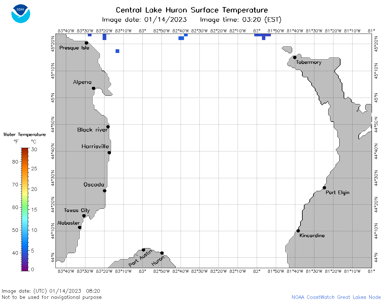
 | h2_2023_01_14_0250.png | 14-Jan-2023 06:25 | 33598 | |
 | h2_2023_01_14_0640.png | 14-Jan-2023 09:24 | 29638 | |
 | h2_2023_01_14_0730.png | 14-Jan-2023 11:24 | 29976 | |
 | h2_2023_01_14_0820.png | 14-Jan-2023 11:25 | 28723 | |
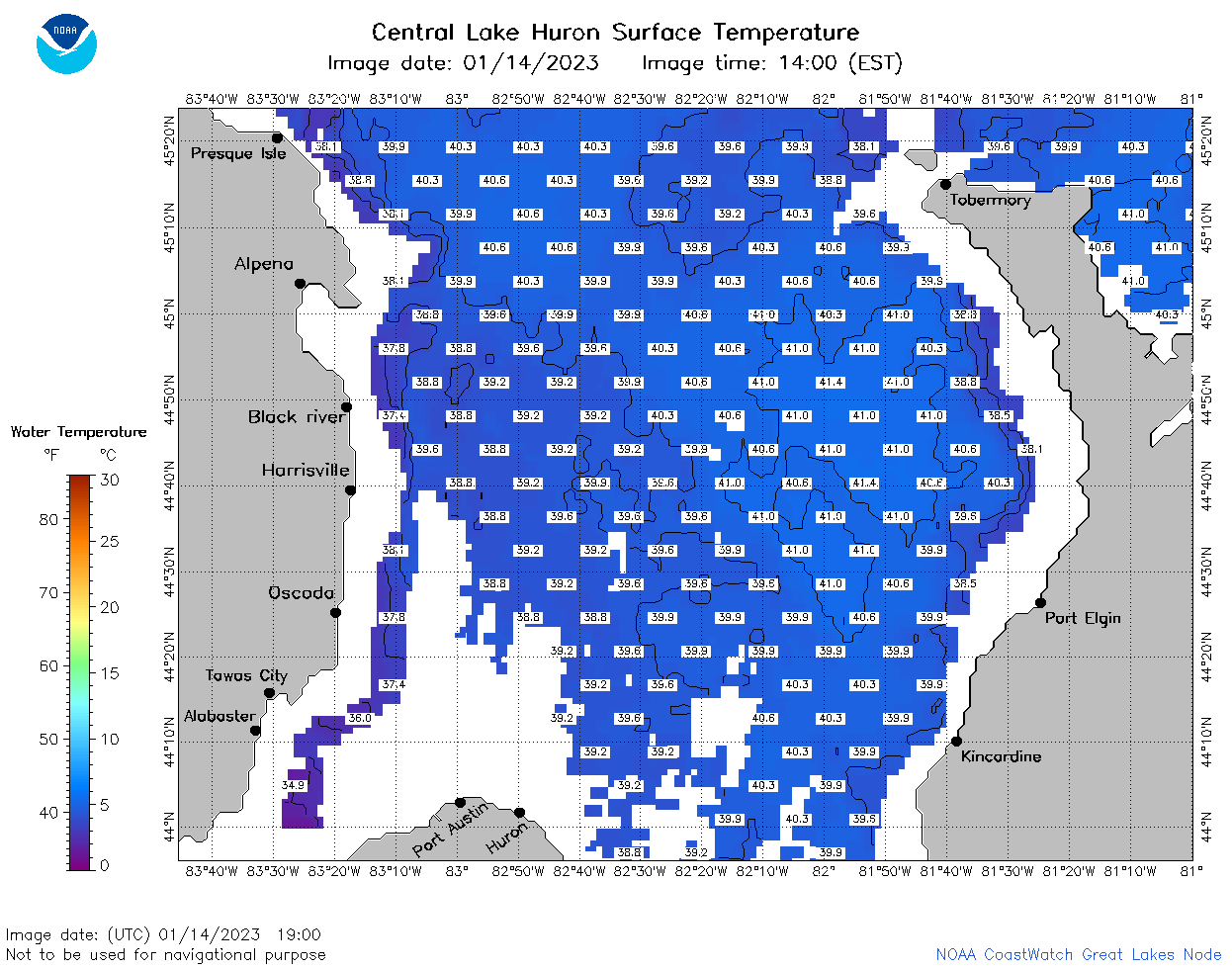
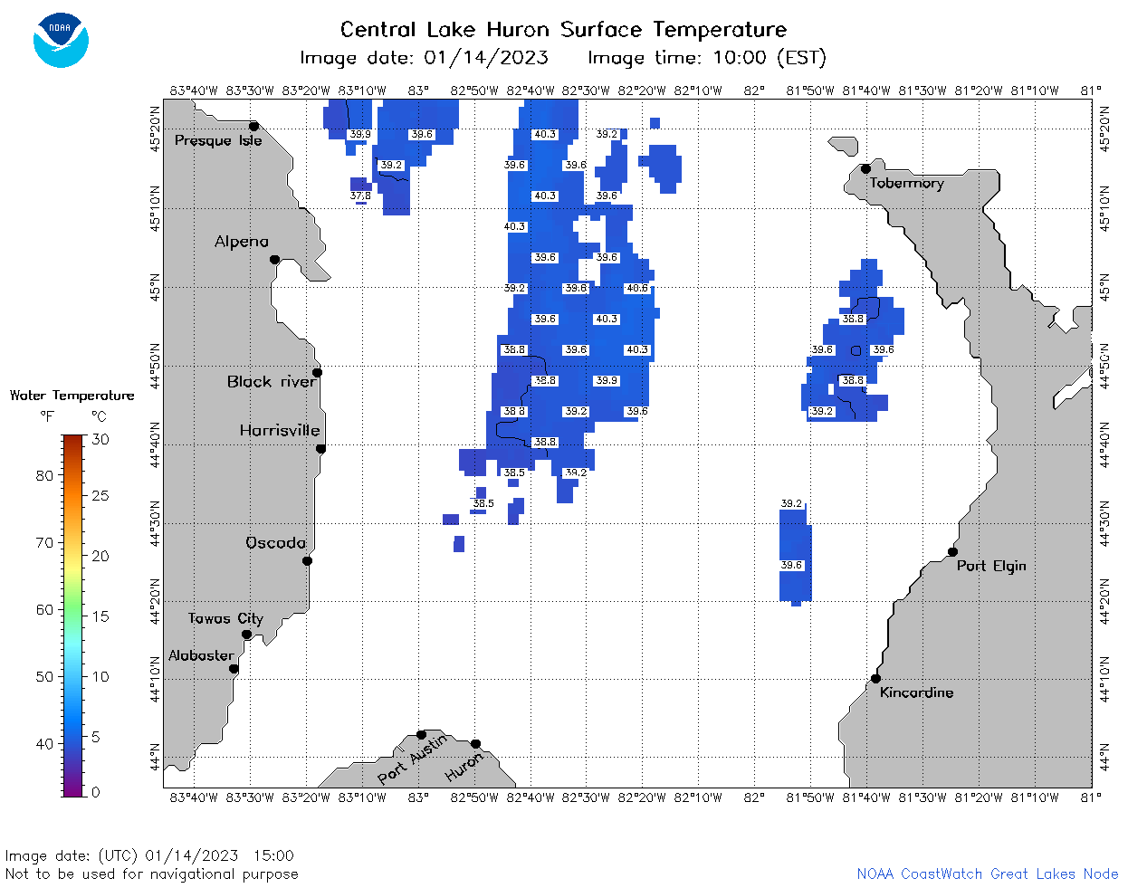 | h2_2023_01_14_1500.png | 14-Jan-2023 19:24 | 34536 | |
 | h2_2023_01_14_1550.png | 14-Jan-2023 18:24 | 39691 | |
 | h2_2023_01_14_1640.png | 14-Jan-2023 20:24 | 32207 | |
 | h2_2023_01_14_1720.png | 14-Jan-2023 21:24 | 43617 | |
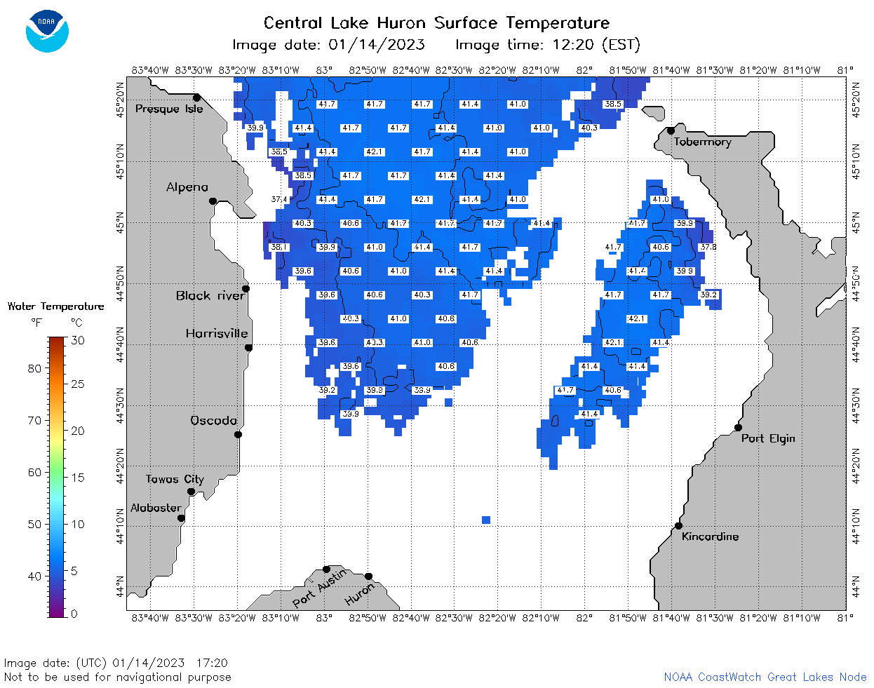
 | h2_2023_01_14_1800.png | 14-Jan-2023 20:26 | 50473 | |
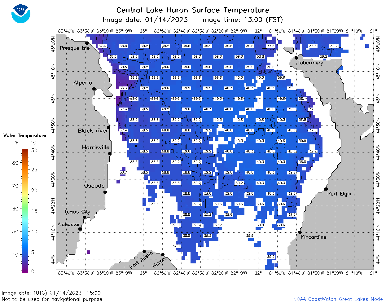
 | h2_2023_01_14_1900.png | 14-Jan-2023 21:25 | 55469 | |