
Easier access to scientific data

Brought to you by NOAA CoastWatch Great Lakes Node
|
ERDDAP
Easier access to scientific data |
|
Brought to you by NOAA CoastWatch Great Lakes Node |
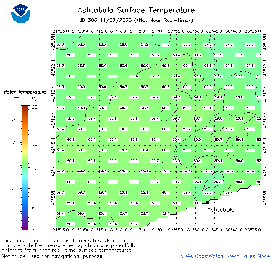
| Dataset Title: | Lake Erie Ashtabula Surface Temperature Contour Map (2022-present)


|
| Institution: | CoastWatch Great Lakes Node (Dataset ID: LE_NRT_TC_e22) |
| Information: | Summary
| License
| Metadata
| Background | Subset
| Data Access Form
| Make a graph
| Subset
| Data Access Form
| Make a graph
|
![[ICO]](https://apps.glerl.noaa.gov/erddap/images/fileIcons/blank.gif) | Name | Last modified | Size | Description |
|---|---|---|---|---|
![[DIR]](https://apps.glerl.noaa.gov/erddap/images/fileIcons/back.gif) | Parent Directory | - | - | |
![[IMG]](https://apps.glerl.noaa.gov/erddap/images/fileIcons/image2.gif)  | e22_2023_11_02_0110.png | 02-Nov-2023 05:41 | 18860 | |
 | e22_2023_11_02_0120.png | 02-Nov-2023 05:48 | 17201 | |
 | e22_2023_11_02_0210.png | 02-Nov-2023 05:54 | 18553 | |
 | e22_2023_11_02_0250.png | 02-Nov-2023 06:01 | 17831 | |
 | e22_2023_11_02_0300.png | 02-Nov-2023 06:08 | 17210 | |
 | e22_2023_11_02_0350.png | 02-Nov-2023 06:14 | 17213 | |
 | e22_2023_11_02_0700.png | 02-Nov-2023 10:34 | 20134 | |
 | e22_2023_11_02_0710.png | 02-Nov-2023 10:41 | 18839 | |
 | e22_2023_11_02_0840.png | 02-Nov-2023 12:34 | 17275 | |
 | e22_2023_11_02_0850.png | 02-Nov-2023 12:41 | 17281 | |
 | e22_2023_11_02_1420.png | 02-Nov-2023 18:34 | 17240 | |
 | e22_2023_11_02_1510.png | 02-Nov-2023 18:41 | 17205 | |
 | e22_2023_11_02_1600.png | 02-Nov-2023 20:37 | 17231 | |
 | e22_2023_11_02_1650.png | 02-Nov-2023 20:44 | 17225 | |
 | e22_2023_11_02_1740.png | 02-Nov-2023 20:58 | 17230 | |
 | e22_2023_11_02_1830.png | 02-Nov-2023 21:06 | 17291 | |
 | e22_2023_306.png | 03-Nov-2023 10:13 | 31933 | |