
Easier access to scientific data

Brought to you by NOAA CoastWatch Great Lakes Node
|
ERDDAP
Easier access to scientific data |
|
Brought to you by NOAA CoastWatch Great Lakes Node |
| Dataset Title: | Lake Erie Ashtabula Surface Temperature Contour Map (2022-present)


|
| Institution: | CoastWatch Great Lakes Node (Dataset ID: LE_NRT_TC_e22) |
| Information: | Summary
| License
| Metadata
| Background | Subset
| Data Access Form
| Make a graph
| Subset
| Data Access Form
| Make a graph
|
![[ICO]](https://apps.glerl.noaa.gov/erddap/images/fileIcons/blank.gif) | Name | Last modified | Size | Description |
|---|---|---|---|---|
![[DIR]](https://apps.glerl.noaa.gov/erddap/images/fileIcons/back.gif) | Parent Directory | - | - | |
![[IMG]](https://apps.glerl.noaa.gov/erddap/images/fileIcons/image2.gif)  | e22_2023_10_12_0100.png | 12-Oct-2023 05:39 | 17298 | |
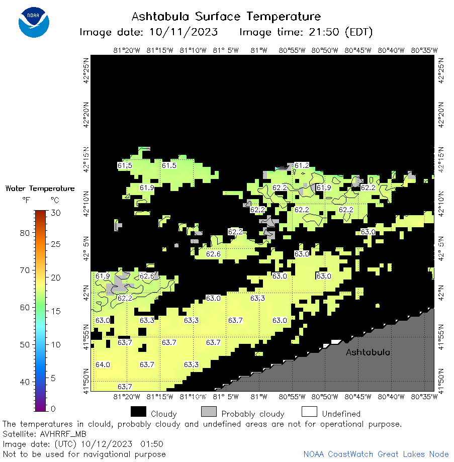 | e22_2023_10_12_0150.png | 12-Oct-2023 05:46 | 29827 | |
 | e22_2023_10_12_0240.png | 12-Oct-2023 05:53 | 26539 | |
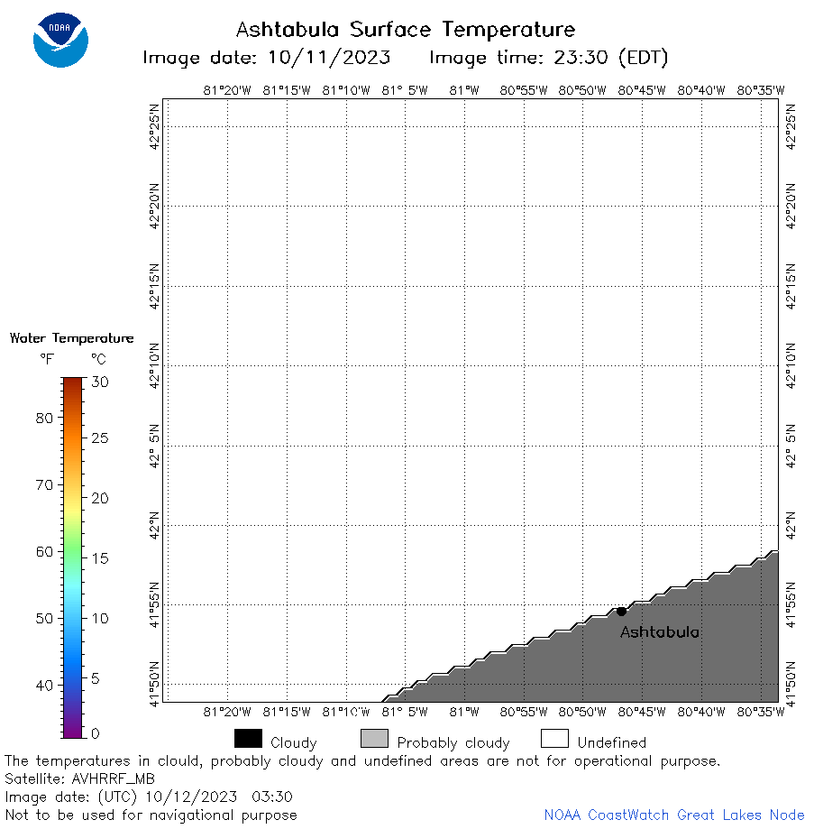 | e22_2023_10_12_0330.png | 12-Oct-2023 06:00 | 17286 | |
 | e22_2023_10_12_0610.png | 12-Oct-2023 10:33 | 37760 | |
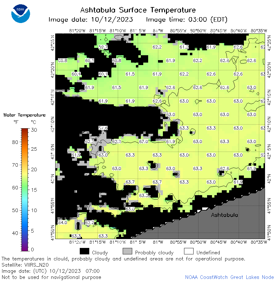 | e22_2023_10_12_0700.png | 12-Oct-2023 10:39 | 39075 | |
 | e22_2023_10_12_0750.png | 12-Oct-2023 10:46 | 31057 | |
 | e22_2023_10_12_0840.png | 12-Oct-2023 10:52 | 17328 | |
 | e22_2023_10_12_1400.png | 12-Oct-2023 17:31 | 17278 | |
 | e22_2023_10_12_1540.png | 12-Oct-2023 19:34 | 22169 | |
 | e22_2023_10_12_1550.png | 12-Oct-2023 19:41 | 17199 | |
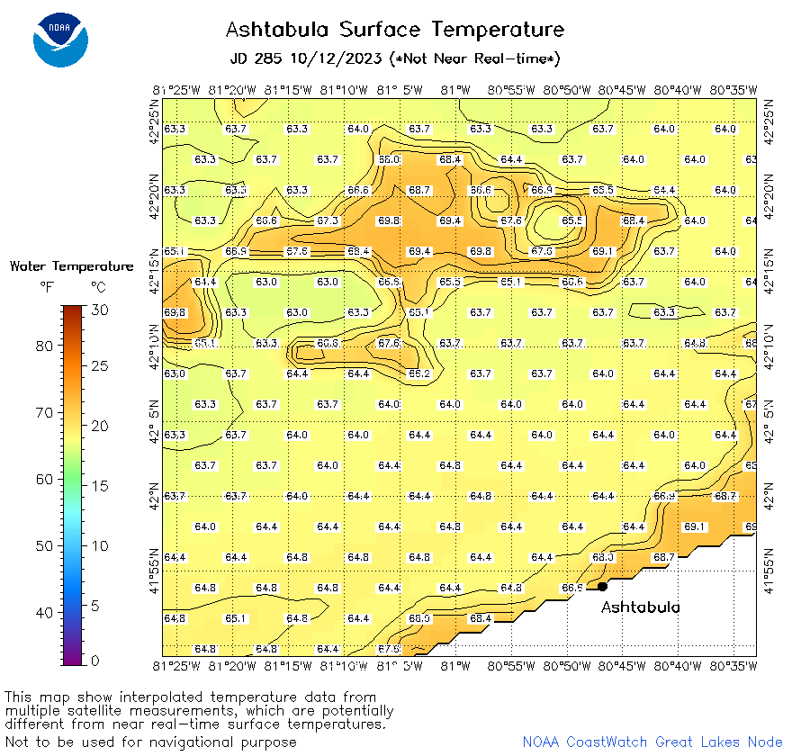 | e22_2023_285.png | 13-Oct-2023 10:13 | 41341 | |