
Easier access to scientific data

Brought to you by NOAA CoastWatch Great Lakes Node
|
ERDDAP
Easier access to scientific data |
|
Brought to you by NOAA CoastWatch Great Lakes Node |
| Dataset Title: | Lake Erie Ashtabula Surface Temperature Contour Map (2022-present)


|
| Institution: | CoastWatch Great Lakes Node (Dataset ID: LE_NRT_TC_e22) |
| Information: | Summary
| License
| Metadata
| Background | Subset
| Data Access Form
| Make a graph
| Subset
| Data Access Form
| Make a graph
|
![[ICO]](https://apps.glerl.noaa.gov/erddap/images/fileIcons/blank.gif) | Name | Last modified | Size | Description |
|---|---|---|---|---|
![[DIR]](https://apps.glerl.noaa.gov/erddap/images/fileIcons/back.gif) | Parent Directory | - | - | |
![[IMG]](https://apps.glerl.noaa.gov/erddap/images/fileIcons/image2.gif)  | e22_2023_09_21_0130.png | 21-Sep-2023 05:42 | 34826 | |
 | e22_2023_09_21_0140.png | 21-Sep-2023 05:50 | 17312 | |
 | e22_2023_09_21_0220.png | 21-Sep-2023 05:57 | 32705 | |
 | e22_2023_09_21_0310.png | 21-Sep-2023 06:05 | 18013 | |
 | e22_2023_09_21_0320.png | 21-Sep-2023 06:12 | 17785 | |
 | e22_2023_09_21_0600.png | 21-Sep-2023 10:56 | 19459 | |
 | e22_2023_09_21_0650.png | 21-Sep-2023 11:03 | 22750 | |
 | e22_2023_09_21_0740.png | 21-Sep-2023 11:10 | 22852 | |
 | e22_2023_09_21_0830.png | 21-Sep-2023 11:32 | 19704 | |
 | e22_2023_09_21_0920.png | 21-Sep-2023 12:32 | 17261 | |
 | e22_2023_09_21_1440.png | 21-Sep-2023 18:32 | 20331 | |
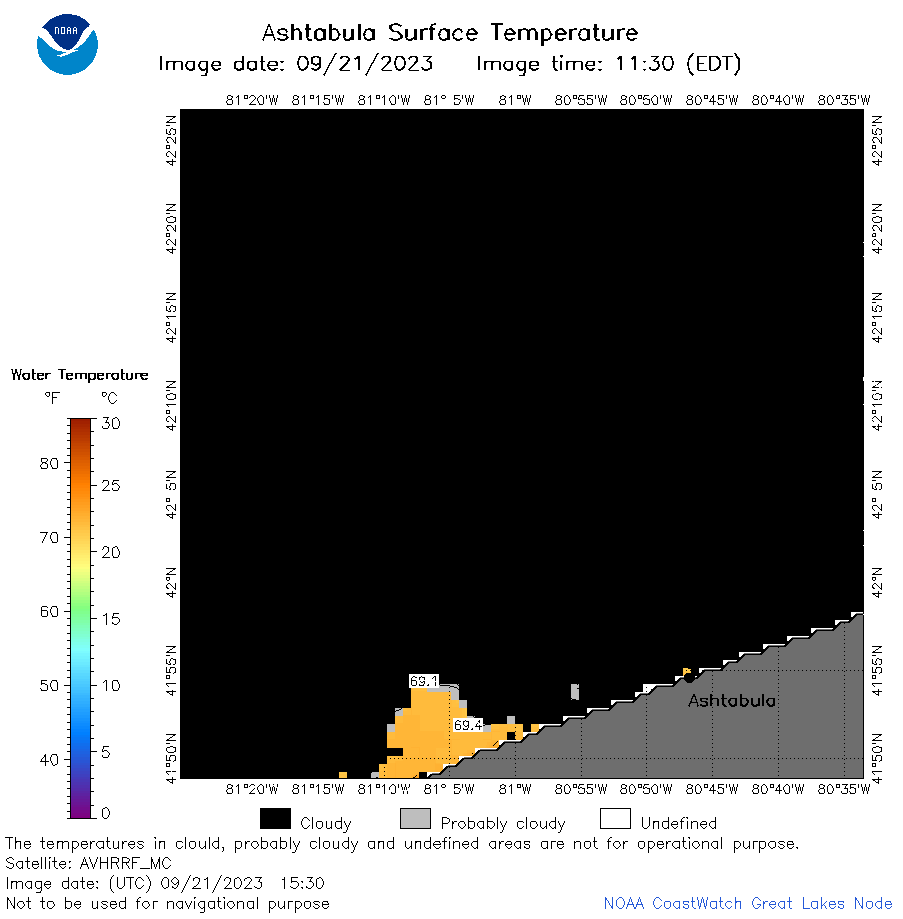 | e22_2023_09_21_1530.png | 21-Sep-2023 18:39 | 18293 | |
 | e22_2023_09_21_1620.png | 21-Sep-2023 18:46 | 17944 | |
 | e22_2023_09_21_1710.png | 21-Sep-2023 22:37 | 17229 | |
 | e22_2023_09_21_1730.png | 21-Sep-2023 22:44 | 39629 | |
 | e22_2023_09_21_1820.png | 21-Sep-2023 22:51 | 41410 | |
 | e22_2023_09_21_1910.png | 21-Sep-2023 22:58 | 47709 | |
 | e22_2023_264.png | 22-Sep-2023 10:15 | 25185 | |