
Easier access to scientific data

Brought to you by NOAA CoastWatch Great Lakes Node
|
ERDDAP
Easier access to scientific data |
|
Brought to you by NOAA CoastWatch Great Lakes Node |
| Dataset Title: | Lake Erie Ashtabula Surface Temperature Contour Map (2022-present)


|
| Institution: | CoastWatch Great Lakes Node (Dataset ID: LE_NRT_TC_e22) |
| Information: | Summary
| License
| Metadata
| Background | Subset
| Data Access Form
| Make a graph
| Subset
| Data Access Form
| Make a graph
|
![[ICO]](https://apps.glerl.noaa.gov/erddap/images/fileIcons/blank.gif) | Name | Last modified | Size | Description |
|---|---|---|---|---|
![[DIR]](https://apps.glerl.noaa.gov/erddap/images/fileIcons/back.gif) | Parent Directory | - | - | |
![[IMG]](https://apps.glerl.noaa.gov/erddap/images/fileIcons/image2.gif) 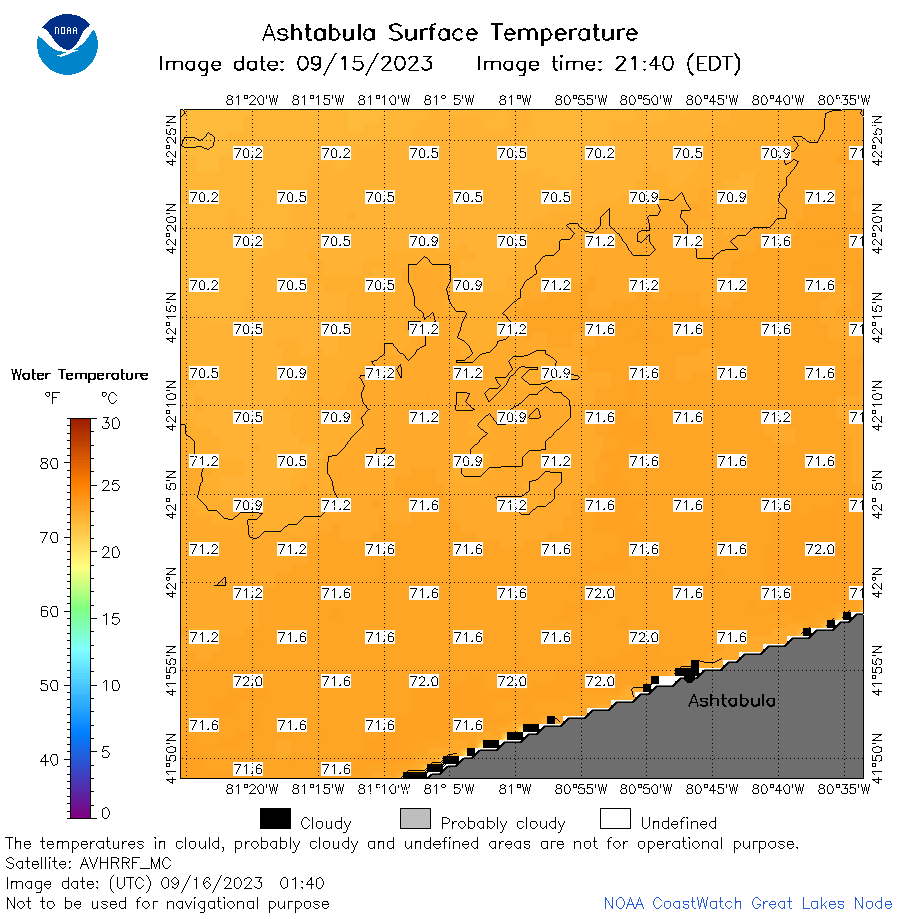 | e22_2023_09_16_0140.png | 16-Sep-2023 05:37 | 33355 | |
 | e22_2023_09_16_0230.png | 16-Sep-2023 05:45 | 43178 | |
 | e22_2023_09_16_0320.png | 16-Sep-2023 05:52 | 30772 | |
 | e22_2023_09_16_0600.png | 16-Sep-2023 09:31 | 17318 | |
 | e22_2023_09_16_0640.png | 16-Sep-2023 09:38 | 17281 | |
 | e22_2023_09_16_0650.png | 16-Sep-2023 09:46 | 38645 | |
 | e22_2023_09_16_0740.png | 16-Sep-2023 10:34 | 41096 | |
 | e22_2023_09_16_0830.png | 16-Sep-2023 10:41 | 40902 | |
 | e22_2023_09_16_0920.png | 16-Sep-2023 13:32 | 17262 | |
 | e22_2023_09_16_1440.png | 16-Sep-2023 18:32 | 30181 | |
 | e22_2023_09_16_1530.png | 16-Sep-2023 18:39 | 17201 | |
 | e22_2023_09_16_1540.png | 16-Sep-2023 18:46 | 40051 | |
 | e22_2023_09_16_1620.png | 16-Sep-2023 18:53 | 24077 | |
 | e22_2023_09_16_1710.png | 16-Sep-2023 21:32 | 17227 | |
 | e22_2023_09_16_1720.png | 16-Sep-2023 22:32 | 37368 | |
 | e22_2023_09_16_1810.png | 16-Sep-2023 21:39 | 36552 | |
 | e22_2023_09_16_1900.png | 16-Sep-2023 22:39 | 22481 | |
 | e22_2023_09_16_1950.png | 16-Sep-2023 22:46 | 17275 | |
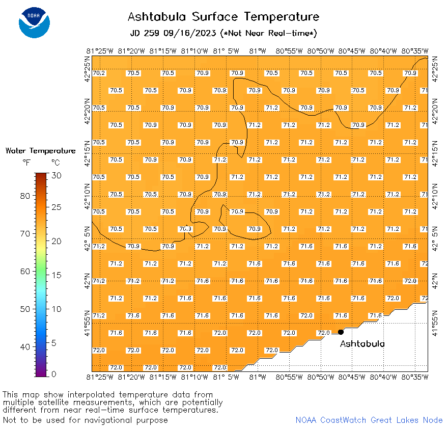 | e22_2023_259.png | 17-Sep-2023 10:12 | 25561 | |