
Easier access to scientific data

Brought to you by NOAA CoastWatch Great Lakes Node
|
ERDDAP
Easier access to scientific data |
|
Brought to you by NOAA CoastWatch Great Lakes Node |
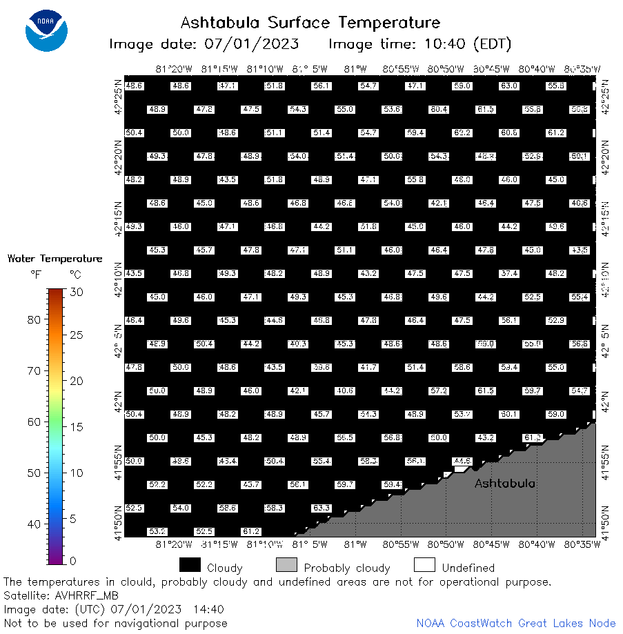
| Dataset Title: | Lake Erie Ashtabula Surface Temperature Contour Map (2022-present)


|
| Institution: | CoastWatch Great Lakes Node (Dataset ID: LE_NRT_TC_e22) |
| Information: | Summary
| License
| Metadata
| Background | Subset
| Data Access Form
| Make a graph
| Subset
| Data Access Form
| Make a graph
|
![[ICO]](https://apps.glerl.noaa.gov/erddap/images/fileIcons/blank.gif) | Name | Last modified | Size | Description |
|---|---|---|---|---|
![[DIR]](https://apps.glerl.noaa.gov/erddap/images/fileIcons/back.gif) | Parent Directory | - | - | |
![[IMG]](https://apps.glerl.noaa.gov/erddap/images/fileIcons/image2.gif)  | e22_2023_07_01_0130.png | 01-Jul-2023 05:38 | 29757 | |
 | e22_2023_07_01_0220.png | 01-Jul-2023 05:50 | 28389 | |
 | e22_2023_07_01_0310.png | 01-Jul-2023 05:58 | 30590 | |
 | e22_2023_07_01_0640.png | 01-Jul-2023 10:35 | 21488 | |
 | e22_2023_07_01_0730.png | 01-Jul-2023 10:43 | 25978 | |
 | e22_2023_07_01_0820.png | 01-Jul-2023 12:35 | 27265 | |
 | e22_2023_07_01_1440.png | 01-Jul-2023 18:39 | 24427 | |
 | e22_2023_07_01_1530.png | 01-Jul-2023 18:47 | 24567 | |
 | e22_2023_07_01_1620.png | 01-Jul-2023 19:00 | 20244 | |
 | e22_2023_07_01_1710.png | 01-Jul-2023 19:38 | 22643 | |
 | e22_2023_07_01_1800.png | 01-Jul-2023 19:44 | 19795 | |
 | e22_2023_07_01_1850.png | 01-Jul-2023 20:38 | 19808 | |
 | e22_2023_182.png | 02-Jul-2023 10:14 | 25564 | |