
Easier access to scientific data

Brought to you by NOAA CoastWatch Great Lakes Node
|
ERDDAP
Easier access to scientific data |
|
Brought to you by NOAA CoastWatch Great Lakes Node |
| Dataset Title: | Lake Erie Ashtabula Surface Temperature Contour Map (2022-present)


|
| Institution: | CoastWatch Great Lakes Node (Dataset ID: LE_NRT_TC_e22) |
| Information: | Summary
| License
| Metadata
| Background | Subset
| Data Access Form
| Make a graph
| Subset
| Data Access Form
| Make a graph
|
![[ICO]](https://apps.glerl.noaa.gov/erddap/images/fileIcons/blank.gif) | Name | Last modified | Size | Description |
|---|---|---|---|---|
![[DIR]](https://apps.glerl.noaa.gov/erddap/images/fileIcons/back.gif) | Parent Directory | - | - | |
![[IMG]](https://apps.glerl.noaa.gov/erddap/images/fileIcons/image2.gif)  | e22_2023_06_30_0150.png | 30-Jun-2023 05:45 | 29344 | |
 | e22_2023_06_30_0240.png | 30-Jun-2023 05:56 | 23962 | |
 | e22_2023_06_30_0610.png | 30-Jun-2023 10:33 | 22747 | |
 | e22_2023_06_30_0700.png | 30-Jun-2023 10:40 | 22617 | |
 | e22_2023_06_30_0750.png | 30-Jun-2023 10:47 | 20408 | |
 | e22_2023_06_30_1410.png | 30-Jun-2023 18:33 | 20730 | |
 | e22_2023_06_30_1500.png | 30-Jun-2023 18:41 | 32922 | |
 | e22_2023_06_30_1550.png | 30-Jun-2023 19:33 | 36078 | |
 | e22_2023_06_30_1730.png | 30-Jun-2023 19:41 | 37829 | |
 | e22_2023_06_30_1820.png | 30-Jun-2023 20:42 | 36474 | |
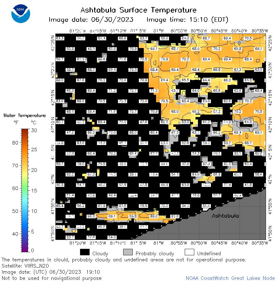 | e22_2023_06_30_1910.png | 30-Jun-2023 21:42 | 40357 | |
 | e22_2023_181.png | 01-Jul-2023 10:12 | 25945 | |