
Easier access to scientific data

Brought to you by NOAA CoastWatch Great Lakes Node
|
ERDDAP
Easier access to scientific data |
|
Brought to you by NOAA CoastWatch Great Lakes Node |
| Dataset Title: | Lake Erie Ashtabula Surface Temperature Contour Map (2022-present)


|
| Institution: | CoastWatch Great Lakes Node (Dataset ID: LE_NRT_TC_e22) |
| Information: | Summary
| License
| Metadata
| Background | Subset
| Data Access Form
| Make a graph
| Subset
| Data Access Form
| Make a graph
|
![[ICO]](https://apps.glerl.noaa.gov/erddap/images/fileIcons/blank.gif) | Name | Last modified | Size | Description |
|---|---|---|---|---|
![[DIR]](https://apps.glerl.noaa.gov/erddap/images/fileIcons/back.gif) | Parent Directory | - | - | |
![[IMG]](https://apps.glerl.noaa.gov/erddap/images/fileIcons/image2.gif)  | e22_2023_06_22_0120.png | 22-Jun-2023 05:38 | 39777 | |
 | e22_2023_06_22_0210.png | 22-Jun-2023 05:45 | 40375 | |
 | e22_2023_06_22_0300.png | 22-Jun-2023 05:53 | 38352 | |
 | e22_2023_06_22_0610.png | 22-Jun-2023 09:31 | 35751 | |
 | e22_2023_06_22_0700.png | 22-Jun-2023 09:38 | 48402 | |
 | e22_2023_06_22_0750.png | 22-Jun-2023 10:32 | 46981 | |
 | e22_2023_06_22_1420.png | 22-Jun-2023 17:31 | 23257 | |
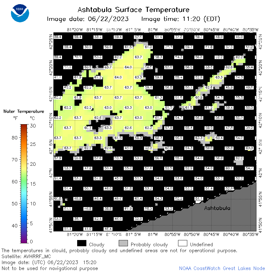 | e22_2023_06_22_1520.png | 22-Jun-2023 19:42 | 31613 | |
 | e22_2023_06_22_1600.png | 22-Jun-2023 19:49 | 28431 | |
 | e22_2023_06_22_1730.png | 22-Jun-2023 21:53 | 32819 | |
 | e22_2023_06_22_1820.png | 22-Jun-2023 22:10 | 32284 | |
 | e22_2023_06_22_1910.png | 22-Jun-2023 22:22 | 31901 | |
 | e22_2023_173.png | 23-Jun-2023 10:13 | 27172 | |