
Easier access to scientific data

Brought to you by NOAA CoastWatch Great Lakes Node
|
ERDDAP
Easier access to scientific data |
|
Brought to you by NOAA CoastWatch Great Lakes Node |
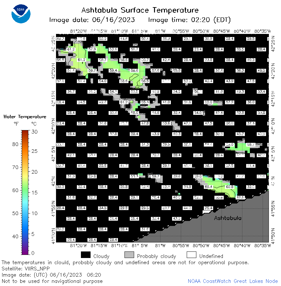
| Dataset Title: | Lake Erie Ashtabula Surface Temperature Contour Map (2022-present)


|
| Institution: | CoastWatch Great Lakes Node (Dataset ID: LE_NRT_TC_e22) |
| Information: | Summary
| License
| Metadata
| Background | Subset
| Data Access Form
| Make a graph
| Subset
| Data Access Form
| Make a graph
|
![[ICO]](https://apps.glerl.noaa.gov/erddap/images/fileIcons/blank.gif) | Name | Last modified | Size | Description |
|---|---|---|---|---|
![[DIR]](https://apps.glerl.noaa.gov/erddap/images/fileIcons/back.gif) | Parent Directory | - | - | |
![[IMG]](https://apps.glerl.noaa.gov/erddap/images/fileIcons/image2.gif)  | e22_2023_06_16_0140.png | 16-Jun-2023 05:38 | 19797 | |
 | e22_2023_06_16_0230.png | 16-Jun-2023 05:50 | 33261 | |
 | e22_2023_06_16_0320.png | 16-Jun-2023 05:57 | 36579 | |
 | e22_2023_06_16_0620.png | 16-Jun-2023 10:34 | 31202 | |
 | e22_2023_06_16_0710.png | 16-Jun-2023 10:41 | 42634 | |
 | e22_2023_06_16_0800.png | 16-Jun-2023 10:48 | 31990 | |
 | e22_2023_06_16_1450.png | 16-Jun-2023 17:37 | 24548 | |
 | e22_2023_06_16_1540.png | 16-Jun-2023 18:35 | 25642 | |
 | e22_2023_06_16_1630.png | 16-Jun-2023 18:42 | 23235 | |
 | e22_2023_06_16_1700.png | 16-Jun-2023 18:47 | 22682 | |
 | e22_2023_06_16_1750.png | 16-Jun-2023 19:37 | 24936 | |
 | e22_2023_06_16_1840.png | 16-Jun-2023 20:38 | 24895 | |
 | e22_2023_06_16_1930.png | 16-Jun-2023 21:35 | 24053 | |
 | e22_2023_167.png | 17-Jun-2023 10:14 | 26761 | |