
Easier access to scientific data

Brought to you by NOAA CoastWatch Great Lakes Node
|
ERDDAP
Easier access to scientific data |
|
Brought to you by NOAA CoastWatch Great Lakes Node |
| Dataset Title: | Lake Erie Ashtabula Surface Temperature Contour Map (2022-present)


|
| Institution: | CoastWatch Great Lakes Node (Dataset ID: LE_NRT_TC_e22) |
| Information: | Summary
| License
| Metadata
| Background | Subset
| Data Access Form
| Make a graph
| Subset
| Data Access Form
| Make a graph
|
![[ICO]](https://apps.glerl.noaa.gov/erddap/images/fileIcons/blank.gif) | Name | Last modified | Size | Description |
|---|---|---|---|---|
![[DIR]](https://apps.glerl.noaa.gov/erddap/images/fileIcons/back.gif) | Parent Directory | - | - | |
![[IMG]](https://apps.glerl.noaa.gov/erddap/images/fileIcons/image2.gif)  | e22_2023_06_10_0110.png | 10-Jun-2023 05:40 | 41399 | |
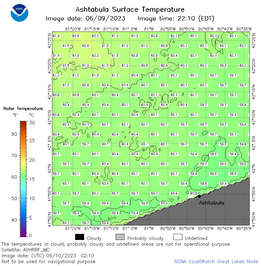 | e22_2023_06_10_0210.png | 10-Jun-2023 05:53 | 41124 | |
 | e22_2023_06_10_0250.png | 10-Jun-2023 05:59 | 40552 | |
 | e22_2023_06_10_0630.png | 10-Jun-2023 10:38 | 26944 | |
 | e22_2023_06_10_0640.png | 10-Jun-2023 10:44 | 32412 | |
 | e22_2023_06_10_0720.png | 10-Jun-2023 10:51 | 42453 | |
 | e22_2023_06_10_0820.png | 10-Jun-2023 11:38 | 44521 | |
 | e22_2023_06_10_1420.png | 10-Jun-2023 18:34 | 25839 | |
 | e22_2023_06_10_1510.png | 10-Jun-2023 18:41 | 31468 | |
 | e22_2023_06_10_1600.png | 10-Jun-2023 19:33 | 40652 | |
 | e22_2023_06_10_1710.png | 10-Jun-2023 18:47 | 23395 | |
 | e22_2023_06_10_1800.png | 10-Jun-2023 20:40 | 38656 | |
 | e22_2023_06_10_1850.png | 10-Jun-2023 20:48 | 43800 | |
 | e22_2023_161.png | 11-Jun-2023 10:14 | 26494 | |