
Easier access to scientific data

Brought to you by NOAA CoastWatch Great Lakes Node
|
ERDDAP
Easier access to scientific data |
|
Brought to you by NOAA CoastWatch Great Lakes Node |
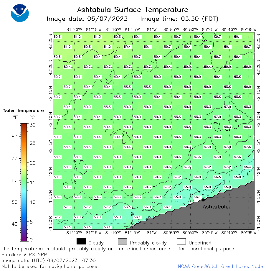
| Dataset Title: | Lake Erie Ashtabula Surface Temperature Contour Map (2022-present)


|
| Institution: | CoastWatch Great Lakes Node (Dataset ID: LE_NRT_TC_e22) |
| Information: | Summary
| License
| Metadata
| Background | Subset
| Data Access Form
| Make a graph
| Subset
| Data Access Form
| Make a graph
|
![[ICO]](https://apps.glerl.noaa.gov/erddap/images/fileIcons/blank.gif) | Name | Last modified | Size | Description |
|---|---|---|---|---|
![[DIR]](https://apps.glerl.noaa.gov/erddap/images/fileIcons/back.gif) | Parent Directory | - | - | |
![[IMG]](https://apps.glerl.noaa.gov/erddap/images/fileIcons/image2.gif)  | e22_2023_06_07_0130.png | 07-Jun-2023 05:36 | 36751 | |
 | e22_2023_06_07_0220.png | 07-Jun-2023 05:43 | 46706 | |
 | e22_2023_06_07_0310.png | 07-Jun-2023 05:51 | 34909 | |
 | e22_2023_06_07_0640.png | 07-Jun-2023 09:33 | 38188 | |
 | e22_2023_06_07_0730.png | 07-Jun-2023 11:35 | 38996 | |
 | e22_2023_06_07_0820.png | 07-Jun-2023 11:42 | 43156 | |
 | e22_2023_06_07_1430.png | 07-Jun-2023 17:32 | 33842 | |
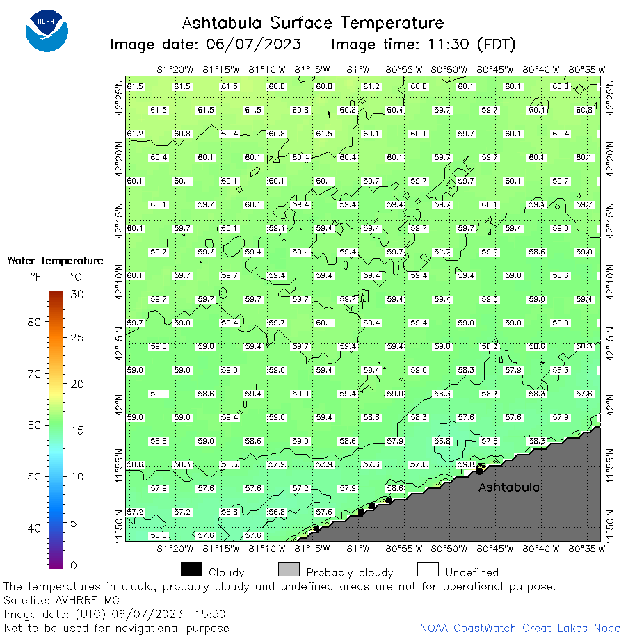 | e22_2023_06_07_1530.png | 07-Jun-2023 19:38 | 41419 | |
 | e22_2023_06_07_1610.png | 07-Jun-2023 19:45 | 35740 | |
 | e22_2023_06_07_1710.png | 07-Jun-2023 20:45 | 22902 | |
 | e22_2023_06_07_1720.png | 07-Jun-2023 21:38 | 31118 | |
 | e22_2023_06_07_1800.png | 07-Jun-2023 19:51 | 38551 | |
 | e22_2023_06_07_1900.png | 07-Jun-2023 21:49 | 32873 | |
 | e22_2023_158.png | 08-Jun-2023 10:13 | 30178 | |