
Easier access to scientific data

Brought to you by NOAA CoastWatch Great Lakes Node
|
ERDDAP
Easier access to scientific data |
|
Brought to you by NOAA CoastWatch Great Lakes Node |
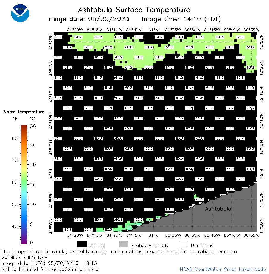
| Dataset Title: | Lake Erie Ashtabula Surface Temperature Contour Map (2022-present)


|
| Institution: | CoastWatch Great Lakes Node (Dataset ID: LE_NRT_TC_e22) |
| Information: | Summary
| License
| Metadata
| Background | Subset
| Data Access Form
| Make a graph
| Subset
| Data Access Form
| Make a graph
|
![[ICO]](https://apps.glerl.noaa.gov/erddap/images/fileIcons/blank.gif) | Name | Last modified | Size | Description |
|---|---|---|---|---|
![[DIR]](https://apps.glerl.noaa.gov/erddap/images/fileIcons/back.gif) | Parent Directory | - | - | |
![[IMG]](https://apps.glerl.noaa.gov/erddap/images/fileIcons/image2.gif)  | e22_2023_05_30_0140.png | 30-May-2023 05:46 | 23670 | |
 | e22_2023_05_30_0230.png | 30-May-2023 05:56 | 22856 | |
 | e22_2023_05_30_0320.png | 30-May-2023 06:10 | 22444 | |
 | e22_2023_05_30_0640.png | 30-May-2023 10:35 | 41483 | |
 | e22_2023_05_30_0730.png | 30-May-2023 10:42 | 40799 | |
 | e22_2023_05_30_0820.png | 30-May-2023 12:35 | 47327 | |
 | e22_2023_05_30_1450.png | 30-May-2023 17:37 | 22182 | |
 | e22_2023_05_30_1540.png | 30-May-2023 18:33 | 22303 | |
 | e22_2023_05_30_1630.png | 30-May-2023 19:35 | 22390 | |
 | e22_2023_05_30_1710.png | 30-May-2023 19:41 | 24307 | |
 | e22_2023_05_30_1810.png | 30-May-2023 21:35 | 24814 | |
 | e22_2023_05_30_1850.png | 30-May-2023 20:38 | 22107 | |
 | e22_2023_150.png | 31-May-2023 10:14 | 31571 | |