
Easier access to scientific data

Brought to you by NOAA CoastWatch Great Lakes Node
|
ERDDAP
Easier access to scientific data |
|
Brought to you by NOAA CoastWatch Great Lakes Node |
| Dataset Title: | Lake Erie Ashtabula Surface Temperature Contour Map (2022-present)


|
| Institution: | CoastWatch Great Lakes Node (Dataset ID: LE_NRT_TC_e22) |
| Information: | Summary
| License
| Metadata
| Background | Subset
| Data Access Form
| Make a graph
| Subset
| Data Access Form
| Make a graph
|
![[ICO]](https://apps.glerl.noaa.gov/erddap/images/fileIcons/blank.gif) | Name | Last modified | Size | Description |
|---|---|---|---|---|
![[DIR]](https://apps.glerl.noaa.gov/erddap/images/fileIcons/back.gif) | Parent Directory | - | - | |
![[IMG]](https://apps.glerl.noaa.gov/erddap/images/fileIcons/image2.gif) 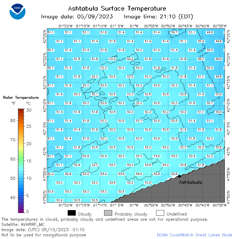 | e22_2023_05_10_0110.png | 10-May-2023 05:35 | 38199 | |
 | e22_2023_05_10_0200.png | 10-May-2023 05:42 | 59894 | |
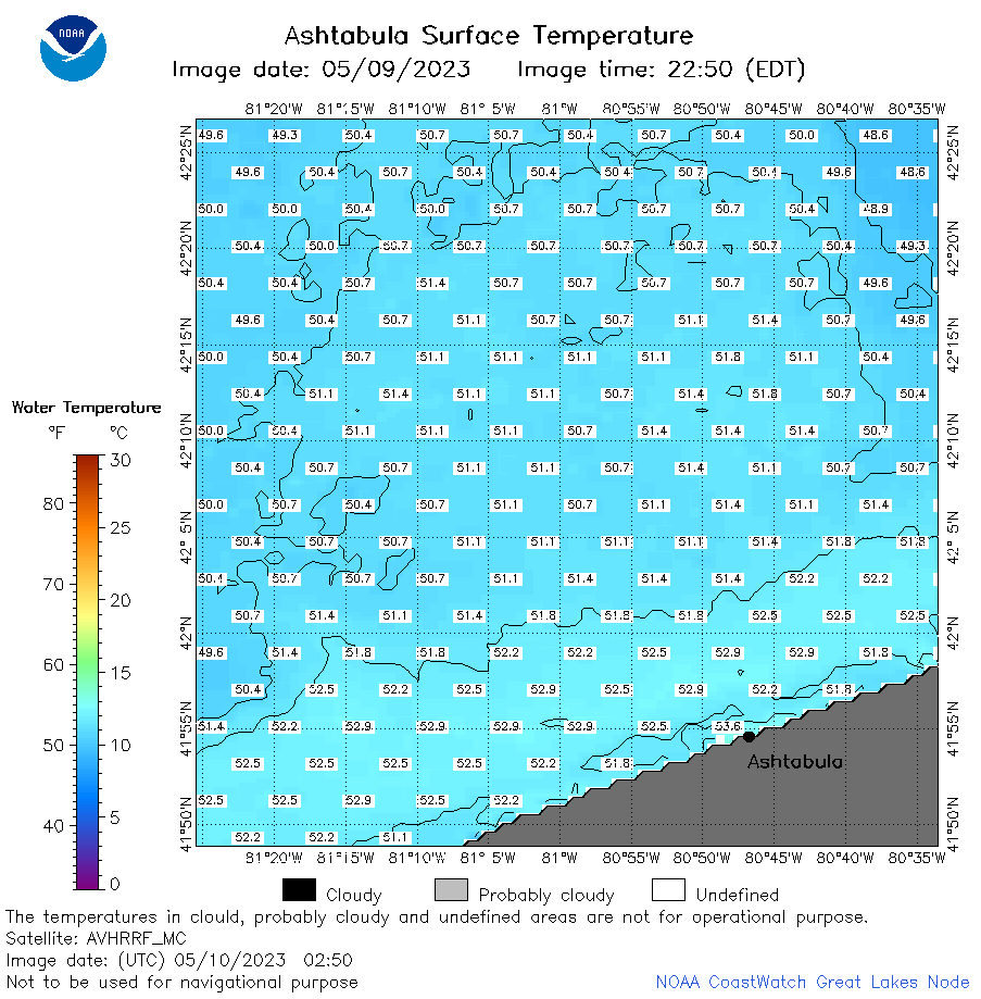 | e22_2023_05_10_0250.png | 10-May-2023 05:49 | 40641 | |
 | e22_2023_05_10_0620.png | 10-May-2023 10:39 | 50504 | |
 | e22_2023_05_10_0710.png | 10-May-2023 10:50 | 43024 | |
 | e22_2023_05_10_0800.png | 10-May-2023 11:01 | 46927 | |
 | e22_2023_05_10_1410.png | 10-May-2023 17:30 | 23754 | |
 | e22_2023_05_10_1510.png | 10-May-2023 19:42 | 46916 | |
 | e22_2023_05_10_1550.png | 10-May-2023 19:48 | 32661 | |
 | e22_2023_130.png | 11-May-2023 10:14 | 30433 | |