
Easier access to scientific data

Brought to you by NOAA CoastWatch Great Lakes Node
|
ERDDAP
Easier access to scientific data |
|
Brought to you by NOAA CoastWatch Great Lakes Node |
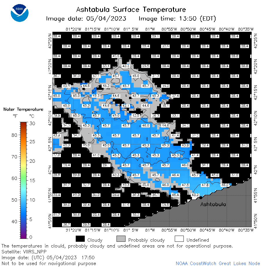
| Dataset Title: | Lake Erie Ashtabula Surface Temperature Contour Map (2022-present)


|
| Institution: | CoastWatch Great Lakes Node (Dataset ID: LE_NRT_TC_e22) |
| Information: | Summary
| License
| Metadata
| Background | Subset
| Data Access Form
| Make a graph
| Subset
| Data Access Form
| Make a graph
|
![[ICO]](https://apps.glerl.noaa.gov/erddap/images/fileIcons/blank.gif) | Name | Last modified | Size | Description |
|---|---|---|---|---|
![[DIR]](https://apps.glerl.noaa.gov/erddap/images/fileIcons/back.gif) | Parent Directory | - | - | |
![[IMG]](https://apps.glerl.noaa.gov/erddap/images/fileIcons/image2.gif)  | e22_2023_05_04_0130.png | 04-May-2023 17:32 | 20431 | |
 | e22_2023_05_04_0220.png | 04-May-2023 17:43 | 20930 | |
 | e22_2023_05_04_0310.png | 04-May-2023 17:50 | 24235 | |
 | e22_2023_05_04_0630.png | 04-May-2023 10:34 | 27397 | |
 | e22_2023_05_04_0720.png | 04-May-2023 10:40 | 39589 | |
 | e22_2023_05_04_0810.png | 04-May-2023 11:32 | 42111 | |
 | e22_2023_05_04_1440.png | 04-May-2023 19:32 | 19824 | |
 | e22_2023_05_04_1530.png | 04-May-2023 19:38 | 20218 | |
 | e22_2023_05_04_1620.png | 04-May-2023 19:49 | 20497 | |
 | e22_2023_05_04_1700.png | 04-May-2023 18:37 | 20825 | |
 | e22_2023_05_04_1750.png | 04-May-2023 19:56 | 35895 | |
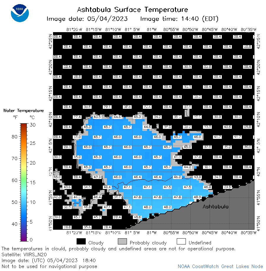 | e22_2023_05_04_1840.png | 04-May-2023 20:45 | 29155 | |
 | e22_2023_124.png | 05-May-2023 10:11 | 33250 | |