
Easier access to scientific data

Brought to you by NOAA CoastWatch Great Lakes Node
|
ERDDAP
Easier access to scientific data |
|
Brought to you by NOAA CoastWatch Great Lakes Node |
| Dataset Title: | Lake Erie Ashtabula Surface Temperature Contour Map (2022-present)


|
| Institution: | CoastWatch Great Lakes Node (Dataset ID: LE_NRT_TC_e22) |
| Information: | Summary
| License
| Metadata
| Background | Subset
| Data Access Form
| Make a graph
| Subset
| Data Access Form
| Make a graph
|
![[ICO]](https://apps.glerl.noaa.gov/erddap/images/fileIcons/blank.gif) | Name | Last modified | Size | Description |
|---|---|---|---|---|
![[DIR]](https://apps.glerl.noaa.gov/erddap/images/fileIcons/back.gif) | Parent Directory | - | - | |
![[IMG]](https://apps.glerl.noaa.gov/erddap/images/fileIcons/image2.gif)  | e22_2023_04_20_0120.png | 20-Apr-2023 05:36 | 28324 | |
 | e22_2023_04_20_0210.png | 20-Apr-2023 05:47 | 33512 | |
 | e22_2023_04_20_0300.png | 20-Apr-2023 05:54 | 22213 | |
 | e22_2023_04_20_0640.png | 20-Apr-2023 10:32 | 19929 | |
 | e22_2023_04_20_0730.png | 20-Apr-2023 13:34 | 27356 | |
 | e22_2023_04_20_0820.png | 20-Apr-2023 10:39 | 20918 | |
 | e22_2023_04_20_1430.png | 20-Apr-2023 17:37 | 20278 | |
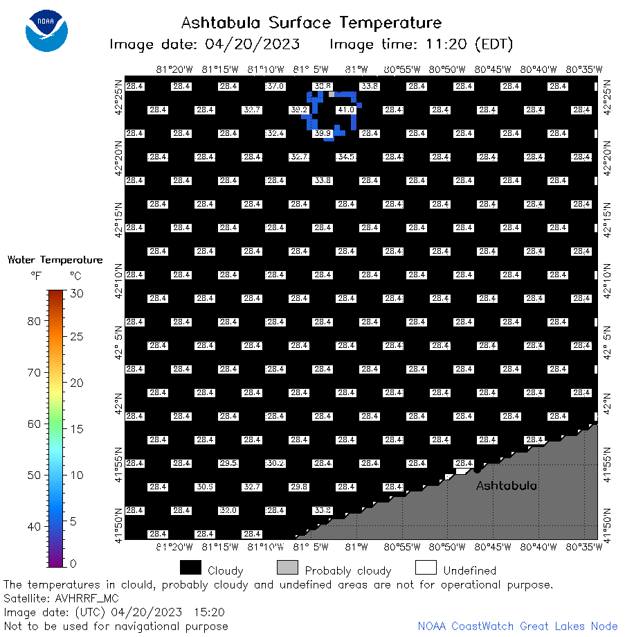 | e22_2023_04_20_1520.png | 20-Apr-2023 19:36 | 21156 | |
 | e22_2023_04_20_1610.png | 20-Apr-2023 19:47 | 19775 | |
 | e22_2023_04_20_1720.png | 20-Apr-2023 22:36 | 19773 | |
 | e22_2023_04_20_1800.png | 20-Apr-2023 20:39 | 23071 | |
 | e22_2023_04_20_1900.png | 20-Apr-2023 21:34 | 32081 | |
 | e22_2023_110.png | 21-Apr-2023 10:12 | 30568 | |