
Easier access to scientific data

Brought to you by NOAA CoastWatch Great Lakes Node
|
ERDDAP
Easier access to scientific data |
|
Brought to you by NOAA CoastWatch Great Lakes Node |
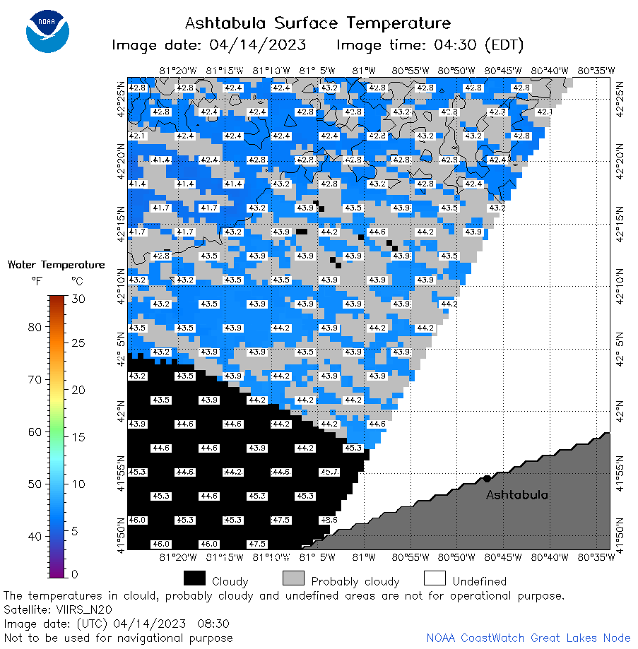
| Dataset Title: | Lake Erie Ashtabula Surface Temperature Contour Map (2022-present)


|
| Institution: | CoastWatch Great Lakes Node (Dataset ID: LE_NRT_TC_e22) |
| Information: | Summary
| License
| Metadata
| Background | Subset
| Data Access Form
| Make a graph
| Subset
| Data Access Form
| Make a graph
|
![[ICO]](https://apps.glerl.noaa.gov/erddap/images/fileIcons/blank.gif) | Name | Last modified | Size | Description |
|---|---|---|---|---|
![[DIR]](https://apps.glerl.noaa.gov/erddap/images/fileIcons/back.gif) | Parent Directory | - | - | |
![[IMG]](https://apps.glerl.noaa.gov/erddap/images/fileIcons/image2.gif)  | e22_2023_04_14_0150.png | 14-Apr-2023 05:44 | 22735 | |
 | e22_2023_04_14_0230.png | 14-Apr-2023 05:51 | 23802 | |
 | e22_2023_04_14_0330.png | 14-Apr-2023 06:04 | 23619 | |
 | e22_2023_04_14_0600.png | 14-Apr-2023 09:30 | 27435 | |
 | e22_2023_04_14_0650.png | 14-Apr-2023 09:38 | 34924 | |
 | e22_2023_04_14_0740.png | 14-Apr-2023 10:31 | 29389 | |
 | e22_2023_04_14_0750.png | 14-Apr-2023 10:37 | 28352 | |
 | e22_2023_04_14_0830.png | 14-Apr-2023 10:44 | 33952 | |
 | e22_2023_04_14_1450.png | 14-Apr-2023 17:37 | 28064 | |
 | e22_2023_04_14_1540.png | 14-Apr-2023 18:32 | 28811 | |
 | e22_2023_04_14_1630.png | 14-Apr-2023 18:39 | 26509 | |
 | e22_2023_04_14_1730.png | 14-Apr-2023 19:35 | 31372 | |
 | e22_2023_04_14_1820.png | 14-Apr-2023 20:38 | 26049 | |
 | e22_2023_04_14_1910.png | 14-Apr-2023 21:35 | 20276 | |
 | e22_2023_104.png | 15-Apr-2023 10:13 | 28658 | |