
Easier access to scientific data

Brought to you by NOAA CoastWatch Great Lakes Node
|
ERDDAP
Easier access to scientific data |
|
Brought to you by NOAA CoastWatch Great Lakes Node |
| Dataset Title: | Lake Erie Ashtabula Surface Temperature Contour Map (2022-present)


|
| Institution: | CoastWatch Great Lakes Node (Dataset ID: LE_NRT_TC_e22) |
| Information: | Summary
| License
| Metadata
| Background | Subset
| Data Access Form
| Make a graph
| Subset
| Data Access Form
| Make a graph
|
![[ICO]](https://apps.glerl.noaa.gov/erddap/images/fileIcons/blank.gif) | Name | Last modified | Size | Description |
|---|---|---|---|---|
![[DIR]](https://apps.glerl.noaa.gov/erddap/images/fileIcons/back.gif) | Parent Directory | - | - | |
![[IMG]](https://apps.glerl.noaa.gov/erddap/images/fileIcons/image2.gif)  | e22_2023_04_11_0110.png | 11-Apr-2023 05:36 | 24423 | |
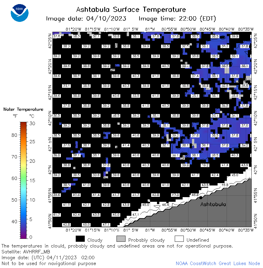 | e22_2023_04_11_0200.png | 11-Apr-2023 05:43 | 31326 | |
 | e22_2023_04_11_0250.png | 11-Apr-2023 05:50 | 24577 | |
 | e22_2023_04_11_0610.png | 11-Apr-2023 09:30 | 36155 | |
 | e22_2023_04_11_0700.png | 11-Apr-2023 09:37 | 38521 | |
 | e22_2023_04_11_0750.png | 11-Apr-2023 10:32 | 44240 | |
 | e22_2023_04_11_1410.png | 11-Apr-2023 17:30 | 26067 | |
 | e22_2023_04_11_1510.png | 11-Apr-2023 18:37 | 29024 | |
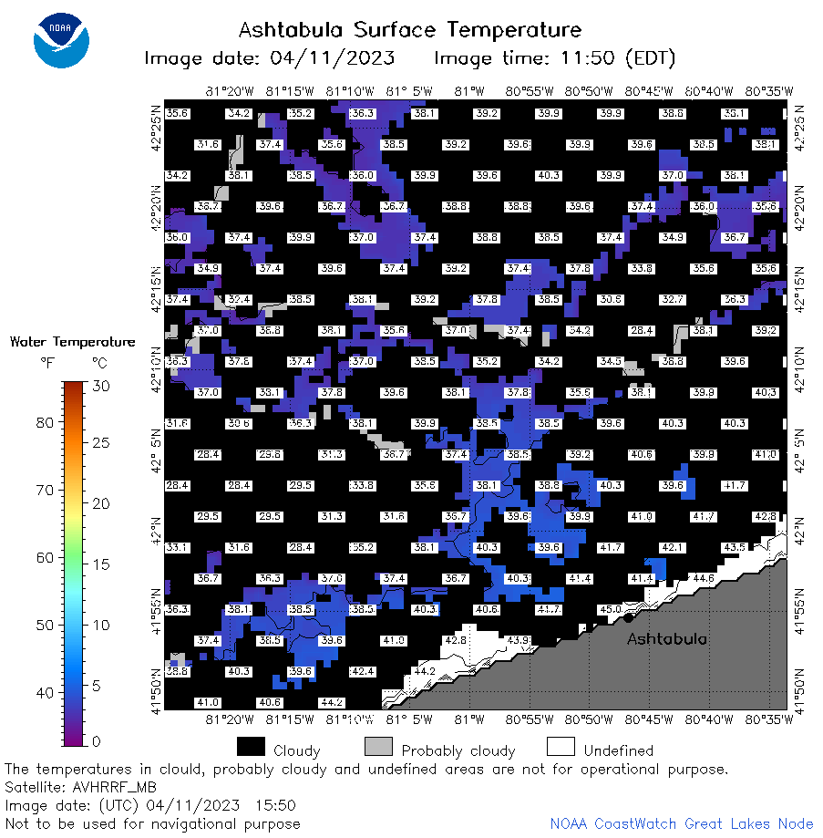 | e22_2023_04_11_1550.png | 11-Apr-2023 17:37 | 34470 | |
 | e22_2023_04_11_1730.png | 11-Apr-2023 19:39 | 23175 | |
 | e22_2023_04_11_1820.png | 11-Apr-2023 20:46 | 30255 | |
 | e22_2023_04_11_1910.png | 11-Apr-2023 21:38 | 21644 | |
 | e22_2023_101.png | 12-Apr-2023 10:13 | 31809 | |