
Easier access to scientific data

Brought to you by NOAA CoastWatch Great Lakes Node
|
ERDDAP
Easier access to scientific data |
|
Brought to you by NOAA CoastWatch Great Lakes Node |
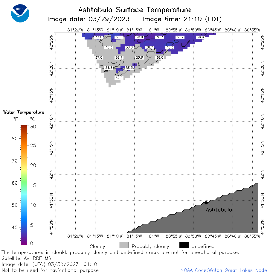
| Dataset Title: | Lake Erie Ashtabula Surface Temperature Contour Map (2022-present)


|
| Institution: | CoastWatch Great Lakes Node (Dataset ID: LE_NRT_TC_e22) |
| Information: | Summary
| License
| Metadata
| Background | Subset
| Data Access Form
| Make a graph
| Subset
| Data Access Form
| Make a graph
|
![[ICO]](https://apps.glerl.noaa.gov/erddap/images/fileIcons/blank.gif) | Name | Last modified | Size | Description |
|---|---|---|---|---|
![[DIR]](https://apps.glerl.noaa.gov/erddap/images/fileIcons/back.gif) | Parent Directory | - | - | |
![[IMG]](https://apps.glerl.noaa.gov/erddap/images/fileIcons/image2.gif)  | e22_2023_03_30_0100.png | 30-Mar-2023 05:39 | 36210 | |
 | e22_2023_03_30_0110.png | 30-Mar-2023 05:44 | 21157 | |
 | e22_2023_03_30_0200.png | 30-Mar-2023 05:50 | 51981 | |
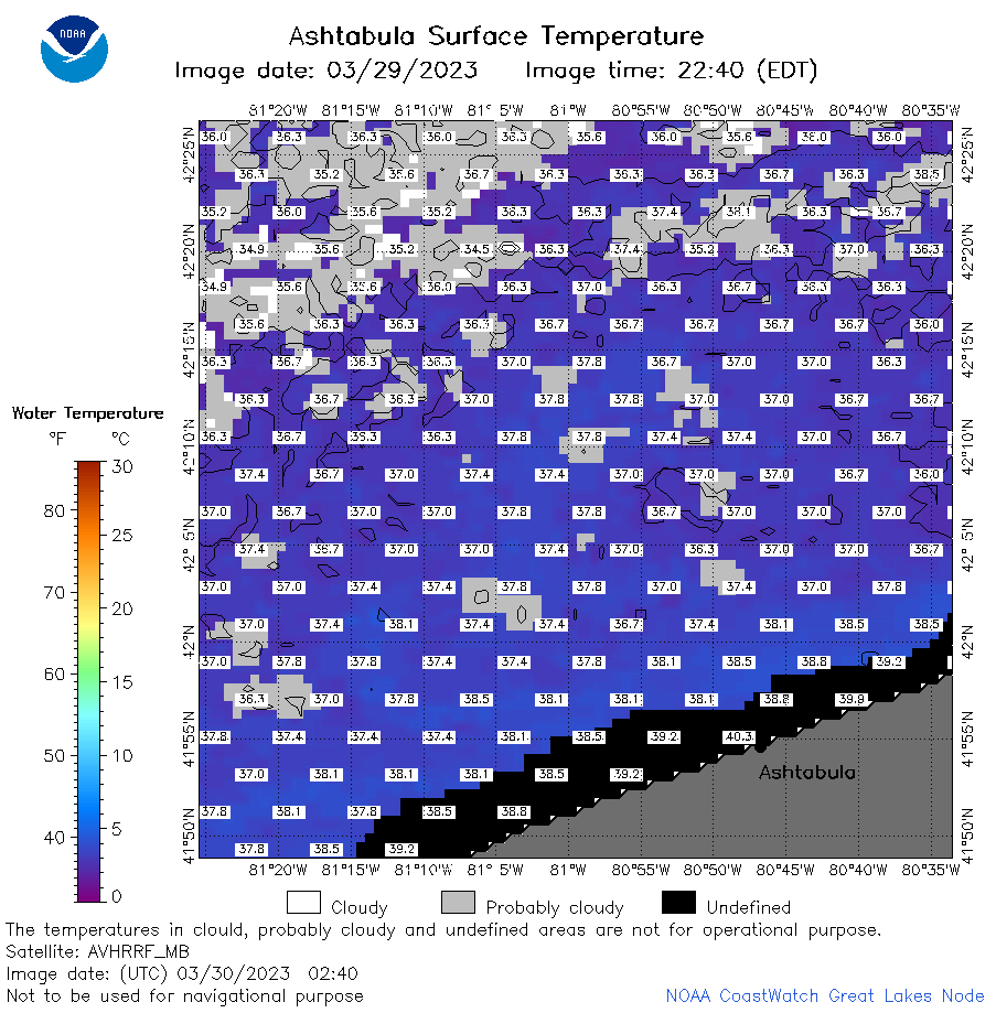 | e22_2023_03_30_0240.png | 30-Mar-2023 05:56 | 50302 | |
 | e22_2023_03_30_0630.png | 30-Mar-2023 10:32 | 40621 | |
 | e22_2023_03_30_0730.png | 30-Mar-2023 11:36 | 35531 | |
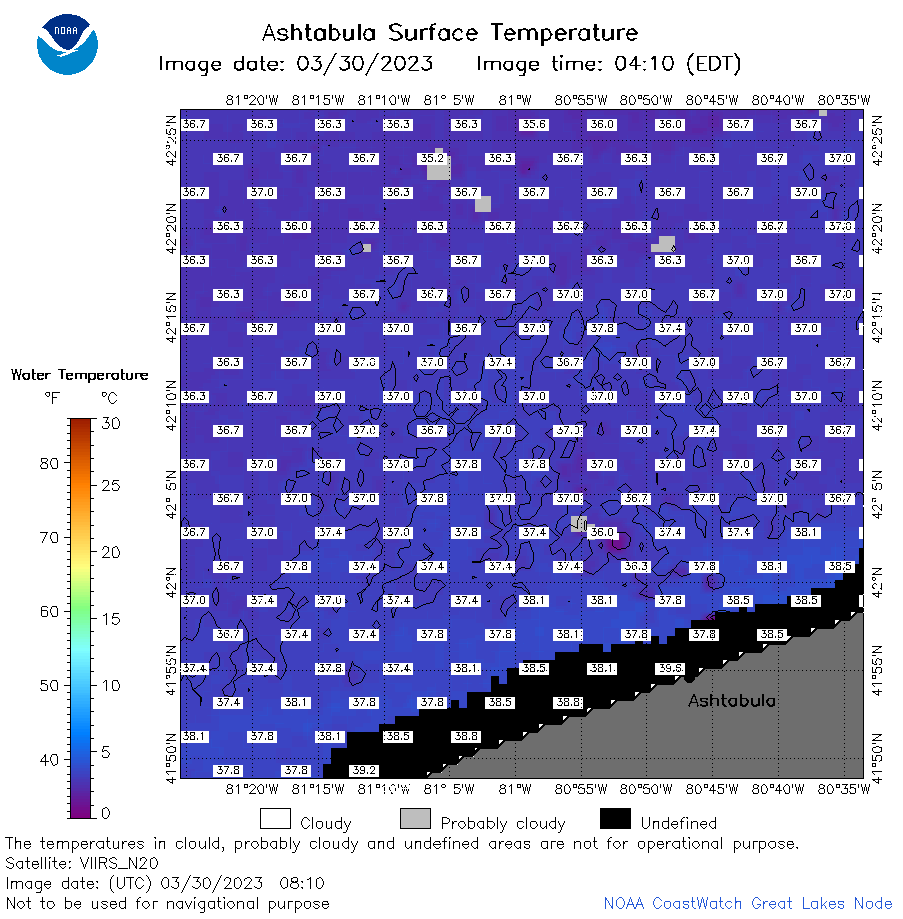 | e22_2023_03_30_0810.png | 30-Mar-2023 10:44 | 49726 | |
 | e22_2023_03_30_1410.png | 30-Mar-2023 18:30 | 31147 | |
 | e22_2023_03_30_1500.png | 30-Mar-2023 18:37 | 41696 | |
 | e22_2023_03_30_1550.png | 30-Mar-2023 19:34 | 38041 | |
 | e22_2023_03_30_1710.png | 30-Mar-2023 19:40 | 43102 | |
 | e22_2023_03_30_1800.png | 30-Mar-2023 20:39 | 31118 | |
 | e22_2023_03_30_1850.png | 30-Mar-2023 21:34 | 33545 | |