
Easier access to scientific data

Brought to you by NOAA CoastWatch Great Lakes Node
|
ERDDAP
Easier access to scientific data |
|
Brought to you by NOAA CoastWatch Great Lakes Node |
| Dataset Title: | Lake Erie Ashtabula Surface Temperature Contour Map (2022-present)


|
| Institution: | CoastWatch Great Lakes Node (Dataset ID: LE_NRT_TC_e22) |
| Information: | Summary
| License
| Metadata
| Background | Subset
| Data Access Form
| Make a graph
| Subset
| Data Access Form
| Make a graph
|
![[ICO]](https://apps.glerl.noaa.gov/erddap/images/fileIcons/blank.gif) | Name | Last modified | Size | Description |
|---|---|---|---|---|
![[DIR]](https://apps.glerl.noaa.gov/erddap/images/fileIcons/back.gif) | Parent Directory | - | - | |
![[IMG]](https://apps.glerl.noaa.gov/erddap/images/fileIcons/image2.gif)  | e22_2023_03_29_0130.png | 29-Mar-2023 05:43 | 61043 | |
 | e22_2023_03_29_0220.png | 29-Mar-2023 05:50 | 48225 | |
 | e22_2023_03_29_0310.png | 29-Mar-2023 05:56 | 53401 | |
 | e22_2023_03_29_0600.png | 29-Mar-2023 10:32 | 39281 | |
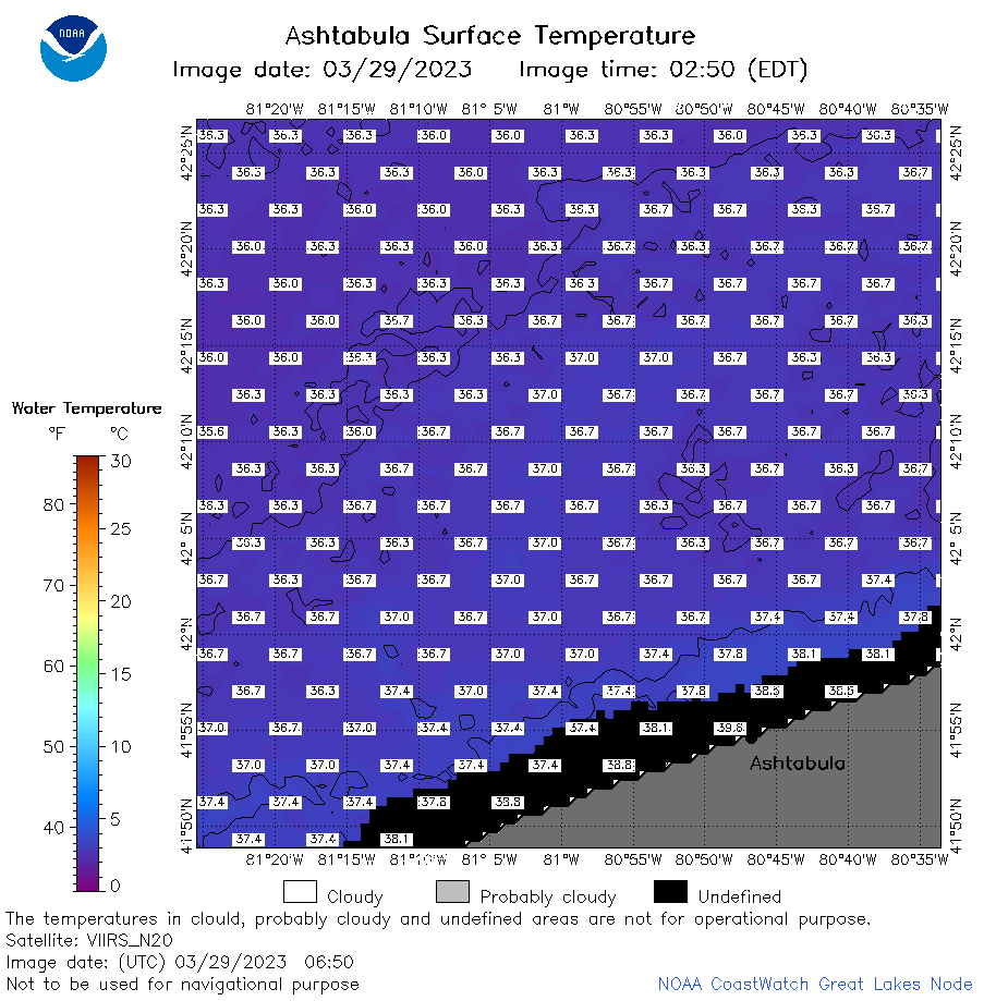 | e22_2023_03_29_0650.png | 29-Mar-2023 10:39 | 40580 | |
 | e22_2023_03_29_0740.png | 29-Mar-2023 10:45 | 41098 | |
 | e22_2023_03_29_0830.png | 29-Mar-2023 11:34 | 43784 | |
 | e22_2023_03_29_1430.png | 29-Mar-2023 18:34 | 20282 | |
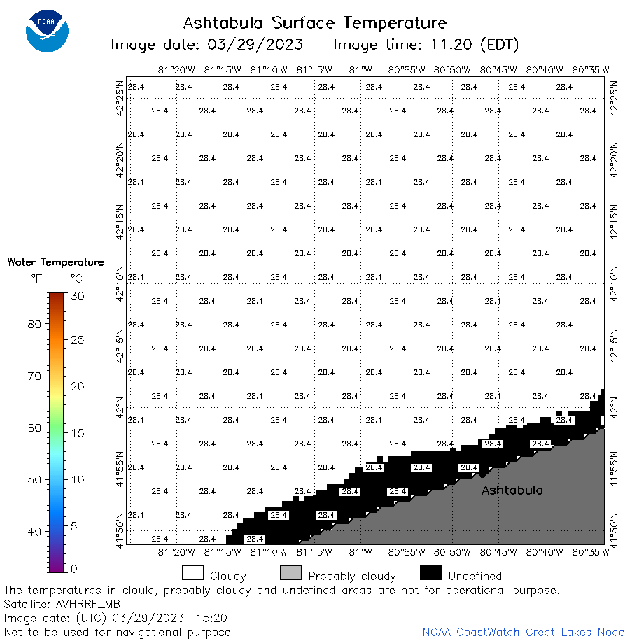 | e22_2023_03_29_1520.png | 29-Mar-2023 18:41 | 20311 | |
 | e22_2023_03_29_1610.png | 29-Mar-2023 20:38 | 20400 | |
 | e22_2023_03_29_1730.png | 29-Mar-2023 20:55 | 20301 | |
 | e22_2023_03_29_1820.png | 29-Mar-2023 21:02 | 20258 | |
 | e22_2023_03_29_1910.png | 29-Mar-2023 23:32 | 20247 | |
 | e22_2023_088.png | 30-Mar-2023 10:12 | 27363 | |