
Easier access to scientific data

Brought to you by NOAA CoastWatch Great Lakes Node
|
ERDDAP
Easier access to scientific data |
|
Brought to you by NOAA CoastWatch Great Lakes Node |
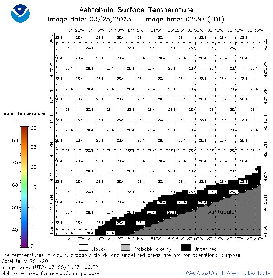
| Dataset Title: | Lake Erie Ashtabula Surface Temperature Contour Map (2022-present)


|
| Institution: | CoastWatch Great Lakes Node (Dataset ID: LE_NRT_TC_e22) |
| Information: | Summary
| License
| Metadata
| Background | Subset
| Data Access Form
| Make a graph
| Subset
| Data Access Form
| Make a graph
|
![[ICO]](https://apps.glerl.noaa.gov/erddap/images/fileIcons/blank.gif) | Name | Last modified | Size | Description |
|---|---|---|---|---|
![[DIR]](https://apps.glerl.noaa.gov/erddap/images/fileIcons/back.gif) | Parent Directory | - | - | |
![[IMG]](https://apps.glerl.noaa.gov/erddap/images/fileIcons/image2.gif)  | e22_2023_03_25_0110.png | 25-Mar-2023 05:35 | 20334 | |
 | e22_2023_03_25_0200.png | 25-Mar-2023 05:42 | 20572 | |
 | e22_2023_03_25_0250.png | 25-Mar-2023 05:49 | 26940 | |
 | e22_2023_03_25_0630.png | 25-Mar-2023 10:32 | 20321 | |
 | e22_2023_03_25_0720.png | 25-Mar-2023 10:38 | 20226 | |
 | e22_2023_03_25_0810.png | 25-Mar-2023 10:45 | 20305 | |
 | e22_2023_03_25_1420.png | 25-Mar-2023 18:41 | 25258 | |
 | e22_2023_03_25_1500.png | 25-Mar-2023 18:48 | 33276 | |
 | e22_2023_03_25_1600.png | 25-Mar-2023 19:40 | 24095 | |
 | e22_2023_03_25_1700.png | 25-Mar-2023 19:09 | 25624 | |
 | e22_2023_03_25_1750.png | 25-Mar-2023 19:47 | 40678 | |
 | e22_2023_03_25_1840.png | 25-Mar-2023 21:33 | 28402 | |
 | e22_2023_084.png | 26-Mar-2023 10:13 | 29983 | |