
Easier access to scientific data

Brought to you by NOAA CoastWatch Great Lakes Node
|
ERDDAP
Easier access to scientific data |
|
Brought to you by NOAA CoastWatch Great Lakes Node |
| Dataset Title: | Lake Erie Ashtabula Surface Temperature Contour Map (2022-present)


|
| Institution: | CoastWatch Great Lakes Node (Dataset ID: LE_NRT_TC_e22) |
| Information: | Summary
| License
| Metadata
| Background | Subset
| Data Access Form
| Make a graph
| Subset
| Data Access Form
| Make a graph
|
![[ICO]](https://apps.glerl.noaa.gov/erddap/images/fileIcons/blank.gif) | Name | Last modified | Size | Description |
|---|---|---|---|---|
![[DIR]](https://apps.glerl.noaa.gov/erddap/images/fileIcons/back.gif) | Parent Directory | - | - | |
![[IMG]](https://apps.glerl.noaa.gov/erddap/images/fileIcons/image2.gif) 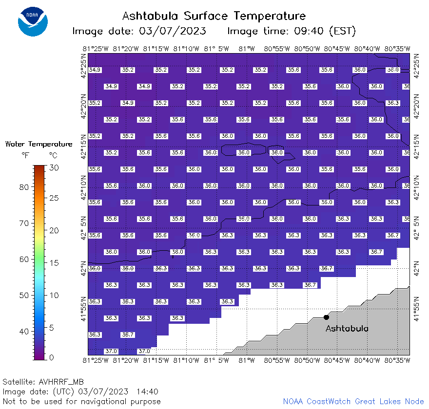 | e22_2023_03_07_1440.png | 07-Mar-2023 17:27 | 23795 | |
 | e22_2023_03_07_1530.png | 07-Mar-2023 19:28 | 24431 | |
 | e22_2023_03_07_1620.png | 07-Mar-2023 19:32 | 23340 | |
 | e22_2023_03_07_1740.png | 07-Mar-2023 19:36 | 24016 | |
 | e22_2023_03_07_1830.png | 07-Mar-2023 20:30 | 23989 | |
 | e22_2023_03_07_1920.png | 07-Mar-2023 21:28 | 26760 | |