
Easier access to scientific data

Brought to you by NOAA CoastWatch Great Lakes Node
|
ERDDAP
Easier access to scientific data |
|
Brought to you by NOAA CoastWatch Great Lakes Node |
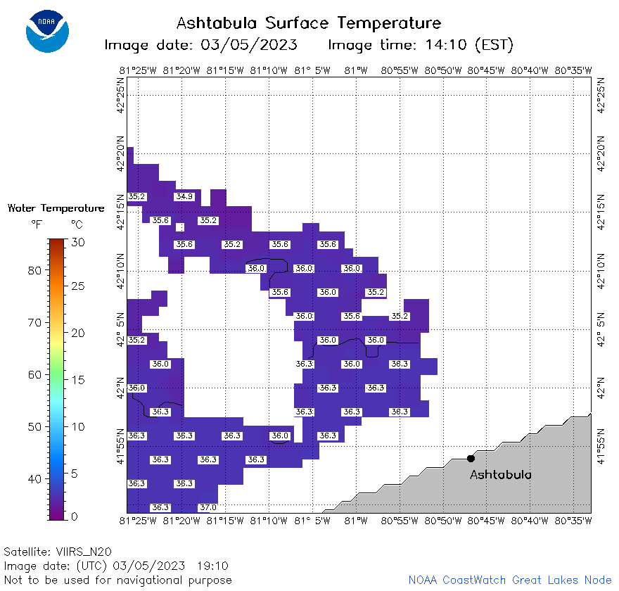
| Dataset Title: | Lake Erie Ashtabula Surface Temperature Contour Map (2022-present)


|
| Institution: | CoastWatch Great Lakes Node (Dataset ID: LE_NRT_TC_e22) |
| Information: | Summary
| License
| Metadata
| Background | Subset
| Data Access Form
| Make a graph
| Subset
| Data Access Form
| Make a graph
|
![[ICO]](https://apps.glerl.noaa.gov/erddap/images/fileIcons/blank.gif) | Name | Last modified | Size | Description |
|---|---|---|---|---|
![[DIR]](https://apps.glerl.noaa.gov/erddap/images/fileIcons/back.gif) | Parent Directory | - | - | |
![[IMG]](https://apps.glerl.noaa.gov/erddap/images/fileIcons/image2.gif) 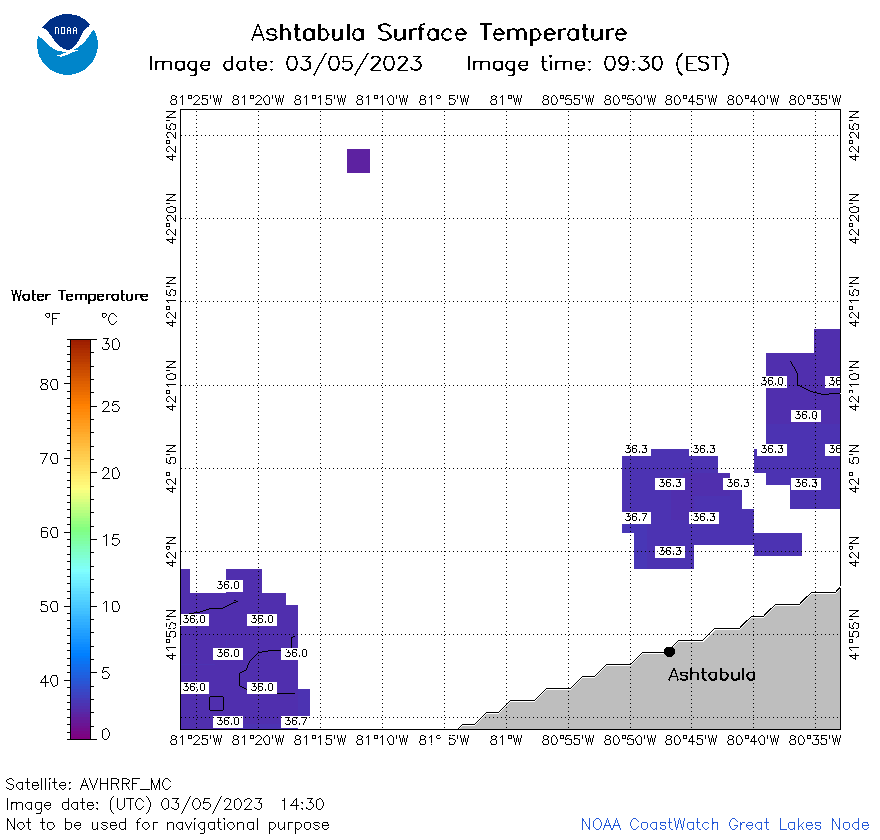 | e22_2023_03_05_1430.png | 05-Mar-2023 18:28 | 17036 | |
 | e22_2023_03_05_1520.png | 05-Mar-2023 18:31 | 15927 | |
 | e22_2023_03_05_1610.png | 05-Mar-2023 20:29 | 18007 | |
 | e22_2023_03_05_1730.png | 05-Mar-2023 20:36 | 20762 | |
 | e22_2023_03_05_1820.png | 05-Mar-2023 20:39 | 21495 | |
 | e22_2023_03_05_1910.png | 05-Mar-2023 21:28 | 19527 | |
 | e22_2023_064.png | 06-Mar-2023 11:12 | 26711 | |