
Easier access to scientific data

Brought to you by NOAA CoastWatch Great Lakes Node
|
ERDDAP
Easier access to scientific data |
|
Brought to you by NOAA CoastWatch Great Lakes Node |
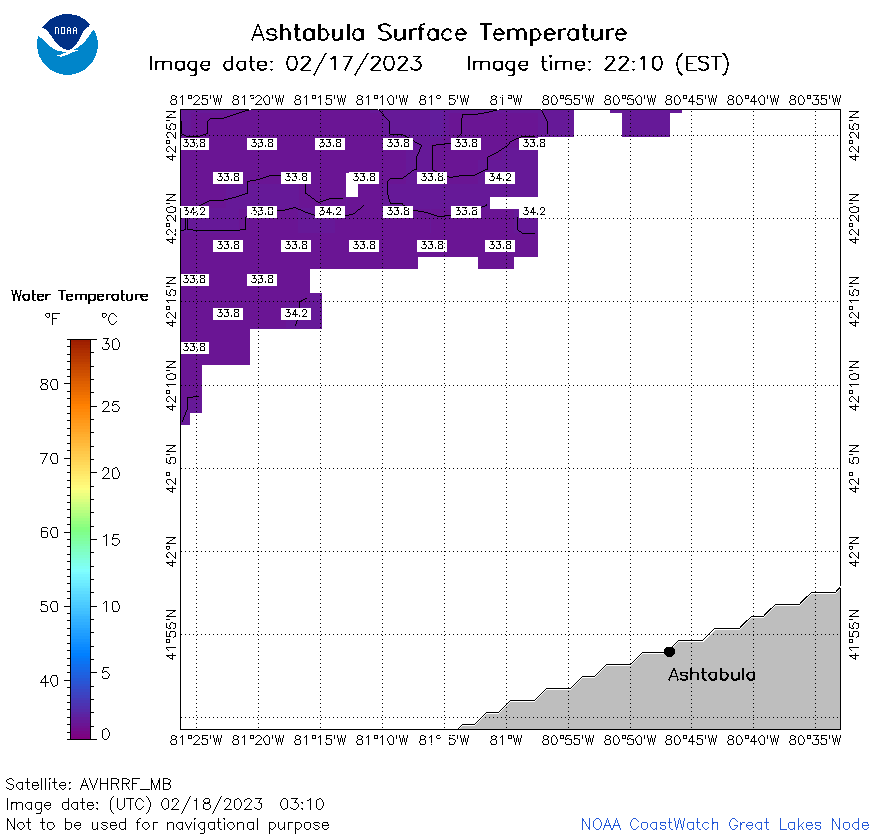
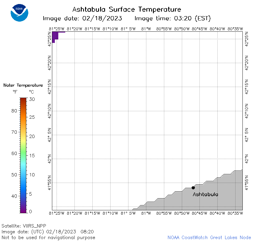
| Dataset Title: | Lake Erie Ashtabula Surface Temperature Contour Map (2022-present)


|
| Institution: | CoastWatch Great Lakes Node (Dataset ID: LE_NRT_TC_e22) |
| Information: | Summary
| License
| Metadata
| Background | Subset
| Data Access Form
| Make a graph
| Subset
| Data Access Form
| Make a graph
|
![[ICO]](https://apps.glerl.noaa.gov/erddap/images/fileIcons/blank.gif) | Name | Last modified | Size | Description |
|---|---|---|---|---|
![[DIR]](https://apps.glerl.noaa.gov/erddap/images/fileIcons/back.gif) | Parent Directory | - | - | |
![[IMG]](https://apps.glerl.noaa.gov/erddap/images/fileIcons/image2.gif)  | e22_2023_02_18_0130.png | 18-Feb-2023 06:30 | 15729 | |
 | e22_2023_02_18_0220.png | 18-Feb-2023 06:32 | 17282 | |
 | e22_2023_02_18_0310.png | 18-Feb-2023 06:38 | 17816 | |
 | e22_2023_02_18_0630.png | 18-Feb-2023 10:29 | 15128 | |
 | e22_2023_02_18_0640.png | 18-Feb-2023 10:31 | 15062 | |
 | e22_2023_02_18_0720.png | 18-Feb-2023 10:35 | 14943 | |
 | e22_2023_02_18_0820.png | 18-Feb-2023 12:31 | 14978 | |
 | e22_2023_02_18_1530.png | 18-Feb-2023 18:27 | 17352 | |
 | e22_2023_02_18_1620.png | 18-Feb-2023 20:28 | 25431 | |
 | e22_2023_02_18_1710.png | 18-Feb-2023 20:33 | 27320 | |
 | e22_2023_02_18_1800.png | 18-Feb-2023 20:36 | 28124 | |
 | e22_2023_02_18_1850.png | 18-Feb-2023 20:38 | 24465 | |
 | e22_2023_049.png | 19-Feb-2023 11:12 | 25859 | |