
Easier access to scientific data

Brought to you by NOAA CoastWatch Great Lakes Node
|
ERDDAP
Easier access to scientific data |
|
Brought to you by NOAA CoastWatch Great Lakes Node |
| Dataset Title: | Lake Erie Ashtabula Surface Temperature Contour Map (2022-present)


|
| Institution: | CoastWatch Great Lakes Node (Dataset ID: LE_NRT_TC_e22) |
| Information: | Summary
| License
| Metadata
| Background | Subset
| Data Access Form
| Make a graph
| Subset
| Data Access Form
| Make a graph
|
![[ICO]](https://apps.glerl.noaa.gov/erddap/images/fileIcons/blank.gif) | Name | Last modified | Size | Description |
|---|---|---|---|---|
![[DIR]](https://apps.glerl.noaa.gov/erddap/images/fileIcons/back.gif) | Parent Directory | - | - | |
![[IMG]](https://apps.glerl.noaa.gov/erddap/images/fileIcons/image2.gif)  | e22_2022_11_03_0150.png | 12-Dec-2022 22:18 | 20866 | |
 | e22_2022_11_03_0240.png | 12-Dec-2022 22:21 | 25885 | |
 | e22_2022_11_03_0330.png | 12-Dec-2022 22:24 | 22914 | |
 | e22_2022_11_03_0640.png | 12-Dec-2022 22:26 | 27207 | |
 | e22_2022_11_03_0730.png | 12-Dec-2022 22:30 | 26323 | |
 | e22_2022_11_03_0820.png | 12-Dec-2022 22:33 | 27629 | |
 | e22_2022_11_03_1450.png | 12-Dec-2022 22:35 | 23951 | |
 | e22_2022_11_03_1540.png | 12-Dec-2022 22:38 | 23360 | |
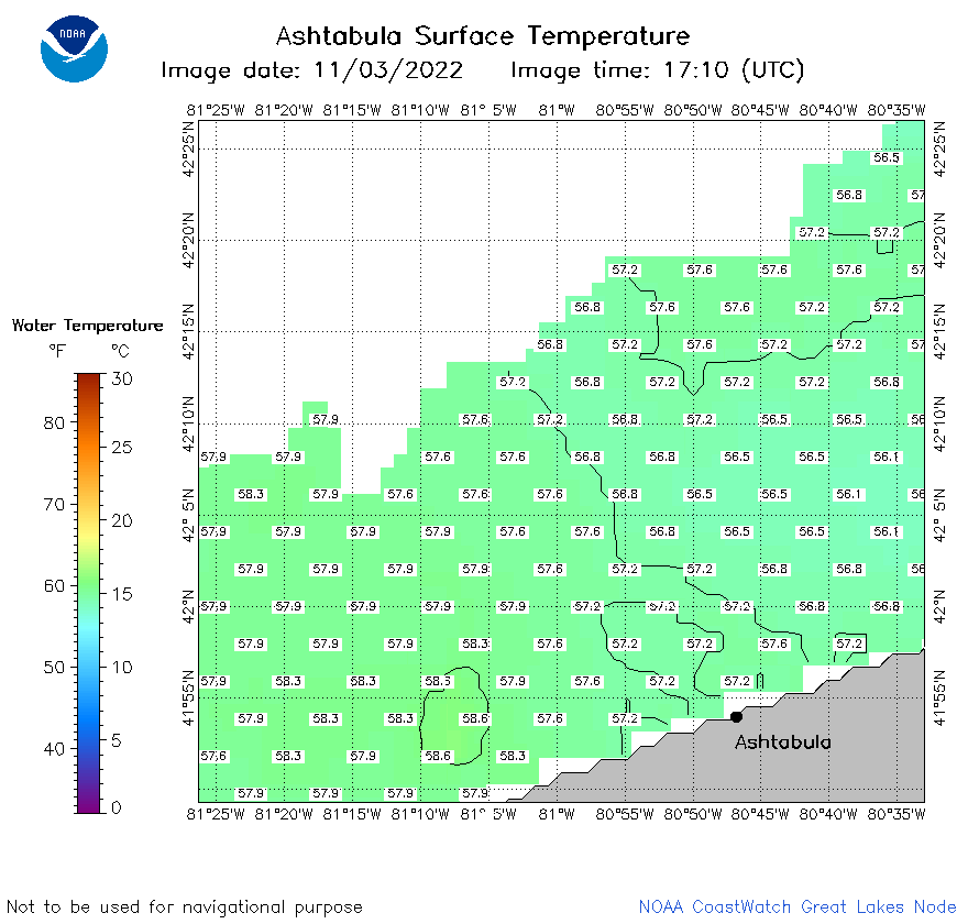 | e22_2022_11_03_1710.png | 12-Dec-2022 22:42 | 23861 | |
 | e22_2022_11_03_1800.png | 12-Dec-2022 22:45 | 26290 | |
 | e22_2022_11_03_1850.png | 12-Dec-2022 22:50 | 27974 | |
 | e22_2022_307.png | 04-Nov-2022 10:12 | 26758 | |