
Easier access to scientific data

Brought to you by CoastWatch Great Lakes Node
|
ERDDAP
Easier access to scientific data |
|
Brought to you by CoastWatch Great Lakes Node |
| Dataset Title: | Lake Erie Cleveland East Surface Temperature Contour Map (2022-present)


|
| Institution: | CoastWatch Great Lakes Node (Dataset ID: LE_NRT_TC_e21) |
| Information: | Summary
| License
| Metadata
| Background | Subset
| Data Access Form
| Make a graph
| Subset
| Data Access Form
| Make a graph
|
![[ICO]](http://apps.glerl.noaa.gov/erddap/images/fileIcons/blank.gif) | Name | Last modified | Size | Description |
|---|---|---|---|---|
![[DIR]](http://apps.glerl.noaa.gov/erddap/images/fileIcons/back.gif) | Parent Directory | - | - | |
![[IMG]](http://apps.glerl.noaa.gov/erddap/images/fileIcons/image2.gif)  | e21_2022_11_10_0150.png | 13-Dec-2022 00:50 | 24776 | |
 | e21_2022_11_10_0240.png | 13-Dec-2022 00:52 | 24573 | |
 | e21_2022_11_10_0610.png | 13-Dec-2022 00:55 | 24399 | |
 | e21_2022_11_10_0700.png | 13-Dec-2022 00:57 | 24063 | |
 | e21_2022_11_10_0750.png | 13-Dec-2022 01:00 | 24239 | |
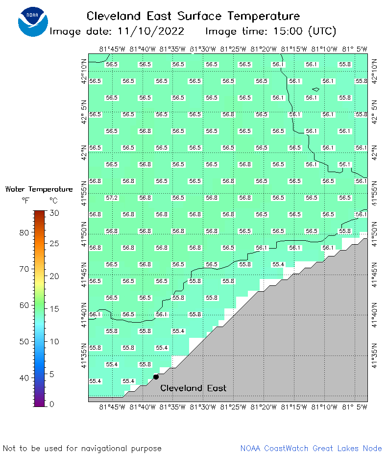 | e21_2022_11_10_1500.png | 13-Dec-2022 01:02 | 23730 | |
 | e21_2022_11_10_1550.png | 13-Dec-2022 01:04 | 24010 | |
 | e21_2022_11_10_1730.png | 13-Dec-2022 01:06 | 24184 | |
 | e21_2022_11_10_1820.png | 13-Dec-2022 01:09 | 23700 | |
 | e21_2022_11_10_1910.png | 13-Dec-2022 01:12 | 26488 | |
 | e21_2022_314.png | 11-Nov-2022 11:11 | 23884 | |