
Easier access to scientific data

Brought to you by NOAA CoastWatch Great Lakes Node
|
ERDDAP
Easier access to scientific data |
|
Brought to you by NOAA CoastWatch Great Lakes Node |
| Dataset Title: | Lake Erie Sandusky Surface Temperature Contour Map (2022-present)


|
| Institution: | CoastWatch Great Lakes Node (Dataset ID: LE_NRT_TC_e12) |
| Information: | Summary
| License
| Metadata
| Background | Subset
| Data Access Form
| Make a graph
| Subset
| Data Access Form
| Make a graph
|
![[ICO]](https://apps.glerl.noaa.gov/erddap/images/fileIcons/blank.gif) | Name | Last modified | Size | Description |
|---|---|---|---|---|
![[DIR]](https://apps.glerl.noaa.gov/erddap/images/fileIcons/back.gif) | Parent Directory | - | - | |
![[IMG]](https://apps.glerl.noaa.gov/erddap/images/fileIcons/image2.gif)  | e12_2024_09_30_0550.png | 30-Sep-2024 16:38 | 18224 | |
 | e12_2024_09_30_0640.png | 30-Sep-2024 16:41 | 18231 | |
 | e12_2024_09_30_0650.png | 30-Sep-2024 16:43 | 38385 | |
 | e12_2024_09_30_0710.png | 30-Sep-2024 16:46 | 41243 | |
 | e12_2024_09_30_0730.png | 30-Sep-2024 16:48 | 44098 | |
 | e12_2024_09_30_0740.png | 30-Sep-2024 16:51 | 19217 | |
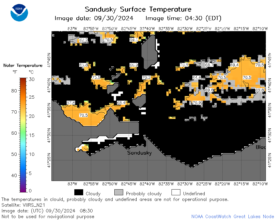 | e12_2024_09_30_0830.png | 30-Sep-2024 16:53 | 33293 | |
 | e12_2024_274.png | 01-Oct-2024 09:30 | 24778 | |