
Easier access to scientific data

Brought to you by NOAA CoastWatch Great Lakes Node
|
ERDDAP
Easier access to scientific data |
|
Brought to you by NOAA CoastWatch Great Lakes Node |
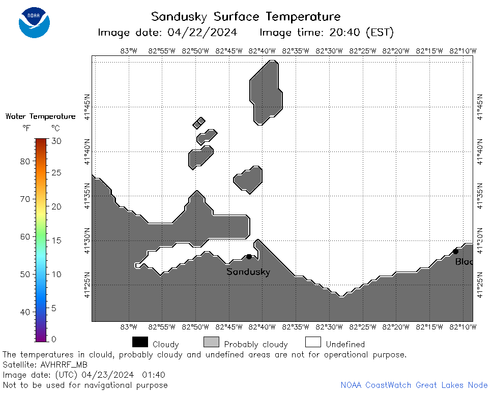
| Dataset Title: | Lake Erie Sandusky Surface Temperature Contour Map (2022-present)


|
| Institution: | CoastWatch Great Lakes Node (Dataset ID: LE_NRT_TC_e12) |
| Information: | Summary
| License
| Metadata
| Background | Subset
| Data Access Form
| Make a graph
| Subset
| Data Access Form
| Make a graph
|
![[ICO]](https://apps.glerl.noaa.gov/erddap/images/fileIcons/blank.gif) | Name | Last modified | Size | Description |
|---|---|---|---|---|
![[DIR]](https://apps.glerl.noaa.gov/erddap/images/fileIcons/back.gif) | Parent Directory | - | - | |
![[IMG]](https://apps.glerl.noaa.gov/erddap/images/fileIcons/image2.gif)  | e12_2024_04_23_0130.png | 23-Apr-2024 06:30 | 32061 | |
 | e12_2024_04_23_0140.png | 23-Apr-2024 06:33 | 18910 | |
 | e12_2024_04_23_0230.png | 23-Apr-2024 06:35 | 36384 | |
 | e12_2024_04_23_0310.png | 23-Apr-2024 06:37 | 24016 | |
 | e12_2024_04_23_0320.png | 23-Apr-2024 06:39 | 21124 | |
 | e12_2024_04_23_0600.png | 23-Apr-2024 09:27 | 18213 | |
 | e12_2024_04_23_0710.png | 23-Apr-2024 14:27 | 19332 | |
 | e12_2024_04_23_0740.png | 23-Apr-2024 12:27 | 20354 | |
 | e12_2024_04_23_0850.png | 23-Apr-2024 21:31 | 18923 | |
 | e12_2024_04_23_0920.png | 23-Apr-2024 21:34 | 18214 | |
 | e12_2024_04_23_1440.png | 23-Apr-2024 18:27 | 19211 | |
 | e12_2024_04_23_1620.png | 23-Apr-2024 21:36 | 19422 | |
 | e12_2024_04_23_1700.png | 23-Apr-2024 21:38 | 18889 | |
 | e12_2024_04_23_1710.png | 23-Apr-2024 21:41 | 18197 | |
 | e12_2024_04_23_1720.png | 23-Apr-2024 21:43 | 19434 | |
 | e12_2024_04_23_1840.png | 24-Apr-2024 00:27 | 19378 | |
 | e12_2024_04_23_1900.png | 23-Apr-2024 21:46 | 19301 | |