
Easier access to scientific data

Brought to you by NOAA CoastWatch Great Lakes Node
|
ERDDAP
Easier access to scientific data |
|
Brought to you by NOAA CoastWatch Great Lakes Node |
| Dataset Title: | Lake Erie Sandusky Surface Temperature Contour Map (2022-present)


|
| Institution: | CoastWatch Great Lakes Node (Dataset ID: LE_NRT_TC_e12) |
| Information: | Summary
| License
| Metadata
| Background | Subset
| Data Access Form
| Make a graph
| Subset
| Data Access Form
| Make a graph
|
![[ICO]](https://apps.glerl.noaa.gov/erddap/images/fileIcons/blank.gif) | Name | Last modified | Size | Description |
|---|---|---|---|---|
![[DIR]](https://apps.glerl.noaa.gov/erddap/images/fileIcons/back.gif) | Parent Directory | - | - | |
![[IMG]](https://apps.glerl.noaa.gov/erddap/images/fileIcons/image2.gif)  | e12_2024_04_08_0100.png | 08-Apr-2024 06:31 | 18205 | |
 | e12_2024_04_08_0140.png | 08-Apr-2024 06:34 | 18918 | |
 | e12_2024_04_08_0150.png | 08-Apr-2024 06:36 | 19357 | |
 | e12_2024_04_08_0240.png | 08-Apr-2024 06:38 | 20342 | |
 | e12_2024_04_08_0330.png | 08-Apr-2024 06:41 | 19241 | |
 | e12_2024_04_08_0650.png | 08-Apr-2024 13:28 | 19376 | |
 | e12_2024_04_08_0720.png | 08-Apr-2024 10:27 | 19362 | |
 | e12_2024_04_08_0830.png | 08-Apr-2024 13:31 | 19433 | |
 | e12_2024_04_08_0900.png | 08-Apr-2024 13:33 | 18902 | |
 | e12_2024_04_08_1400.png | 08-Apr-2024 18:27 | 18172 | |
 | e12_2024_04_08_1450.png | 08-Apr-2024 18:30 | 19332 | |
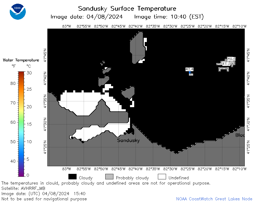 | e12_2024_04_08_1540.png | 08-Apr-2024 18:32 | 19820 | |
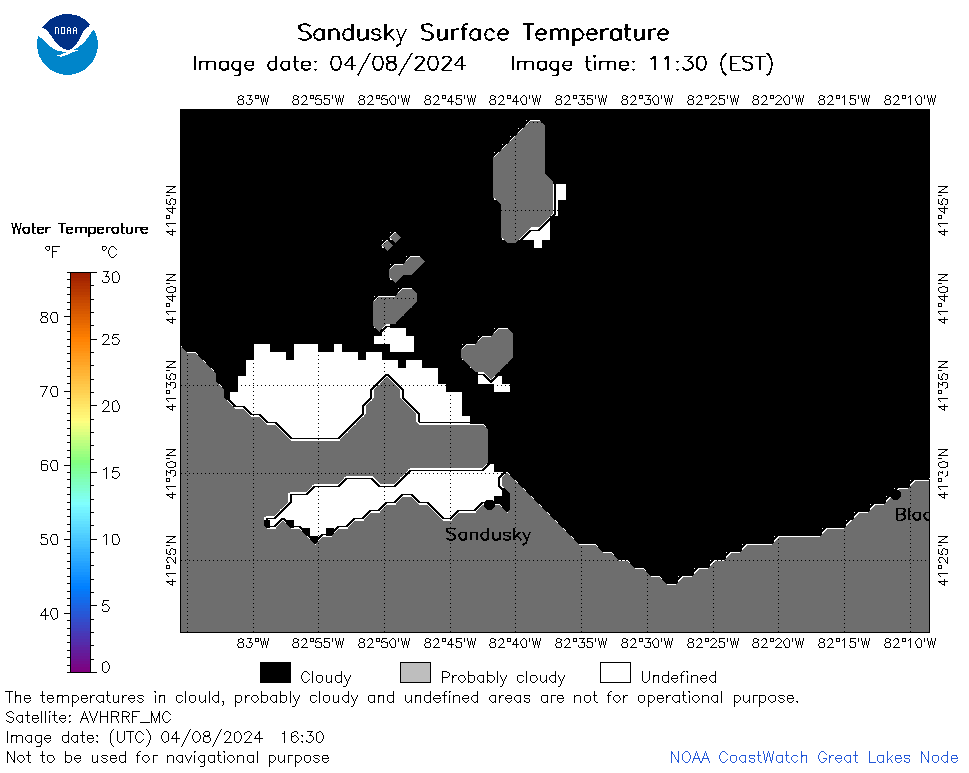 | e12_2024_04_08_1630.png | 08-Apr-2024 19:27 | 19459 | |
 | e12_2024_04_08_1700.png | 08-Apr-2024 18:34 | 20282 | |
 | e12_2024_04_08_1720.png | 08-Apr-2024 19:29 | 18191 | |
 | e12_2024_04_08_1820.png | 08-Apr-2024 22:27 | 19344 | |
 | e12_2024_04_08_1840.png | 08-Apr-2024 22:30 | 19343 | |