
Easier access to scientific data

Brought to you by NOAA CoastWatch Great Lakes Node
|
ERDDAP
Easier access to scientific data |
|
Brought to you by NOAA CoastWatch Great Lakes Node |
| Dataset Title: | Lake Erie Sandusky Surface Temperature Contour Map (2022-present)


|
| Institution: | CoastWatch Great Lakes Node (Dataset ID: LE_NRT_TC_e12) |
| Information: | Summary
| License
| Metadata
| Background | Subset
| Data Access Form
| Make a graph
| Subset
| Data Access Form
| Make a graph
|
![[ICO]](https://apps.glerl.noaa.gov/erddap/images/fileIcons/blank.gif) | Name | Last modified | Size | Description |
|---|---|---|---|---|
![[DIR]](https://apps.glerl.noaa.gov/erddap/images/fileIcons/back.gif) | Parent Directory | - | - | |
![[IMG]](https://apps.glerl.noaa.gov/erddap/images/fileIcons/image2.gif)  | e12_2024_02_10_0100.png | 10-Feb-2024 06:43 | 18202 | |
 | e12_2024_02_10_0140.png | 10-Feb-2024 06:49 | 20600 | |
 | e12_2024_02_10_0150.png | 10-Feb-2024 06:55 | 18898 | |
 | e12_2024_02_10_0240.png | 10-Feb-2024 07:02 | 20578 | |
 | e12_2024_02_10_0320.png | 10-Feb-2024 07:08 | 19807 | |
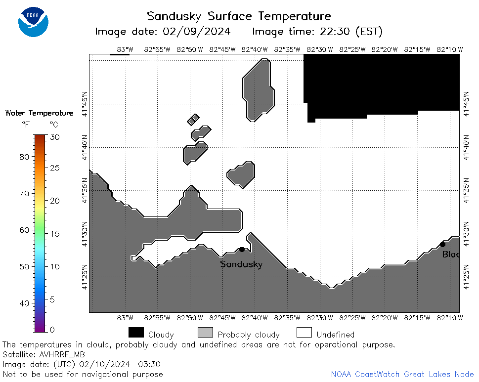 | e12_2024_02_10_0330.png | 10-Feb-2024 07:14 | 19492 | |
 | e12_2024_02_10_0640.png | 10-Feb-2024 11:32 | 22002 | |
 | e12_2024_02_10_0820.png | 10-Feb-2024 11:38 | 20738 | |
 | e12_2024_02_10_1400.png | 10-Feb-2024 17:31 | 18156 | |
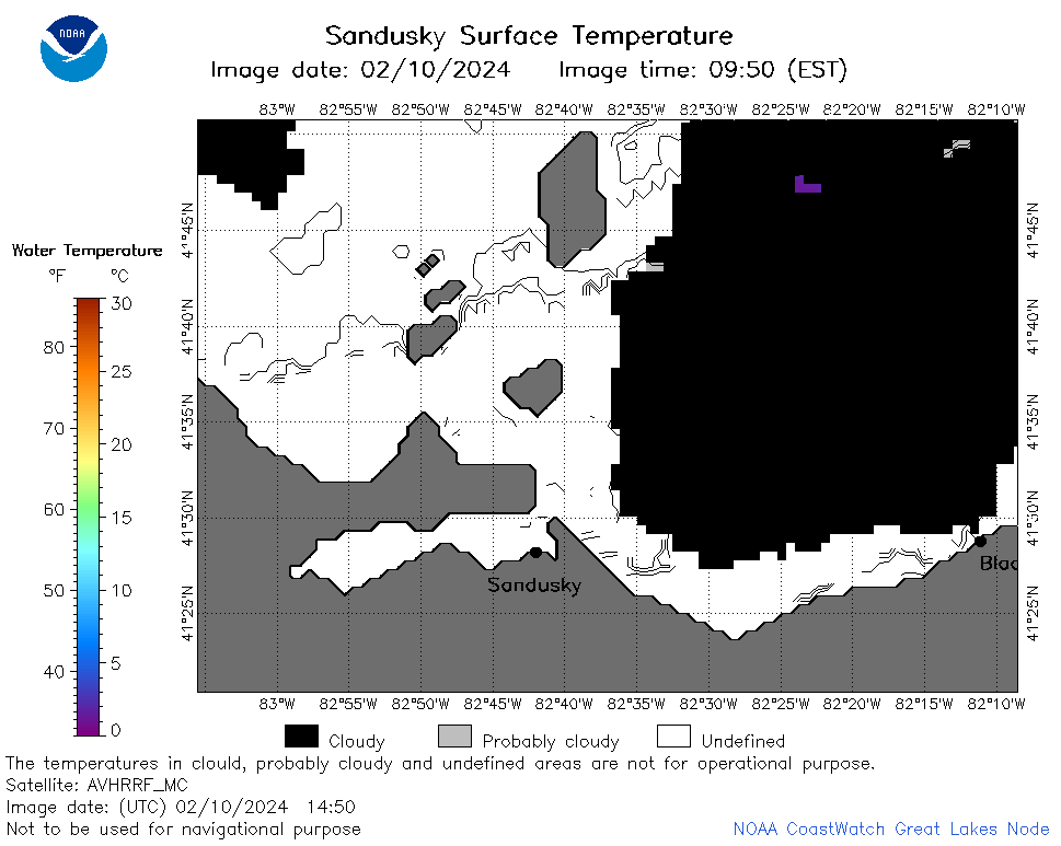 | e12_2024_02_10_1450.png | 10-Feb-2024 18:32 | 22759 | |
 | e12_2024_02_10_1540.png | 10-Feb-2024 17:38 | 21471 | |
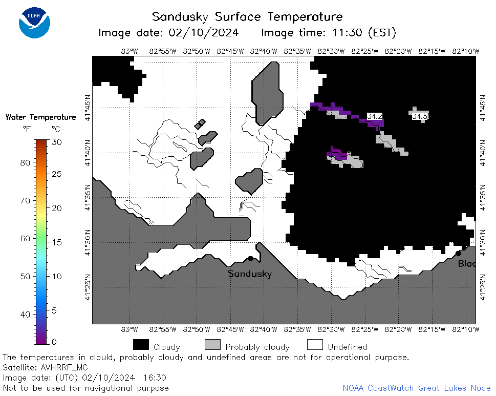 | e12_2024_02_10_1630.png | 10-Feb-2024 19:32 | 22960 | |
 | e12_2024_02_10_1720.png | 10-Feb-2024 19:38 | 18162 | |
 | e12_2024_02_10_1800.png | 10-Feb-2024 19:44 | 30131 | |
 | e12_2024_02_10_1810.png | 10-Feb-2024 22:34 | 18151 | |
 | e12_2024_02_10_1940.png | 10-Feb-2024 22:40 | 18871 | |
 | e12_2024_02_10_1950.png | 11-Feb-2024 00:31 | 18866 | |
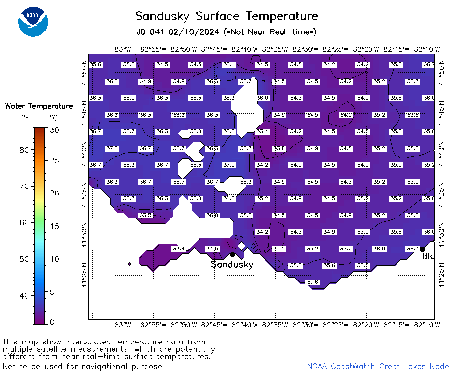 | e12_2024_041.png | 11-Feb-2024 11:07 | 31063 | |