
Easier access to scientific data

Brought to you by NOAA CoastWatch Great Lakes Node
|
ERDDAP
Easier access to scientific data |
|
Brought to you by NOAA CoastWatch Great Lakes Node |
| Dataset Title: | Lake Erie Sandusky Surface Temperature Contour Map (2022-present)


|
| Institution: | CoastWatch Great Lakes Node (Dataset ID: LE_NRT_TC_e12) |
| Information: | Summary
| License
| Metadata
| Background | Subset
| Data Access Form
| Make a graph
| Subset
| Data Access Form
| Make a graph
|
![[ICO]](https://apps.glerl.noaa.gov/erddap/images/fileIcons/blank.gif) | Name | Last modified | Size | Description |
|---|---|---|---|---|
![[DIR]](https://apps.glerl.noaa.gov/erddap/images/fileIcons/back.gif) | Parent Directory | - | - | |
![[IMG]](https://apps.glerl.noaa.gov/erddap/images/fileIcons/image2.gif)  | e12_2023_09_29_0120.png | 29-Sep-2023 05:39 | 18644 | |
 | e12_2023_09_29_0210.png | 29-Sep-2023 05:46 | 19182 | |
 | e12_2023_09_29_0300.png | 29-Sep-2023 05:54 | 19158 | |
 | e12_2023_09_29_0350.png | 29-Sep-2023 06:01 | 18896 | |
 | e12_2023_09_29_0600.png | 29-Sep-2023 09:32 | 18188 | |
 | e12_2023_09_29_0650.png | 29-Sep-2023 09:39 | 18744 | |
 | e12_2023_09_29_0740.png | 29-Sep-2023 09:47 | 18788 | |
 | e12_2023_09_29_0830.png | 29-Sep-2023 12:34 | 18751 | |
 | e12_2023_09_29_0920.png | 29-Sep-2023 12:42 | 18181 | |
 | e12_2023_09_29_1420.png | 29-Sep-2023 18:36 | 18183 | |
 | e12_2023_09_29_1430.png | 29-Sep-2023 18:44 | 18556 | |
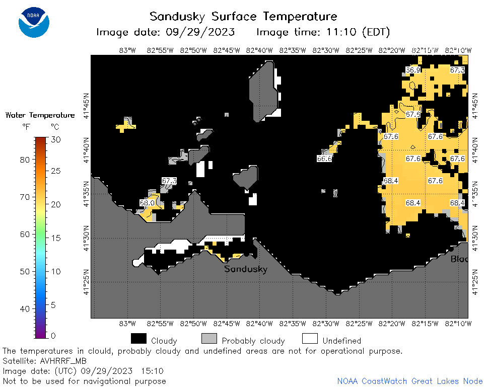 | e12_2023_09_29_1510.png | 29-Sep-2023 18:51 | 23688 | |
 | e12_2023_09_29_1610.png | 29-Sep-2023 20:32 | 23528 | |
 | e12_2023_09_29_1650.png | 29-Sep-2023 19:32 | 18887 | |
 | e12_2023_09_29_1730.png | 29-Sep-2023 18:58 | 25372 | |
 | e12_2023_09_29_1820.png | 29-Sep-2023 21:32 | 28569 | |
 | e12_2023_272.png | 30-Sep-2023 10:10 | 26626 | |