
Easier access to scientific data

Brought to you by NOAA CoastWatch Great Lakes Node
|
ERDDAP
Easier access to scientific data |
|
Brought to you by NOAA CoastWatch Great Lakes Node |
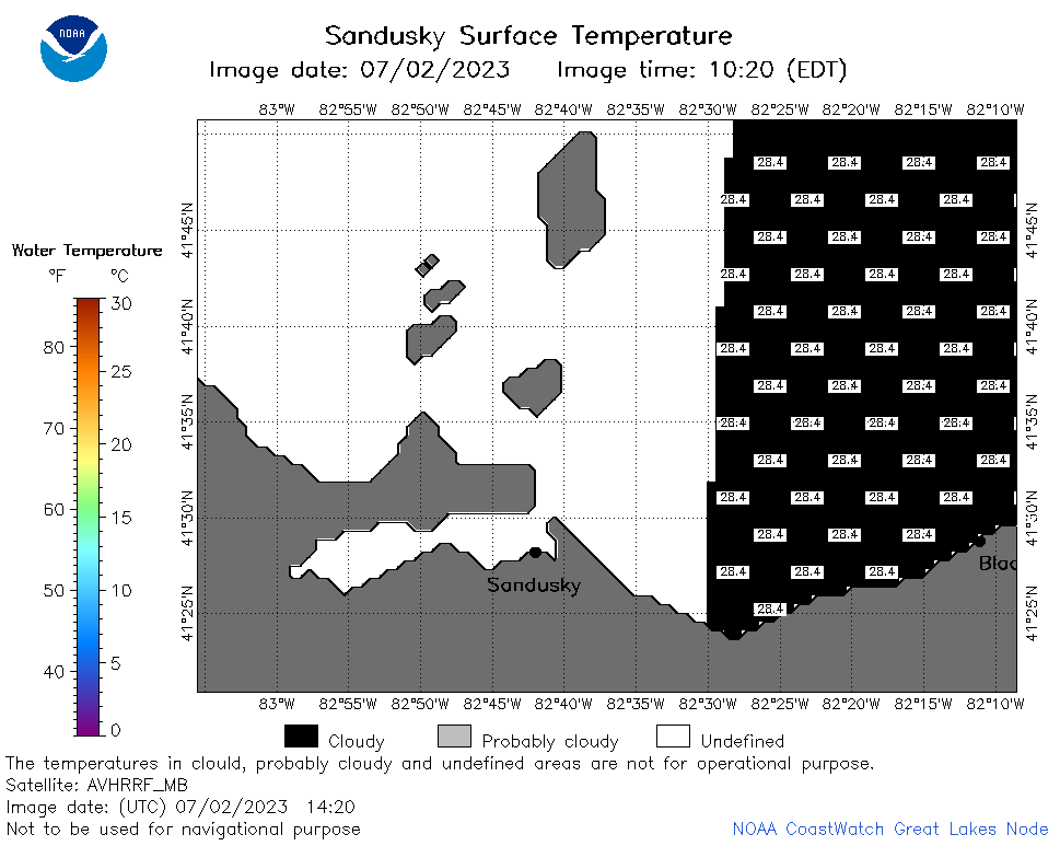
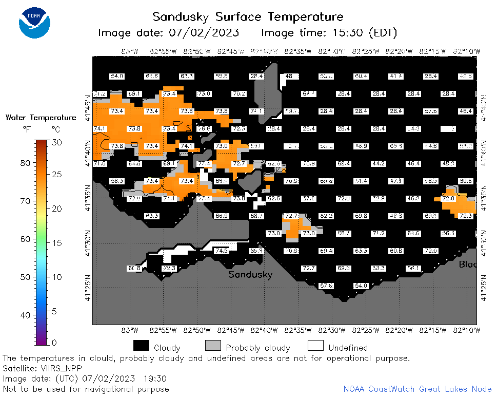
| Dataset Title: | Lake Erie Sandusky Surface Temperature Contour Map (2022-present)


|
| Institution: | CoastWatch Great Lakes Node (Dataset ID: LE_NRT_TC_e12) |
| Information: | Summary
| License
| Metadata
| Background | Subset
| Data Access Form
| Make a graph
| Subset
| Data Access Form
| Make a graph
|
![[ICO]](https://apps.glerl.noaa.gov/erddap/images/fileIcons/blank.gif) | Name | Last modified | Size | Description |
|---|---|---|---|---|
![[DIR]](https://apps.glerl.noaa.gov/erddap/images/fileIcons/back.gif) | Parent Directory | - | - | |
![[IMG]](https://apps.glerl.noaa.gov/erddap/images/fileIcons/image2.gif)  | e12_2023_07_02_0110.png | 02-Jul-2023 05:35 | 21100 | |
 | e12_2023_07_02_0200.png | 02-Jul-2023 05:42 | 33521 | |
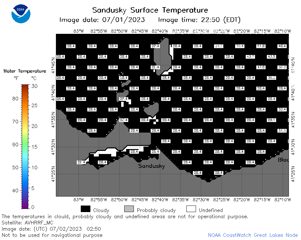 | e12_2023_07_02_0250.png | 02-Jul-2023 05:50 | 21273 | |
 | e12_2023_07_02_0620.png | 02-Jul-2023 10:33 | 20563 | |
 | e12_2023_07_02_0710.png | 02-Jul-2023 10:41 | 20642 | |
 | e12_2023_07_02_0800.png | 02-Jul-2023 10:48 | 20672 | |
 | e12_2023_07_02_1420.png | 02-Jul-2023 17:37 | 21366 | |
 | e12_2023_07_02_1510.png | 02-Jul-2023 19:40 | 20550 | |
 | e12_2023_07_02_1600.png | 02-Jul-2023 19:53 | 20919 | |
 | e12_2023_07_02_1750.png | 02-Jul-2023 20:07 | 23590 | |
 | e12_2023_07_02_1840.png | 02-Jul-2023 20:40 | 26196 | |
 | e12_2023_07_02_1930.png | 02-Jul-2023 21:35 | 27386 | |
 | e12_2023_183.png | 03-Jul-2023 10:09 | 28883 | |