
Easier access to scientific data

Brought to you by NOAA CoastWatch Great Lakes Node
|
ERDDAP
Easier access to scientific data |
|
Brought to you by NOAA CoastWatch Great Lakes Node |
| Dataset Title: | Lake Erie Sandusky Surface Temperature Contour Map (2022-present)


|
| Institution: | CoastWatch Great Lakes Node (Dataset ID: LE_NRT_TC_e12) |
| Information: | Summary
| License
| Metadata
| Background | Subset
| Data Access Form
| Make a graph
| Subset
| Data Access Form
| Make a graph
|
![[ICO]](https://apps.glerl.noaa.gov/erddap/images/fileIcons/blank.gif) | Name | Last modified | Size | Description |
|---|---|---|---|---|
![[DIR]](https://apps.glerl.noaa.gov/erddap/images/fileIcons/back.gif) | Parent Directory | - | - | |
![[IMG]](https://apps.glerl.noaa.gov/erddap/images/fileIcons/image2.gif)  | e12_2023_06_28_0140.png | 28-Jun-2023 05:45 | 28943 | |
 | e12_2023_06_28_0230.png | 28-Jun-2023 05:55 | 26437 | |
 | e12_2023_06_28_0320.png | 28-Jun-2023 10:32 | 24603 | |
 | e12_2023_06_28_0650.png | 28-Jun-2023 10:48 | 45912 | |
 | e12_2023_06_28_0740.png | 28-Jun-2023 11:38 | 35684 | |
 | e12_2023_06_28_0830.png | 28-Jun-2023 10:55 | 30398 | |
 | e12_2023_06_28_1450.png | 28-Jun-2023 20:36 | 22840 | |
 | e12_2023_06_28_1540.png | 28-Jun-2023 17:37 | 33707 | |
 | e12_2023_06_28_1630.png | 28-Jun-2023 20:44 | 23821 | |
 | e12_2023_06_28_1720.png | 28-Jun-2023 20:57 | 23709 | |
 | e12_2023_06_28_1810.png | 28-Jun-2023 21:05 | 23977 | |
 | e12_2023_06_28_1900.png | 28-Jun-2023 21:38 | 21067 | |
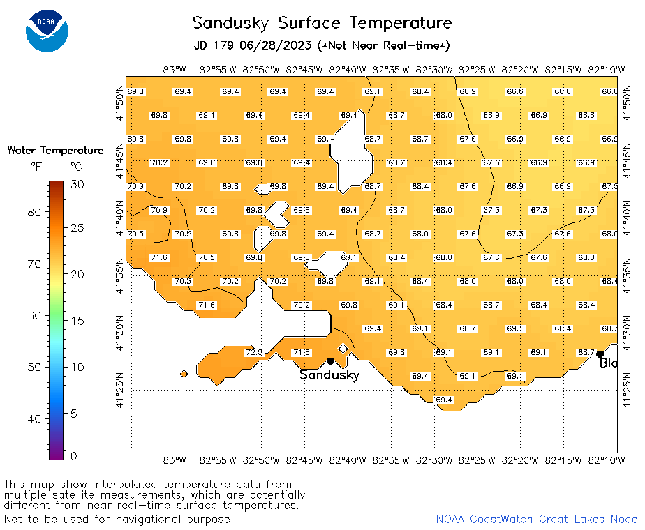 | e12_2023_179.png | 29-Jun-2023 10:09 | 27913 | |