
Easier access to scientific data

Brought to you by NOAA CoastWatch Great Lakes Node
|
ERDDAP
Easier access to scientific data |
|
Brought to you by NOAA CoastWatch Great Lakes Node |
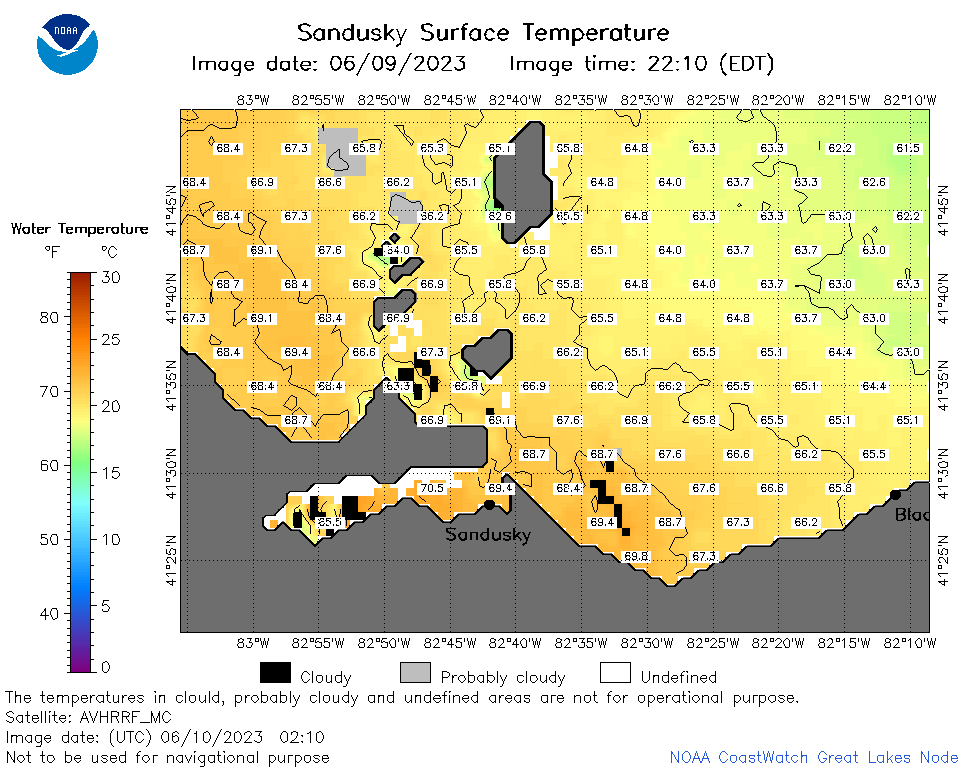
| Dataset Title: | Lake Erie Sandusky Surface Temperature Contour Map (2022-present)


|
| Institution: | CoastWatch Great Lakes Node (Dataset ID: LE_NRT_TC_e12) |
| Information: | Summary
| License
| Metadata
| Background | Subset
| Data Access Form
| Make a graph
| Subset
| Data Access Form
| Make a graph
|
![[ICO]](https://apps.glerl.noaa.gov/erddap/images/fileIcons/blank.gif) | Name | Last modified | Size | Description |
|---|---|---|---|---|
![[DIR]](https://apps.glerl.noaa.gov/erddap/images/fileIcons/back.gif) | Parent Directory | - | - | |
![[IMG]](https://apps.glerl.noaa.gov/erddap/images/fileIcons/image2.gif)  | e12_2023_06_10_0110.png | 10-Jun-2023 05:40 | 40840 | |
 | e12_2023_06_10_0210.png | 10-Jun-2023 05:53 | 40132 | |
 | e12_2023_06_10_0250.png | 10-Jun-2023 05:58 | 40480 | |
 | e12_2023_06_10_0640.png | 10-Jun-2023 10:44 | 36753 | |
 | e12_2023_06_10_0720.png | 10-Jun-2023 10:50 | 38674 | |
 | e12_2023_06_10_0820.png | 10-Jun-2023 11:37 | 36937 | |
 | e12_2023_06_10_1420.png | 10-Jun-2023 18:34 | 29982 | |
 | e12_2023_06_10_1510.png | 10-Jun-2023 18:41 | 36444 | |
 | e12_2023_06_10_1600.png | 10-Jun-2023 19:33 | 42502 | |
 | e12_2023_06_10_1710.png | 10-Jun-2023 18:47 | 23126 | |
 | e12_2023_06_10_1800.png | 10-Jun-2023 20:40 | 45921 | |
 | e12_2023_06_10_1850.png | 10-Jun-2023 20:47 | 23553 | |
 | e12_2023_161.png | 11-Jun-2023 10:10 | 29576 | |