
Easier access to scientific data

Brought to you by NOAA CoastWatch Great Lakes Node
|
ERDDAP
Easier access to scientific data |
|
Brought to you by NOAA CoastWatch Great Lakes Node |
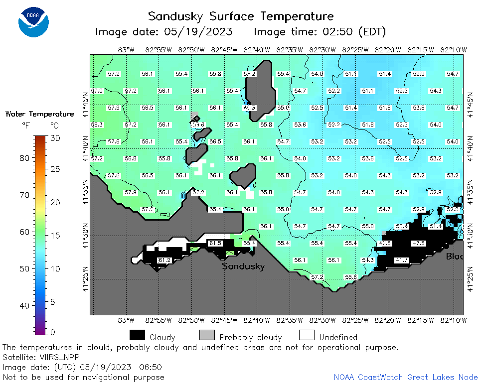
| Dataset Title: | Lake Erie Sandusky Surface Temperature Contour Map (2022-present)


|
| Institution: | CoastWatch Great Lakes Node (Dataset ID: LE_NRT_TC_e12) |
| Information: | Summary
| License
| Metadata
| Background | Subset
| Data Access Form
| Make a graph
| Subset
| Data Access Form
| Make a graph
|
![[ICO]](https://apps.glerl.noaa.gov/erddap/images/fileIcons/blank.gif) | Name | Last modified | Size | Description |
|---|---|---|---|---|
![[DIR]](https://apps.glerl.noaa.gov/erddap/images/fileIcons/back.gif) | Parent Directory | - | - | |
![[IMG]](https://apps.glerl.noaa.gov/erddap/images/fileIcons/image2.gif)  | e12_2023_05_19_0120.png | 19-May-2023 05:35 | 28899 | |
 | e12_2023_05_19_0210.png | 19-May-2023 05:45 | 23439 | |
 | e12_2023_05_19_0300.png | 19-May-2023 05:51 | 25562 | |
 | e12_2023_05_19_0650.png | 19-May-2023 10:36 | 36050 | |
 | e12_2023_05_19_0740.png | 19-May-2023 10:46 | 35198 | |
 | e12_2023_05_19_0830.png | 19-May-2023 12:34 | 43092 | |
 | e12_2023_05_19_1430.png | 19-May-2023 17:36 | 23466 | |
 | e12_2023_05_19_1520.png | 19-May-2023 19:38 | 33872 | |
 | e12_2023_05_19_1610.png | 19-May-2023 19:48 | 24829 | |
 | e12_2023_05_19_1720.png | 19-May-2023 19:55 | 20671 | |
 | e12_2023_05_19_1810.png | 19-May-2023 21:37 | 23869 | |
 | e12_2023_05_19_1900.png | 19-May-2023 21:44 | 22128 | |
 | e12_2023_139.png | 20-May-2023 10:06 | 30802 | |